Showing posts with label Minor Climb. Show all posts

Tuesday, July 18, 2017

Mt. 387 / Mt. Batong Amat traverse to Aloha Falls

“Thousands of tired, nerve-shaken, over-civilized people are beginning to find out that going to the mountains is going home; that wildness is a necessity”
                                                                                               
                                                                                           ― John Muir, Our National Parks

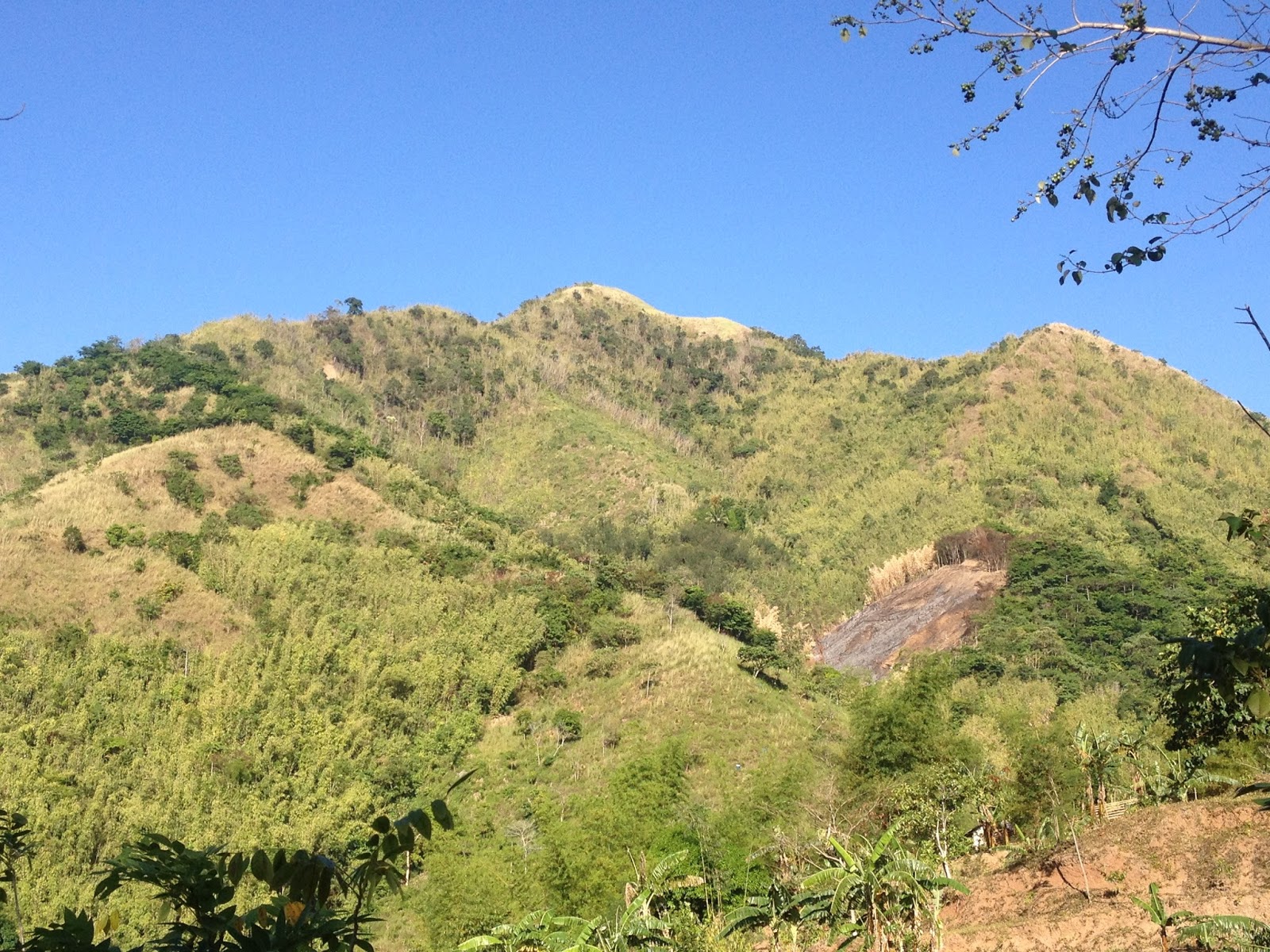
Mt. 387 (also known as Batong Amat) has instantly gained its ground as one of the more popular climbs in Central Luzon since the time it was introduced to the mountaineering community at the onset of 2017. Now, it has become as one of the favorites even by newbies and occasional hikers because mainly of two factors: 1. the supposed view of the so-called Chocolate Hills of the North; and 2. the cool dip at the nearby Aloha Falls after the climb.

What is referred to as the Chocolate Hills of the North is actually a part of the Caraballo Mountain Range....notice a faint Mt. Arayat in the background.

The Stone Marker near the Summit...the actual Summit is the clearing about 200 meters from this area.

Solitude
Aloha Falls
While we were supposed to participate in the National Mountain Cleanup Day, cancellations and conflicts in our respective schedules resulted to us five (5) deciding to climb Mt. 387 and do some tree-planting. It was already 15 minutes before midnight when we left McDonald's Quezon Avenue (corner EDSA), and as I practically know the easiest and fastest route to Carranglan, driving there would practically be a breeze.

Tuesday, June 27, 2017

Mt. Daguldol + Ambon-Ambon Falls + Laiya Beach

“Hiking is a bit like life:
The journey only requires you to put one foot in front of the other…again and again and again.
And if you allow yourself the opportunity to be present throughout the entirety of the trek,
you will witness beauty every step of the way,
not just at the summit”


As our plan to go on an extended hike up North failed to materialize, we decided to go down South for a dayhike. So we decided to drive all the way to San Juan, Batangas and climb Mt. Daguldol. It was practically a drive of about three (3) hours from Quezon City to the quaint Sitio Biga in Hugom, San Juan, Batangas.

While we were paying the registration fees and securing our local guide for the hike, we were forewarned by the locals that there seems to be brewing problem among the local guides. According to our guide, a guide from the Lobo (the summit and campsite is supposedly within the jurisdiction of the town of Lobo) was prevented from leading a group of hikers the past weekend owing to the fact that he was drunks at that time. Trouble erupted among them since those from Lobo claimed (which is supposedly true) that a guide from San Juan (the jumpoff is within the jurisdiction of the town of San Juan) was allegedly previously allowed to act as such even though such guide was similarly intoxicated at that time.

Thursday, April 27, 2017

Mt. Lagyo traverse to Mt. Susong Dalaga

“Do not follow where the path may lead. Go instead where there is no path and leave a trail”

                                                                                                   – Ralph Waldo Emerson


After almost two years, we were finally back in Wawa to explore the mountains that were newly opened as hiking destinations.

Commencing the hike at 0720H, we threaded the road leading to Mt. Parawagan. We were initially surprised to see that the dirt road has now been cemented up to the point where a public resort is located just a few minutes before the junction leading to Mt. Lagyo is located. As there was an on-going fun ride at that time, we had to contend with a considerable number of riders making their way to the summit of Mt. Parawagan.


As it was Engr. who scouted for our hike and prepared our itinerary, we were then expecting a leisurely hike. Nonetheless, through the prodding of our guide (Mang Geovanni), we were persuaded to traverse Mt. Lagyo onward to Mt. Susong Dalaga for a twinhike.

It was already 0800H when we reached the junction where we bid farewell to the bikers and continued towards Mt. Lagyo. It was after we reached another junction (where we took the trail on the left...the path on the right leads toward a residential area) that the trail began to get steeper. A mountain biker followed us and asked for directions saying that he is going to Pintong Bukawe which is still at least 3-4 hours from Mt. Lagyo (depending on the pace) considering the terrain of the trail that he still needs to cover. From the said junction where a store is located, we had to circle around Mt. Lagyo until we finally reached the trail that leads to the upper portions of the mountain.


It was 0820H when we reached the trail at the base of Mt. Lagyo where we decided to have some time to catch our breathes and prepare for the steeper climbs ahead. Initially, banana and some fruit-bearing trees dot the trail, until the rock scrambling began. Then we reached a bamboo grove which ultimately gave way to some more rock scrambling. The hike went on until 0915H, we reached the general area where the 1st Peak (viewdeck) of Mt. Lagyo is located.

Friday, March 31, 2017

Mt. Lubog - Hiking after a bumpy ride

"Fill your life with experiences, not things. Have stories to tell, not stuffs to show."
                                                                                      - Anonymous -


Mt. Lubog and its rocky peak

Mt. Lubog: taken from the jumpoff

"Manong, bakit naman ngayon ka pa umikot ng Morato at E.Rod kung kelan napakaluwag ng EDSA? Timog hanggang Aurora, nakailang traffic light tayo?" 

Okay, that was me badgering the taxi driver who was obviously trying to rip me off by inflating my taxi fare in going to our meet up place in Cubao. Haahaa...fast forward.

As we were five (5) in our group and another group of four (4) hikers joined us in the fx, we decided to just pay for the last slot instead of spending time waiting for a chance passenger to arrive. It was a rather smooth ride through Commonwealth, and Litex in Quezon City, until we finally reached the Total Gas Station in Eastwood (Rodriguez, Rizal), where incidentally a 7-11 convenience store is also located and where we are set to meet our habal-habal driver.

It was still dark when we left the Total Station and went through the different subdivisions in Eastwood, until we finally reached the concrete road leading to Brgy. Mascap. Before reaching Mascap Proper, we however turned left towards Sitio Macaingalan and sooner than we think, we were already traversing an unpaved and bumpy road.

I actually lost count of the number of times that we had to alight from the habal-habal, push it, or just hike until it is able to negotiate the steep and/or difficult portions in the road. We passed by the local chapel and even the so'called Ark (similar in intent and purposes as the Noah's Ark) that was featured in news reports some years back. As we continued to ascend the dirt road, we reached the concrete structure that the locals refer to as "Simbahan" (concrete house with inscriptions in its wall...and what I remember is something like "Paraiso ni Diyos Ama"). After the next Station of the Cross along the road, our habal-habal again encountered difficulties in negotiating the dirt road that is obviously in a severe state of disrepair. Hence, we had to hike (to our surprise) at least 500 meters of continuous uphill climb until we reached the remains of what was supposed to be a "Welcome Arch".

That was actually the longest (but not the last) among the hikes that we had to take.Huffing and puffing, it felt like I already hiked a good deal of peaks even before we actually reached the trailhead.

Our butts definitely took a beating in this roller coaster-like and bumpy ride into the midst of the Sierra Madre. Good thing, our habal-habal had rubber straps for seats. It therefore is Newton's Law simplified, "for every action, there is an equal and opposite reaction". More so, the view of the vastness of the Sierra Madre, and the Metro Manila skyline, somewhat made up for the grueling ride. To tell you honestly, we were actually enjoying at that time.


Tuesday, January 31, 2017

Laiban Quatro - Mt. Lubo, Mt. Ngusong Kabayo traverse to Tangwa Peak + (Laiban Falls)

"Only those who will risk going too far can possibly find out how far one can go."
                                                                                          - T.S. Eliot 

Since we were badly in need for a tune-up climb for our upcoming climb in Akiki, and having no idea to go, we decided to join an organized climb for a change. After threshing out the details from Kagawad, we were in no time up and about to tramp in the newest hiking hotbed in Tanay, Rizal, the Laiban Quatro.

Mt. Ngusong Kabayo
Upon arriving at Sitio Mayagay, our vehicle went straight to and parked at the basketball court. We then transferred to the monster jeep that will take us to Brgy. Laiban. As we were at least fifty (50) in the group, a good number of participants decided to topload. It was one cold and bumpy ride to Laiban since the usual morning mists were accompanied a drizzle. After forty minutes and nine (9) river crossings, we finally arrived at the Brgy. Hall in Laiban.
Laiban Brgy. Hall
Surprisingly, there are already a lot of hikers (one big group handled by an organizer) taking time to register. As for us, we just waited for our turn and decided to sit on the wooden benches in the makeshift stalls just opposite the Brgy. Hall. After we have logged-in, we were led to the house of Kagawad to re-group and for some to drink coffee and eat breakfast.

Sign in front of Kagawad Toto's home
It was already 0540H when we left the house of Kagawad. At the Brgy. Hall, we had a briefing as to what we are going to expect during the hike. After a short prayer, we settled ourselves into smaller groups (there are four of us in our group). And at 0555H, we were off and commenced hiking.

From the main road in Laiban, we backtrailed for about a hundred meters, turned right toward, and followed a footpath in between residential houses until we ascended into the mountain trail. As rain poured throughout the previous night, it was already one muddy and slippery climb from that point on. As we were told, our first stop would be Mt. Lubo, then proceed to Mt. Ngusong Kabayo, traverse to Tangwa Peak, and then take the backtrail to Mt. Lubo before turning left for the descent towards the famed four (4) waterfalls of Laiban.

Thursday, September 29, 2016

Maysawa Circuit - Mt. Sa Pari traverse to Mt. Binutasan, traverse to Maysawa Falls / Sapa

“Walk away quietly in any direction and taste the freedom of the mountaineer.” 

                                                                                                                  ― John Muir

After months of not having a hike, we were choosing whether to climb Pico de Loro (before it eventually closes its trails for the meantime), or to climb one of the newest traipsing trails of Southern Sierra Madre. Obviously, taking into consideration the expected foot traffic, we opted to go for the latter and hike up the now famous Maysawa Circuit.

Welcome to Maysawa Circuit
Maysawa Circuit is referred as such by reason of two things. First, it is located within Sitio Maysawa (pronounced as "May Sawa", interpreted in English as "There is a Python."). Second, it is a Circuit because its series of trails offers climbing a number of peaks and mountains namely, Mt. Sa Pari and Mt. Binutasan.

The appellation Mt. Sa Pari ("owned by the priest" when interpreted in English) was derived from the fact that the adjoining lands in the mountain was supposedly previously owned by a priest. On the other hand, Mt. Binutasan was christened as such since this is supposedly where a road going to the adjoining Brgy. Sto. Niño was made. In the vernacular, according to our guide (Ryan), "binutas ang bundok para gunmawa ng daan".

A faint Mt. Irid (left) and Mt. Tukduang Banoi (right)


From LRT-2 Cubao Station, we traversed Aurora Boulevard, and went on our usual route up to Masinag and Cogeo in Antipolo City via the Marifanta / MariLaQue Highway. Owing to the fact that we have previously hiked up Mt. Paliparan, we are now familiar where to register in Cuyambay. Hence, upon seeing a number of vehicles parked on the left side of the road (just before the junction going to Cuyambay Proper), we immediately recognized the place as the trailhead to Maysawa Circuit.

Nonetheless, as it is mandatory for hikers to first register and secure a guide at the Barangay Hall, we continued towards Brgy. Cuyambay Proper. (Hopefully, a satellite office / registration area will be established at the Maysawa JOP so that hikers will no longer be required to go to Cuyambay).

When we arrived, the Brgy. Hall is teeming with activity. As a considerable number of hikers have just registered and were busy preparing their gears (supposedly to climb Mt. Paliparan or Nagpatong Rock), groups of hikers continue to arrive. Obvious signs that Cuyambay has etched its own mark in the world of mountaineering / hiking. The local guide assigned to assist us during the climb is Ryan.

It was already a few ticks after 0700H when we left the trailhead / Maysawa Junction and started hiking. We hopped on the trail giddily, as we were enthusiastic to be back hiking. Hence, we politely declined the offer of riding the habal-habal. As we followed the dirt path, we snaked through the residential area and eventually passed by the makeshift basketball court. Then we reached the concrete part of the road, which according to Ryan, signifies that we are now nearing the rest house of a famous actor / actress. The end of the pavement ends at the habal-habal station, which incidentally is where patrons of the habal-habal are drop. Propitiously, the road / trail continued to dip, and to our amazement (as lady luck may have smiled to us), the sea of clouds were still prominent at that time.


Friday, July 8, 2016

Mt. Batulao - New Trail to Old Trail Traverse (Solohike)

"Great things are done when men and mountains meet."
                                 - William Blake -

Mt. Batulao has been known in the mountaineering circle as one of the better climbs near Metro Manila. It offers a challenging hike that offers a lot of rewards to aspiring hikers that would wish to practice some technical facets of climbing. Hence, it is not uncommon for mountaineers to have their baptism of fire in this mountain.

This popularity of Mt. Batulao has reared its ugly head. Controversies and issues regarding registrations and rules on climbing and guides resulted to climbers shying away from tramping in this hub of Philippine mountaineering.


Previously, in any given holiday or weekend, hikers would come in droves, 300 hikers tramping on its picturesque peaks and ridges would be an understatement. Foot traffic at the roped segments is comparable to EDSA and the summit is jam-packed at any given time of the day. But now, according to the local that I talked to, a lucky day would mean about a hundred or so hikers passing through the registration areas. I admit, I am one of those who were disenchanted and eventually became indifferent to climbing this popular tramping ground because of the so many issues that supposedly cropped up from the personal interests of some people.

Wednesday, April 27, 2016

Maynoba Circuit - Mt. Maynoba + Mt. Cayabu + 8 waterfalls

We were not pioneers ourselves, but we journeyed over old trails that were new to us, and with hearts open. Who shall distinguish?
                                                         ― J. Monroe Thorington, The Glittering Mountains of Canada: A Record of                                                                           Exploration and Pioneer Ascents in the Canadian Rockies, 1914-1924


A new tramping ground has recently been launched in Tanay, Rizal. Dubbed as Maynoba Circuit, it was formally opened last March 22, 2016. And this early, I am sure that the Maynoba Circuit will soon be in the bucket list of mountaineers, hikers, climbers, and weekend warriors.

Mt. Maynoba
Mt. Maynoba / Mt. Cayabu
Climbing the Maynoba Circuit would entail climbing Mt. Maynoba and Mt. Cayabu. But the added bonus of having a chance to take a dip in any, if not all of the 8 waterfalls that may be found along the trail surely makes this climb undeniably enticing to everyone.

Having overslept (because I again dozed off after acknowledging the alarm that I have set), it was already 0545H when I arrived at the McDonald’s in Marco Highway to fetch my best hiking buddy (Gani). And after buying some of our needed provisions at a convenience store in Cogeo, we went straight to finding Brgy. Cayabu (Tanay, Rizal).

It was already 0720H when we arrived at Mar-ning’s Resort, the jump-off point for the Maynoba Circuit. After paying the registration fees and securing our local guide for the day, we started hiking at 0745H. Thinking that what we are going to climb is the mountain opposite the resort, we were actually surprised when our guide led us towards the back of the resort.

Welcome to Mar-Nings Farm and Resort

Swimming pool
We initially hiked on rice paddies (one can actually survey the course of the hike here) until we reached the dirt path that eventually led to the “bamboo gate”. We then reached the bohoan at 0800H. While the initial terrain is mainly ascending, there are also some rolling parts that may serve as a breather for the harder climbs ahead.

Monday, April 11, 2016

Mt. Tangisan - Hike after the forest fire

There are two kinds of people. Those who climb mountains and those who sit in the shadow of the mountains and critique the climbers.” 
                                                                                                                            ― Richard Paul Evans

As I only had barely two days left to use my Birthday Leave (we are only allowed to use it during our birth month), it was my first time in a long while to again climb solo, and on a weekday at that.

At first, I could barely decide where to go until a brilliant idea pique my interest and which eventually made me decide to visit some friends in my province. As such, I found myself driving towards the NLEX while eagerly anticipating the climb up Mt. Tangisan.


Mt. Tangisan

Mt. Tangisan as seen from Monasterio de Tarlac


For starters, Mt. Tangisan is one of the mountains located in Western Tarlac (particularly in the town of San Jose), thus the popular term "San Jose Circuit". As I have already done the Circuit Climb twice, I know how humid the climb up the mountains of San Jose can be. Yes, while the mountains in San Jose are not really that tall, the climbing conditions (especially the heat/humidity) can take its toll on a climber / hiker.

Sunday, February 28, 2016

Manabu Peak - Mataas na Bundok

"He that plants trees loves others besides himself."
- Thomas Fuller -

Manabu Peak is one of the more popular minor climbs that is relevantly close to Metro Manila. Most enjoy its dense forest cover, the interesting flora and fauna within its range, and the wonderful views that it offers. Of course, who would ever forget the free civet coffee of Mang Tino and Mang Pirying. There are really a lot of reasons that climbers continue to flock and climb Manabu.


Arriving at the trail head, we changed gears and prepared to climb. Holding the seedling that we purchased at the registration area in one, we were so eager to trailblaze again.


Engr's seedling
The initial part of the trail is similar to the approach in Mt. Sembrano and Mt. Romelo. Subsequent to the preliminary plunge and ascent, we passed by agricultural  crops and some orchards as we slowly went deeper into the forest and reach the Stations of the Manabu Loop (Yes, the trail is a loop that is comprised by a number of Stations).

The rolling terrain went on until we finally arrived at Station 3 where we briefly stopped for some photo ops. Here, we also had to cross the brook. As the forest in the Malipunyo Range (where Manabu is located) is really one of the more impressive ones in the entire Philippines, it is not surprising that the flora and fauna in the area is really remarkable.


At the Station 3
Onwards, we passed by farmlands and even had to stoop down at one point in order to get pass by steel wires that resemble a clothesline, which I supposed is being used by the locals as a trellis for their vegetable crops.We decided to have our first rest stop at Station 4. This is where the loop trail merges. The trail on the left leads directly to the Grotto (Station 8) and is relatively an easier ascent towards the summit. On the other hand, while the conventional trail on the right is the steeper assault, it nonetheless leads to Station 5, where Mang Tino and Mang Pirying shall gamely offer a free taste of civet coffee to hikers.

Saturday, February 13, 2016

Mt. Pulag - Tramping Advisory (20 hikers per group)

The Mt. Pulag National Park has imposed a limitation on the number of hikers that a specific coordinator/organizer shall be allowed to include in a group. Now, the maximum members allowed for each group shall be twenty (20) and only those who comply with this requirement shall be allowed to leave for the Ranger Station.


In line with this, all organizers with more than 20 participants are advised to reduce the members of their respective teams. Those who have previous reservations are given the chance to enter the park but from now on, the management will now start imposing the 20 pax per team to give chances for other climbers to trek the park.

Also, the DENR has qualified that the suspension of reservations for 2017 covers the Babadak Trail on Saturdays only. Trekkers below 10 members per team could however be accommodated to provide social assistance to the community guides and porters.

And lastly, since the park management has not increased its fees since 2000. It was also announced that there shall be an increase in the Entrance Free from P100 per head to P175.00/head pursuant to the Resolution of the Protected Area Management Board (PAMB) in 2015. .

Link to the post: Mt. Pulag - 20 members in a team


Tramping Advisory 011
002.010.016
Mt. Pulag - Members per team; Suspension of Resevations

#MtPulag #SeaofClouds

Friday, February 12, 2016

Mt. Pulag - Tramping Advisory (Marking of Hikers; Suspension of Reservations for all weekends in 2017)

The management of the Mt. Pulag National Park has mandated the marking of the hands of all trekkers at the Visitors' Center, after it has been verified that the hikers involved have reservations and that they have undergone the orientation before entering the park. As such, trekkers with no seal from the Visitors' Center/Protected Area Office shall not be allowed entry. Hence, trekkers with no reservations are hereby advised not to proceed directly to the Babadak Ranger Station.


Organizers who usher hikers more than what were actually indicated in their reservations are also advised to just visit the mountain lakes located at the northern part of Mt. Pulag so that they may have an alternative activity.
Lastly, it has also been resolved that reservations for all weekends of 2017 are suspended until further notice.


Visit the post here: Mt. Pulag

Tramping Advisory 010
002.010.016
Mt. Pulag - Marking of Hikers; Suspension of Resevations

#MtPulag #SeaofClouds

Tuesday, February 9, 2016

Mt. Mamara: a newly-opened mountain in Daraitan


“You don't need to climb a mountain to know that it's high.” 
                                                                            ― Paulo Coelho, Aleph


Nestled within a river valley in the Southern Sierra Madre is a paradise known as Barangay Daraitan, which lies within the boundaries of Tanay, Rizal. What was previously a haven for illegal loggers, has now become a sanctuary for mountaineers, hikers, weekend warriors, and casual tourists that ceaselessly flock to the place especially during holidays and weekends. So, as our first hike for 2016, we finally decided to hike in Daraitan.


Mt. Mamara...taken somewhere along the Tinipak River
Mt. Mamara...as seen a few meters from the jump off point
Fly high...Skookum jump
As our plan to hire a van did not materialize, we decided to just meet at the designated stop for jeepneys bound for Tanay opposite the Shangri-la Plaza Mall along Shaw Boulevard in Mandaluyong City. It was already 0445H when we boarded a jeepney, hoping that we are still within the 300 hikers to summit in a day quota that was recently imposed in Barangay Daraitan. We ultimately arrived at the Tanay Public Market at 0610H together with at least 12 hikers that flagged the jeepney somewhere in Cainta and Pasig.

Friday, December 18, 2015

Mt. Timbac / Mt. Singkalsa - Hiking within the salad bowl of the Philippines + Highest Point of Philippine Highway System

“If you get the taste of the mountains once, you will always find the cities horribly tasteless!” 
                                                          ― Mehmet Murat ildan


Mt. Timbac, otherwise known as Mt. Singkalsa, is sacred among the tribes of the Cordillera. According to one account that I have read at the National Museum in Kabayan, Benguet, the local tribesmen lay their dead in Mt. Timbac believing that the souls of their departed loved ones shall join that of their ancestors in Mt. Pulag (located east of Mt. Timbac), hence its monicker "the playground of the gods".

Mt. Timbac / Mt. Singkalsa

Mt. Timbac / Mt. Singkalsa

Taken from the Akiki Trail jumpoff
Although touted as the third (3rd) highest mountain in Luzon (9th highest in the Philippines), the existing of the Halsema Highway (the highest highway system in the Philippines) within its confines has in a way made the trek up to the summit of Mt. Timbac a relatively easy one.

From the KM 55 (I am not really sure why they call it as KM. 55), look for the signage welcoming you to the Mt. Timbac Mummies. The road, although concrete, is a very steep and continuous ascent. At the fork, turn left and continue until you get past the school. From the school, continue straight until you see the junction on the right side of the road that would seem to make you do a sharp U-turn. For additional reference, consider that there a number of houses on the left side of the road.

Sunday, November 29, 2015

Mt. Tagapo - Hiking in the middle of Laguna Lake


While we were already along EDSA going southbound at that time, we were still debating where to go for a hike. And since it is the end of the APEC Holidays, we anticipated the traffic down south as countless vacationers troop back to the Metro. Hence, we decided to proceed to Binangonan, Rizal to try our luck for a parking space (our only consideration actually), before we proceed to Talim Island and hike up Mt. Tagapo.

Mt. Tagapo...up close from the grassland

Mt. Tagapo in the middle....Bundok ng Susong Dalaga

We then arrived in Binangonan at 0715H and tried to look for a much-needed parking space. We first tried to park at the nearby church, but since Sunday mass was on-going at that time, we decided to push our luck somewhere else. Good for us, we eventually were able to secure a parking slot (along the road) on the side of the local hospital.

After buying some of our supplies, we proceeded towards the port, bought packed lunch, trail food and water, jumped into the boat headed for Brgy. Janosa (which incidentally was the first boat in the queue), and waited for the departure time (0800H).

A usual scene at Binangonan Port
The boat left Binangonan Port at exactly 0800H. Along the way, we were treated to views of birds diving for fish from the lake, a series of fish pens, and locals doing some fishing. The boat then made a brief stopover in Barangay Buhangin to drop of some passengers. A few minutes later, we were already in Brgy. Janosa.

Sunday, November 1, 2015

Mt. Hapunang Banoi - Climbing the Eagles' Eyrie

The popularity of the Wawa area in Rodriguez, Rizal as a mountaineering/hiking destination has really reached leaps and bounds since the time that the area was formally opened earlier this 2015. When we first hiked the trails of Mt. Binacayan and Mt Pamitinan, Mt. Hapunang Banoi is yet to be formally opened for mountaineers and hikers. Hence, as fate would have it, we saved the best (...and for me the hardest..) for last.

Peak 1

Peak 2

Peak 3 (Summit)

From our usual meeting place in Quezon City, we left for Wawa at 0515H and arrived at the registration center at 0600H. Surprisingly, the local guide assigned to us was Alvin, our guide when we first hiked the trails in Wawa.

We immediately commenced hiking after saying our own personal prayers. We crossed the Hanging Bridge to the other side of Wawa River, and made our way to the concrete steps leading to the residential area until we had to cross the mini-river onwards to the forest part of the trail. We continued and decided to take a short rest at the fork leading to Pamitinan Cave.

...at the Hanging Bridge

The famous Mt. Pamitinan and Mt. Binacayan


Wawa River

The wrath of Typhoon Lando wreaked havoc on the Banana Trees along the trail.

Tuesday, October 6, 2015

Mt. Sembrano - Manggahan Falls & Pililla Windmills

After months of shelving carefully laden plans in the past, we eventually decided to summit Mt. Sembrano. Hence, I had to fetch my climb buddy (Gani) along Ortigas Ave (near Robinsons Galleria) at 0530H.

Mt. Sembrano's South Summit....taken from the North Summit

Fortunately, we were able to find our way to the Barangay Hall of Malaya, Pililla, Rizal (where we eventually parked Jaff). After signing our names in the log book and paying the mandatory registration fee, we continued towards the trailhead leading to the summit of Mt. Sembrano which is just 100 meters, more or less, from the Barangay Hall (2nd street after the Flying V gas station). It was already 0755 when we commenced hiking.


Brgy. Hall / Registration Center
The hike began from the highway as the concrete road started to become steep, this would actually be the start of the never-ending assault until the summit (Yes, the climb is mostly uphill, maybe 85% thereof.). We made our way through the residential area until the pavement gave way to the “Rocky Road”.
It's a cloudy day in Mt. Sembrano


The Rocky Road begins where the concrete road ends.
Although there are still residential houses along the Rocky Road, it actually signified that we are nearing the edge of the forest. We then encountered the 1st split and took the trail on the right. We likewise crossed a brook thereafter. There are trail signs along the way except at the junction where the trail on the right leads down to the river (this is actually the old trail). Here, you must take the trail on the left since the old trail has already been closed due to landslide.