Showing posts with label Twinhike. Show all posts

Thursday, April 27, 2017

Mt. Lagyo traverse to Mt. Susong Dalaga

“Do not follow where the path may lead. Go instead where there is no path and leave a trail”

                                                                                                   – Ralph Waldo Emerson


After almost two years, we were finally back in Wawa to explore the mountains that were newly opened as hiking destinations.

Commencing the hike at 0720H, we threaded the road leading to Mt. Parawagan. We were initially surprised to see that the dirt road has now been cemented up to the point where a public resort is located just a few minutes before the junction leading to Mt. Lagyo is located. As there was an on-going fun ride at that time, we had to contend with a considerable number of riders making their way to the summit of Mt. Parawagan.


As it was Engr. who scouted for our hike and prepared our itinerary, we were then expecting a leisurely hike. Nonetheless, through the prodding of our guide (Mang Geovanni), we were persuaded to traverse Mt. Lagyo onward to Mt. Susong Dalaga for a twinhike.

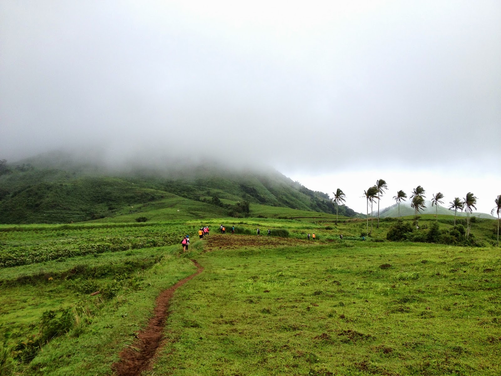
It was already 0800H when we reached the junction where we bid farewell to the bikers and continued towards Mt. Lagyo. It was after we reached another junction (where we took the trail on the left...the path on the right leads toward a residential area) that the trail began to get steeper. A mountain biker followed us and asked for directions saying that he is going to Pintong Bukawe which is still at least 3-4 hours from Mt. Lagyo (depending on the pace) considering the terrain of the trail that he still needs to cover. From the said junction where a store is located, we had to circle around Mt. Lagyo until we finally reached the trail that leads to the upper portions of the mountain.


It was 0820H when we reached the trail at the base of Mt. Lagyo where we decided to have some time to catch our breathes and prepare for the steeper climbs ahead. Initially, banana and some fruit-bearing trees dot the trail, until the rock scrambling began. Then we reached a bamboo grove which ultimately gave way to some more rock scrambling. The hike went on until 0915H, we reached the general area where the 1st Peak (viewdeck) of Mt. Lagyo is located.

Thursday, June 4, 2015

Mt. Pamitinan and Mt. Binacayan - Twinhike

Deciding to keep our next hike close to Metro Manila, we opted to do a twin hike of Mt. Pamitinan and Mt. Binacayan in  Rodriguez (formerly known as Montalban), Rizal.

Considered by many as twin mountains, Mt. Pamitinan and Mt. Binacayan are located in Sitio Wawa, Brgy. San Rafael Extension, Rodriguez, Rizal. These mountains are regarded as the home of the legendary Bernardo Carpio. Legend has it that Bernardo, a young man with unbelievable strength and power was supposedly trapped between these two mountains. He used his bare hands to push the two mountains apart from each other, thereby making a gap between the mountains in the process. The gap formed is allegedly the spot where Wawa Dam is found.

The Arch in Sitio Wawa just before the Multi-Purpose Hall and the Tourism Office

Km Post

As climb of the month (May 2015), Gani and I decided to do a twin dayhike of these "twin mountains" as they have aroused a lot of attention from both mountaineers and casual hikers since the start of the year.

We left McDonald's Eton Centris at 0520H for Rodriguez, Rizal via Commonwealth Avenue. We arrived in Sitio Wawa at 0630H, where we saw a number of hikers already on their way to Mt. Binacayan. We parked our vehicle near the Multi-Purpose Hall (cum Brgy. Hall) and immediately prepared our gears.


Nearing Sitio Wawa

At the local office of the DENR, we paid the registration fee of Php2.00 per/pax and P20.00 parking fee. The DENR also required us to sign a waiver and they likewise assigned us Alvin Dalida as our guide (He turned out to be a gem of a guide in the end). And after a few more formalities, we commenced hiking at 0730H.


Registration here is also required


The Waiver...at the Office of the DENR

Friday, July 11, 2014

Mt.Talamitam and Mt. Batulao - Twin Dayhike on a stormy weather


Since Typhoon Florita was then within the so-called Philippine Area of Responsibility, the Southwest Monsoon was relatively enhanced thereby causing inclement weather throughout the archipelago. Nevertheless, we did not let this dampen our spirits as Gani and I dared not only to brave the elements but to take it a notch higher this time by doing a twin dayhike.

In mountaineering jargon, a twin dayhike (as the term implies) refers to summiting two separate mountains within a single day. While this is no longer uncommon since there are also those who even do triple dayhikes (also referred to as circuit hikes), it is safe to say that only the most hardcore of mountaineers dare to do a twin dayhike. In our case, we went for the Mt. Talamitan - Mt Batulao Twin Dayhike.


Mt. Talamitam is covered by storm clouds

I left our house in Quezon City at 0430H and was able to fetch Gani at the MRT Boni Station 10 minutes later. At 0610H, we arrived at the jump-off point to Mt. Talamitam, Km. 83 along the Tagaytay-Batangas highway in Sitio Bayabasan, Brgy. Aga, Nasugbu, Batangas.

That is the Highway (the truck is heading towards Nasugbu); the road leads to the trail leading to Mt. Talamitam


B1 (Hardcore #1)
B2 (Hardcore #2)
  
Since as per our intended itinerary, we are scheduled to summit Mt. Talamitam and supposedly get back to the jump-off point before noontime, we already ate for breakfast the beef tapa that Bette prepared as our lunch. At 0635H, we commenced our twin dayhike.

The 1st Registration Area located along the Highway (just after Km. 83)