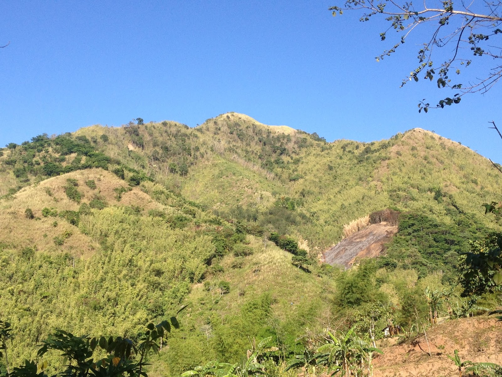
Showing posts with label Sierra Madre. Show all posts

Thursday, April 27, 2017

Mt. Lagyo traverse to Mt. Susong Dalaga

“Do not follow where the path may lead. Go instead where there is no path and leave a trail”

                                                                                                   – Ralph Waldo Emerson


After almost two years, we were finally back in Wawa to explore the mountains that were newly opened as hiking destinations.

Commencing the hike at 0720H, we threaded the road leading to Mt. Parawagan. We were initially surprised to see that the dirt road has now been cemented up to the point where a public resort is located just a few minutes before the junction leading to Mt. Lagyo is located. As there was an on-going fun ride at that time, we had to contend with a considerable number of riders making their way to the summit of Mt. Parawagan.


As it was Engr. who scouted for our hike and prepared our itinerary, we were then expecting a leisurely hike. Nonetheless, through the prodding of our guide (Mang Geovanni), we were persuaded to traverse Mt. Lagyo onward to Mt. Susong Dalaga for a twinhike.

It was already 0800H when we reached the junction where we bid farewell to the bikers and continued towards Mt. Lagyo. It was after we reached another junction (where we took the trail on the left...the path on the right leads toward a residential area) that the trail began to get steeper. A mountain biker followed us and asked for directions saying that he is going to Pintong Bukawe which is still at least 3-4 hours from Mt. Lagyo (depending on the pace) considering the terrain of the trail that he still needs to cover. From the said junction where a store is located, we had to circle around Mt. Lagyo until we finally reached the trail that leads to the upper portions of the mountain.


It was 0820H when we reached the trail at the base of Mt. Lagyo where we decided to have some time to catch our breathes and prepare for the steeper climbs ahead. Initially, banana and some fruit-bearing trees dot the trail, until the rock scrambling began. Then we reached a bamboo grove which ultimately gave way to some more rock scrambling. The hike went on until 0915H, we reached the general area where the 1st Peak (viewdeck) of Mt. Lagyo is located.

Tuesday, January 31, 2017

Laiban Quatro - Mt. Lubo, Mt. Ngusong Kabayo traverse to Tangwa Peak + (Laiban Falls)

"Only those who will risk going too far can possibly find out how far one can go."
                                                                                          - T.S. Eliot 

Since we were badly in need for a tune-up climb for our upcoming climb in Akiki, and having no idea to go, we decided to join an organized climb for a change. After threshing out the details from Kagawad, we were in no time up and about to tramp in the newest hiking hotbed in Tanay, Rizal, the Laiban Quatro.

Mt. Ngusong Kabayo
Upon arriving at Sitio Mayagay, our vehicle went straight to and parked at the basketball court. We then transferred to the monster jeep that will take us to Brgy. Laiban. As we were at least fifty (50) in the group, a good number of participants decided to topload. It was one cold and bumpy ride to Laiban since the usual morning mists were accompanied a drizzle. After forty minutes and nine (9) river crossings, we finally arrived at the Brgy. Hall in Laiban.
Laiban Brgy. Hall
Surprisingly, there are already a lot of hikers (one big group handled by an organizer) taking time to register. As for us, we just waited for our turn and decided to sit on the wooden benches in the makeshift stalls just opposite the Brgy. Hall. After we have logged-in, we were led to the house of Kagawad to re-group and for some to drink coffee and eat breakfast.

Sign in front of Kagawad Toto's home
It was already 0540H when we left the house of Kagawad. At the Brgy. Hall, we had a briefing as to what we are going to expect during the hike. After a short prayer, we settled ourselves into smaller groups (there are four of us in our group). And at 0555H, we were off and commenced hiking.

From the main road in Laiban, we backtrailed for about a hundred meters, turned right toward, and followed a footpath in between residential houses until we ascended into the mountain trail. As rain poured throughout the previous night, it was already one muddy and slippery climb from that point on. As we were told, our first stop would be Mt. Lubo, then proceed to Mt. Ngusong Kabayo, traverse to Tangwa Peak, and then take the backtrail to Mt. Lubo before turning left for the descent towards the famed four (4) waterfalls of Laiban.

Thursday, September 29, 2016

Maysawa Circuit - Mt. Sa Pari traverse to Mt. Binutasan, traverse to Maysawa Falls / Sapa

“Walk away quietly in any direction and taste the freedom of the mountaineer.” 

                                                                                                                  ― John Muir

After months of not having a hike, we were choosing whether to climb Pico de Loro (before it eventually closes its trails for the meantime), or to climb one of the newest traipsing trails of Southern Sierra Madre. Obviously, taking into consideration the expected foot traffic, we opted to go for the latter and hike up the now famous Maysawa Circuit.

Welcome to Maysawa Circuit
Maysawa Circuit is referred as such by reason of two things. First, it is located within Sitio Maysawa (pronounced as "May Sawa", interpreted in English as "There is a Python."). Second, it is a Circuit because its series of trails offers climbing a number of peaks and mountains namely, Mt. Sa Pari and Mt. Binutasan.

The appellation Mt. Sa Pari ("owned by the priest" when interpreted in English) was derived from the fact that the adjoining lands in the mountain was supposedly previously owned by a priest. On the other hand, Mt. Binutasan was christened as such since this is supposedly where a road going to the adjoining Brgy. Sto. NiƱo was made. In the vernacular, according to our guide (Ryan), "binutas ang bundok para gunmawa ng daan".

A faint Mt. Irid (left) and Mt. Tukduang Banoi (right)


From LRT-2 Cubao Station, we traversed Aurora Boulevard, and went on our usual route up to Masinag and Cogeo in Antipolo City via the Marifanta / MariLaQue Highway. Owing to the fact that we have previously hiked up Mt. Paliparan, we are now familiar where to register in Cuyambay. Hence, upon seeing a number of vehicles parked on the left side of the road (just before the junction going to Cuyambay Proper), we immediately recognized the place as the trailhead to Maysawa Circuit.

Nonetheless, as it is mandatory for hikers to first register and secure a guide at the Barangay Hall, we continued towards Brgy. Cuyambay Proper. (Hopefully, a satellite office / registration area will be established at the Maysawa JOP so that hikers will no longer be required to go to Cuyambay).

When we arrived, the Brgy. Hall is teeming with activity. As a considerable number of hikers have just registered and were busy preparing their gears (supposedly to climb Mt. Paliparan or Nagpatong Rock), groups of hikers continue to arrive. Obvious signs that Cuyambay has etched its own mark in the world of mountaineering / hiking. The local guide assigned to assist us during the climb is Ryan.

It was already a few ticks after 0700H when we left the trailhead / Maysawa Junction and started hiking. We hopped on the trail giddily, as we were enthusiastic to be back hiking. Hence, we politely declined the offer of riding the habal-habal. As we followed the dirt path, we snaked through the residential area and eventually passed by the makeshift basketball court. Then we reached the concrete part of the road, which according to Ryan, signifies that we are now nearing the rest house of a famous actor / actress. The end of the pavement ends at the habal-habal station, which incidentally is where patrons of the habal-habal are drop. Propitiously, the road / trail continued to dip, and to our amazement (as lady luck may have smiled to us), the sea of clouds were still prominent at that time.


Thursday, May 19, 2016

Mt. Paliparan - Traverse to Tuoy + Tungtong Falls (where the kites roam free)

"Unless we are willing to encourage our children to reconnect with and appreciate the natural world. We can't expect them to help protect and care for it."
                                                                                    - David Suzuki


The town of Tanay in the province of  Rizal is fast becoming a mountaineering/hiking hotbed. Proof of this is the emergence of new tramping grounds in the area.

The newest addition to the growing list of mountains in Tanay is Mt. Paliparan (meaning "airport" or "from where things are flown"). Situated in quaint Brgy. Cuyambay, Mt. Paliparan was christened as such since this is supposed to be the place where people belonging to the Dumagat Tribe fly kites, either for fun or for wagers. According to our guide Mang Carling, aside from bragging rights, bets in the kite fighting usually involve a sack of rice, kamote, and other agricultural products.

Mt. Paliparan...taken from the ridge leading to Tuoy

Another view of Mt. Paliparan

Mt. Paliparan...photo taken from Tuoy


Mt. Paliparan Summit
After more than an hour of travel from Quezon City, we finally arrived in Brgy. Cuyambay, Tanay, Rizal. As we tried to ask a lady who just bought something from a store for directions in going to the Brgy. Hall of Cuyambay, a man suddenly appeared and inquired if we intend to climb Mt. Paliparan, The man was no other than Kuya Inso, also referred to as Sir Inso by our guide. He then conducted a brief lecture regarding what to expect during the hike, including the climbing conditions and the places of special interests along the trail.

We were greeted by this view of Mt. Batolusong
Subsequent to paying the registration and environmental fees, we waited for the arrival of Mang Carling, the guide who was assigned to us for the day. It was 0745H when we left the trailhead (Brgy. Hall) for another day of adventure.

Wednesday, April 27, 2016

Maynoba Circuit - Mt. Maynoba + Mt. Cayabu + 8 waterfalls

We were not pioneers ourselves, but we journeyed over old trails that were new to us, and with hearts open. Who shall distinguish?
                                                         ― J. Monroe Thorington, The Glittering Mountains of Canada: A Record of                                                                           Exploration and Pioneer Ascents in the Canadian Rockies, 1914-1924


A new tramping ground has recently been launched in Tanay, Rizal. Dubbed as Maynoba Circuit, it was formally opened last March 22, 2016. And this early, I am sure that the Maynoba Circuit will soon be in the bucket list of mountaineers, hikers, climbers, and weekend warriors.

Mt. Maynoba
Mt. Maynoba / Mt. Cayabu
Climbing the Maynoba Circuit would entail climbing Mt. Maynoba and Mt. Cayabu. But the added bonus of having a chance to take a dip in any, if not all of the 8 waterfalls that may be found along the trail surely makes this climb undeniably enticing to everyone.

Having overslept (because I again dozed off after acknowledging the alarm that I have set), it was already 0545H when I arrived at the McDonald’s in Marco Highway to fetch my best hiking buddy (Gani). And after buying some of our needed provisions at a convenience store in Cogeo, we went straight to finding Brgy. Cayabu (Tanay, Rizal).

It was already 0720H when we arrived at Mar-ning’s Resort, the jump-off point for the Maynoba Circuit. After paying the registration fees and securing our local guide for the day, we started hiking at 0745H. Thinking that what we are going to climb is the mountain opposite the resort, we were actually surprised when our guide led us towards the back of the resort.

Welcome to Mar-Nings Farm and Resort

Swimming pool
We initially hiked on rice paddies (one can actually survey the course of the hike here) until we reached the dirt path that eventually led to the “bamboo gate”. We then reached the bohoan at 0800H. While the initial terrain is mainly ascending, there are also some rolling parts that may serve as a breather for the harder climbs ahead.
Tuesday, February 9, 2016

Mt. Mamara: a newly-opened mountain in Daraitan


“You don't need to climb a mountain to know that it's high.” 
                                                                            ― Paulo Coelho, Aleph


Nestled within a river valley in the Southern Sierra Madre is a paradise known as Barangay Daraitan, which lies within the boundaries of Tanay, Rizal. What was previously a haven for illegal loggers, has now become a sanctuary for mountaineers, hikers, weekend warriors, and casual tourists that ceaselessly flock to the place especially during holidays and weekends. So, as our first hike for 2016, we finally decided to hike in Daraitan.


Mt. Mamara...taken somewhere along the Tinipak River
Mt. Mamara...as seen a few meters from the jump off point
Fly high...Skookum jump
As our plan to hire a van did not materialize, we decided to just meet at the designated stop for jeepneys bound for Tanay opposite the Shangri-la Plaza Mall along Shaw Boulevard in Mandaluyong City. It was already 0445H when we boarded a jeepney, hoping that we are still within the 300 hikers to summit in a day quota that was recently imposed in Barangay Daraitan. We ultimately arrived at the Tanay Public Market at 0610H together with at least 12 hikers that flagged the jeepney somewhere in Cainta and Pasig.

Sunday, November 1, 2015

Mt. Hapunang Banoi - Climbing the Eagles' Eyrie

The popularity of the Wawa area in Rodriguez, Rizal as a mountaineering/hiking destination has really reached leaps and bounds since the time that the area was formally opened earlier this 2015. When we first hiked the trails of Mt. Binacayan and Mt Pamitinan, Mt. Hapunang Banoi is yet to be formally opened for mountaineers and hikers. Hence, as fate would have it, we saved the best (...and for me the hardest..) for last.

Peak 1

Peak 2

Peak 3 (Summit)

From our usual meeting place in Quezon City, we left for Wawa at 0515H and arrived at the registration center at 0600H. Surprisingly, the local guide assigned to us was Alvin, our guide when we first hiked the trails in Wawa.

We immediately commenced hiking after saying our own personal prayers. We crossed the Hanging Bridge to the other side of Wawa River, and made our way to the concrete steps leading to the residential area until we had to cross the mini-river onwards to the forest part of the trail. We continued and decided to take a short rest at the fork leading to Pamitinan Cave.

...at the Hanging Bridge

The famous Mt. Pamitinan and Mt. Binacayan


Wawa River

The wrath of Typhoon Lando wreaked havoc on the Banana Trees along the trail.

Tuesday, October 6, 2015

Mt. Sembrano - Manggahan Falls & Pililla Windmills

After months of shelving carefully laden plans in the past, we eventually decided to summit Mt. Sembrano. Hence, I had to fetch my climb buddy (Gani) along Ortigas Ave (near Robinsons Galleria) at 0530H.

Mt. Sembrano's South Summit....taken from the North Summit

Fortunately, we were able to find our way to the Barangay Hall of Malaya, Pililla, Rizal (where we eventually parked Jaff). After signing our names in the log book and paying the mandatory registration fee, we continued towards the trailhead leading to the summit of Mt. Sembrano which is just 100 meters, more or less, from the Barangay Hall (2nd street after the Flying V gas station). It was already 0755 when we commenced hiking.


Brgy. Hall / Registration Center
The hike began from the highway as the concrete road started to become steep, this would actually be the start of the never-ending assault until the summit (Yes, the climb is mostly uphill, maybe 85% thereof.). We made our way through the residential area until the pavement gave way to the “Rocky Road”.
It's a cloudy day in Mt. Sembrano


The Rocky Road begins where the concrete road ends.
Although there are still residential houses along the Rocky Road, it actually signified that we are nearing the edge of the forest. We then encountered the 1st split and took the trail on the right. We likewise crossed a brook thereafter. There are trail signs along the way except at the junction where the trail on the right leads down to the river (this is actually the old trail). Here, you must take the trail on the left since the old trail has already been closed due to landslide.

Friday, September 4, 2015

Mt. Romelo - Buruwisan Falls + Lanzones Falls

 
Although considered as one of the more famous climbs for mountaineering newbies, Mt. Romelo is better known for its waterfalls, namely: Buruwisan Falls, Lanzones Falls, Sampaloc Falls, Sapang Labo Falls, Batya-Batya Falls, Old Buruwisan, and Twin Falls (some say there is an 8th, "Diwata Falls, but I failed to verify this with the locals) that continue to serve as its crowd-drawers throughout the year.

Located in quaint Siniloan, Laguna, Mt. Romelo (although some fondly refer to it as Mt. Famy in reference to the adjoining town of Famy, Laguna) is regarded as a fun climb at 240 MASL. Nevertheless, climbing it would not be that fun and challenging unless one is ready to get wet and dirty because of its muddy horse trails (yes, even during summer).
While some would recommend hiking Mt. Romelo at summertime because it would mean less mud on the trail, hiking during the rainy season  however would be ideal for those who would want to see any of its seven (7) waterfalls at their best and mightiest.

With all these in mind, my former officemates collectively known as P@Akyat together with my best climbing buddy (and his boxing trainer) went on a dayhike within the so-called Waterfalls Sanctuary of Eastern Laguna. While most in our group went to the Raymond Bus Terminal in Legarda (Sampaloc, Manila) at 0400H, three (3) of us decided to just wait for and hail the bus along Ortigas Avenue near Robinsons Galleria. Needless to say, the bus that will take us to Siniloan encountered some delays as it was already 0615H when the bus left the station. Fifteen (15) minutes later, we were lucky to be on board as the driver refused to stop at the gas station where we were waiting (because there was already a traffic enforcer at the intersection at that time). Hence, we had no choice but to jaywalk and run for the bus like crazy (in the middle of Ortigas and Meralco Avenue intersection).

It was 0850H when bus had a brief stop-over somewhere in the town of Mabitac, Laguna. The bus continued its trip after fifteen (15) minutes and we arrived at the junction after 10 minutes. We finally arrived at the jumpoff (opposite the KTri Restaurant) five minutes later (0920H).

After buying snacks and food for lunch at KTri, we proceeded towards and arrived at the Registration Area after a 5-10 minute walk from the highway. We paid the mandatory registration fees and after some pleasantries, we started hiking at 0945H.

The sign...on the left side of the highway

We passed by this mini dam at the residential area

Going to the jumpoff...there is a Dragonfruit Plantation on the left side of the road

The Registration Area
From the Registration Area, we passed through the hanging bridge and made our way through a number of houses and eventually entered the forest as the trail became steeper. We inched our way until we reached a clearing (It was one of the parts of the trail where there are no forest cover). The view of some parts of Laguna and Rizal were spectacular as the rustic scene of the countryside is really something to behold. We again entered the forest until we finally arrived at the 1st Station (Hut) at 1025H.

Monday, July 20, 2015

Mt. Manalmon + Bayukbok Cave - Hiking and Spelunking on a rainy day!

Situated within the Biak-na-Bato National Park, Mt. Manalmon is a famous haven for mountaineers and weekend warriors. Last year, it has hugged the limelight due to the unfortunate incident that resulted to the untimely demise of some students of the Bulacan State University. As a result, the LGU, DENR, including the local guides, have decided to strictly enforce a no river-crossing policy as soon as the waters of the mysterious Madlum River becomes knee-high. As an added precaution, hikers are now required to secure permits either from the LGU of San Miguel, Bulacan or of Barangay Sibul. Hence, it is best to coordinate with the guides / coordinators in Sitio Madlum. Hikers are likewise required to sign a waiver at the registration center.

We left Cubao Quezon City at around 0600H and arrived at the jumpoff two hours later. Surprisingly, we saw a lot of mountaineers / hikers preparing their gears. We then crossed the hanging bridge (Thank God we never had to cross the river using the Monkey Bridge) and had to register on the other side of the river.


At the junction...take the rough road on the right.

Hanging Bridge


Looks like the Wawa Gorge

Registration
After paying the mandatory registration fees (Php5.00 per person), we immediately secured a guide and queried whether we can do a twinhike of Mt. Manalmon and Mt. Gola. Unfortunately, our guide (Jek) informed us that they do not allow river crossings at the Madlum River at that time because of the swollen waters of the river.

Monday, July 13, 2015

Climbing in Tanay, Rizal? - Read This....

The Tanay Tourism Office recently issued a list of guidelines that climbers / hikers / mountaineers should comply. This was posted on the Facebook page of Tanay Tourism and has caused a stir because of the controversial requirement of submitting a medical certificate as proof of one's physical fitness.

Mt. Batolusong's Rangyas Peak and Mapatag Plateau

As copied verbatim from the post in Tanay Tourism Facebook page, the mandatory requirements before climbing include:

"REQUIREMENTS FOR MOUNTAIN CLIMBING/MOUNTAINEERS:
1. Permit/clearance to climb from the municipality of Tanay (and the concerned barangay);

 2. Email your request to climb to jeffpino@gmail.com and/or jeffpino@yahoo.com (please address your letter to Hon. Rafael A. Tanjuatco, attention to Engr. Carlos E. Inofre, Environment Officer, and Mr. Jeffrey M. Pino, Tourism Officer ;

 3. List of persons participating the climb, with complete address and contact numbers and copy of ID's s...hould be provided/attached to the letter;

4. Itinerary of the activity should be attached to the letter/email;


5. Climbing gear and paraphernalia must be provided by the mountaineer;


6. Medical certificate from a competent physician, certifying that the mountaineer is physically fit and medically fit to do such activity must be presented to Tanay Tourism or Barangay Chairman before the mountain climbing activity. No medical certificate – no climb. Medical certificate may also be secured from the Rural Health Unit of Tanay or Barangay Sampaloc;


7. Must register at Barangay Hall, attend a short briefing and orientation, pay required fees, and tour guide assignment;


8. Must comply with the municipality’s ordinance on plastic/styro ban;


9. No alcoholic beverage is to be consumed during the mountain climbing activity;


10. Local tour guide is a MUST;


For further info/inquiry please contact 0917.5229024 / 0936.2284173 / 7361059 or 0998.9881590"


While I believe that the local tourism office only has the best of interests in setting the aforementioned mandatory requirements, submitting a medical certificate as proof of physical fitness will make a lot of mountaineers shy away from climbing in Tanay, Rizal. Among the popular climbs in the area are Mt. Irid, Mt. Batolusong, and Mt. Daraitan.

Filipinos are known for their aversion of going to the doctor since many view it as an added and unnecessary expense. Also most mountaineers are actually trying to enjoy the outdoors while  possibly having the least spending. And whatever happened to the good old waiver? Isn't the waiver also a declaration that one is fit enough to climb mountains? And I remember, we had to sign a waiver when we climbed Mt. Batolusong twice earlier this year. Just my two cents though.

In view of the foregoing, mountaineers and occasional hikers should be aware of the rules that are being implemented in Tanay and coordinate with the authorities prior to their scheduled climb.

*There are claims that hikers without medical certificates are allowed to proceed as long as they sign a waiver at the jumpoff

Tramping Advisory 002
Medical Certificate - Tanay, Rizal

Sunday, July 5, 2015

Mt. Ayaas - Wawa Dam traverse to Mascap

To climb or not to climb is not the question that we are to answer. Instead we were at that time asking ourselves, where to now? This is what actually transpired when we climbed Mt. Ayaas, a mountain situated in the up-and-coming mountaineering hotbed, that is Rodriguez (Montalban), Rizal.

Mt. Ayaas taken from the Bulakan Tree
 Days prior to the planned hike we were endlessly trying to contact Emman, the guide extraordinaire when it comes to the mountains of Montalban, and with supposed contact for our fallback climb being likewise unreachable, we surprisingly have nowhere to go.
Making our way towards the Wawa Dam
It was already 0445H when I was able to fetch the Engineer at our usual meeting place (Mcdonald’s Eton Centris). With a dilemma of having nowhere to climb, we made a last ditch effort of contacting Emman. Providentially, the other line rang. And from then, Emman told us to meet him at the DENR in Sitio Wawa at 0700H. Consequently, we found ourselves buying for additional supplies and eating our favorite breakfast every climb (Jollibee Corned Beef Meal weehee…”nasa Mcdo na nag-Jollibee pa”.). In that regard, it was already 0545H when we left Timog Avenue, Quezon City for Wawa Dam.

Although we took easy on the gas, we arrived in Wawa still 30 minutes early. Thus, we decided to park at the Multi-Purpose Hall in the hope getting additional sleep. But we were roused by a knock in the front passenger seat window by a smiling man, who turned out to be Emman, our guide for the day.

Thursday, June 4, 2015

Mt. Pamitinan and Mt. Binacayan - Twinhike

Deciding to keep our next hike close to Metro Manila, we opted to do a twin hike of Mt. Pamitinan and Mt. Binacayan in  Rodriguez (formerly known as Montalban), Rizal.

Considered by many as twin mountains, Mt. Pamitinan and Mt. Binacayan are located in Sitio Wawa, Brgy. San Rafael Extension, Rodriguez, Rizal. These mountains are regarded as the home of the legendary Bernardo Carpio. Legend has it that Bernardo, a young man with unbelievable strength and power was supposedly trapped between these two mountains. He used his bare hands to push the two mountains apart from each other, thereby making a gap between the mountains in the process. The gap formed is allegedly the spot where Wawa Dam is found.

The Arch in Sitio Wawa just before the Multi-Purpose Hall and the Tourism Office

Km Post

As climb of the month (May 2015), Gani and I decided to do a twin dayhike of these "twin mountains" as they have aroused a lot of attention from both mountaineers and casual hikers since the start of the year.

We left McDonald's Eton Centris at 0520H for Rodriguez, Rizal via Commonwealth Avenue. We arrived in Sitio Wawa at 0630H, where we saw a number of hikers already on their way to Mt. Binacayan. We parked our vehicle near the Multi-Purpose Hall (cum Brgy. Hall) and immediately prepared our gears.


Nearing Sitio Wawa

At the local office of the DENR, we paid the registration fee of Php2.00 per/pax and P20.00 parking fee. The DENR also required us to sign a waiver and they likewise assigned us Alvin Dalida as our guide (He turned out to be a gem of a guide in the end). And after a few more formalities, we commenced hiking at 0730H.


Registration here is also required


The Waiver...at the Office of the DENR