Showing posts with label Sea of Clouds. Show all posts

Thursday, September 29, 2016

Maysawa Circuit - Mt. Sa Pari traverse to Mt. Binutasan, traverse to Maysawa Falls / Sapa

“Walk away quietly in any direction and taste the freedom of the mountaineer.” 

                                                                                                                  ― John Muir

After months of not having a hike, we were choosing whether to climb Pico de Loro (before it eventually closes its trails for the meantime), or to climb one of the newest traipsing trails of Southern Sierra Madre. Obviously, taking into consideration the expected foot traffic, we opted to go for the latter and hike up the now famous Maysawa Circuit.

Welcome to Maysawa Circuit
Maysawa Circuit is referred as such by reason of two things. First, it is located within Sitio Maysawa (pronounced as "May Sawa", interpreted in English as "There is a Python."). Second, it is a Circuit because its series of trails offers climbing a number of peaks and mountains namely, Mt. Sa Pari and Mt. Binutasan.

The appellation Mt. Sa Pari ("owned by the priest" when interpreted in English) was derived from the fact that the adjoining lands in the mountain was supposedly previously owned by a priest. On the other hand, Mt. Binutasan was christened as such since this is supposedly where a road going to the adjoining Brgy. Sto. NiƱo was made. In the vernacular, according to our guide (Ryan), "binutas ang bundok para gunmawa ng daan".

A faint Mt. Irid (left) and Mt. Tukduang Banoi (right)


From LRT-2 Cubao Station, we traversed Aurora Boulevard, and went on our usual route up to Masinag and Cogeo in Antipolo City via the Marifanta / MariLaQue Highway. Owing to the fact that we have previously hiked up Mt. Paliparan, we are now familiar where to register in Cuyambay. Hence, upon seeing a number of vehicles parked on the left side of the road (just before the junction going to Cuyambay Proper), we immediately recognized the place as the trailhead to Maysawa Circuit.

Nonetheless, as it is mandatory for hikers to first register and secure a guide at the Barangay Hall, we continued towards Brgy. Cuyambay Proper. (Hopefully, a satellite office / registration area will be established at the Maysawa JOP so that hikers will no longer be required to go to Cuyambay).

When we arrived, the Brgy. Hall is teeming with activity. As a considerable number of hikers have just registered and were busy preparing their gears (supposedly to climb Mt. Paliparan or Nagpatong Rock), groups of hikers continue to arrive. Obvious signs that Cuyambay has etched its own mark in the world of mountaineering / hiking. The local guide assigned to assist us during the climb is Ryan.

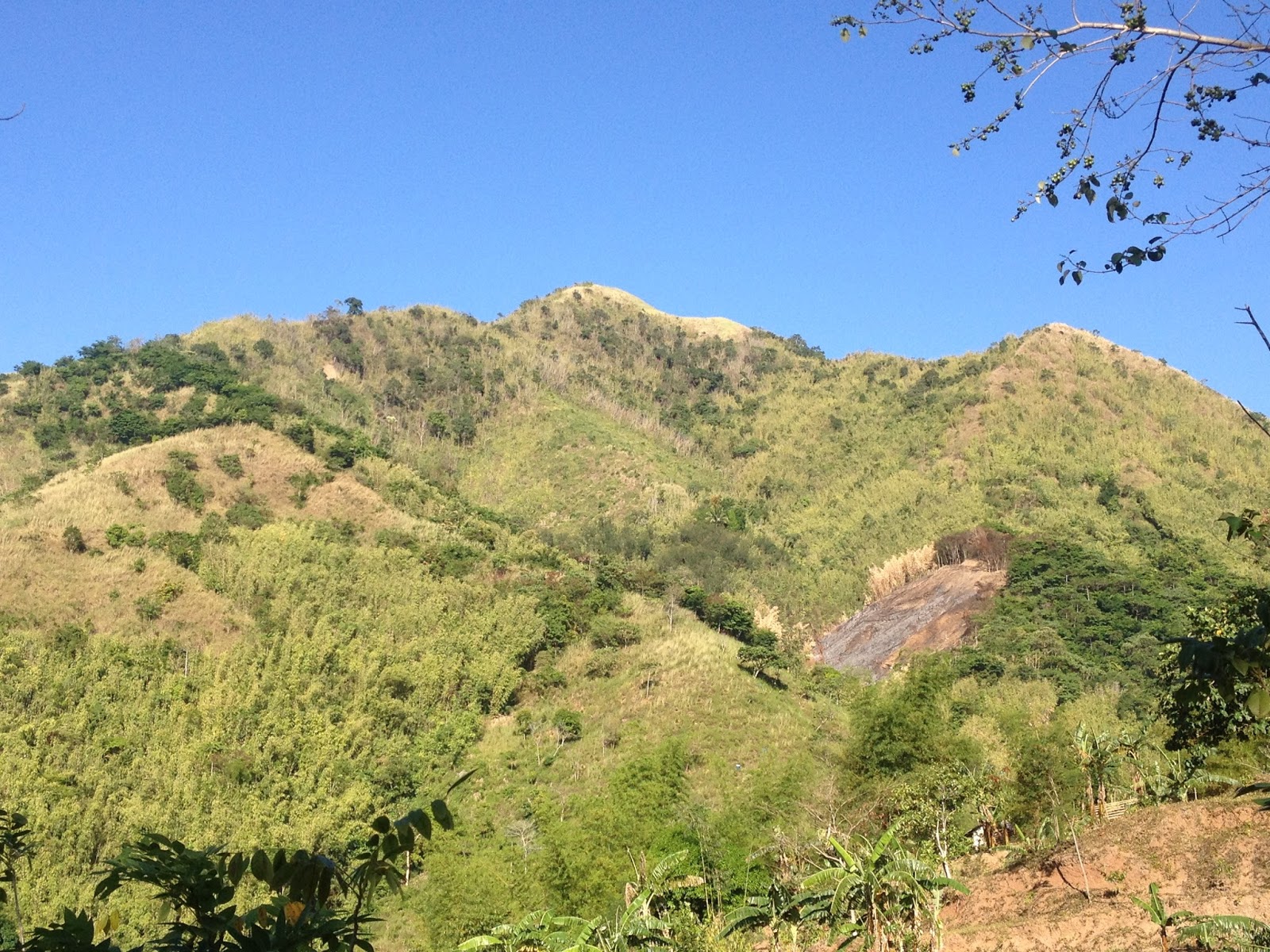
It was already a few ticks after 0700H when we left the trailhead / Maysawa Junction and started hiking. We hopped on the trail giddily, as we were enthusiastic to be back hiking. Hence, we politely declined the offer of riding the habal-habal. As we followed the dirt path, we snaked through the residential area and eventually passed by the makeshift basketball court. Then we reached the concrete part of the road, which according to Ryan, signifies that we are now nearing the rest house of a famous actor / actress. The end of the pavement ends at the habal-habal station, which incidentally is where patrons of the habal-habal are drop. Propitiously, the road / trail continued to dip, and to our amazement (as lady luck may have smiled to us), the sea of clouds were still prominent at that time.

Wednesday, April 27, 2016

Maynoba Circuit - Mt. Maynoba + Mt. Cayabu + 8 waterfalls

We were not pioneers ourselves, but we journeyed over old trails that were new to us, and with hearts open. Who shall distinguish?
                                                         ― J. Monroe Thorington, The Glittering Mountains of Canada: A Record of                                                                           Exploration and Pioneer Ascents in the Canadian Rockies, 1914-1924


A new tramping ground has recently been launched in Tanay, Rizal. Dubbed as Maynoba Circuit, it was formally opened last March 22, 2016. And this early, I am sure that the Maynoba Circuit will soon be in the bucket list of mountaineers, hikers, climbers, and weekend warriors.

Mt. Maynoba
Mt. Maynoba / Mt. Cayabu
Climbing the Maynoba Circuit would entail climbing Mt. Maynoba and Mt. Cayabu. But the added bonus of having a chance to take a dip in any, if not all of the 8 waterfalls that may be found along the trail surely makes this climb undeniably enticing to everyone.

Having overslept (because I again dozed off after acknowledging the alarm that I have set), it was already 0545H when I arrived at the McDonald’s in Marco Highway to fetch my best hiking buddy (Gani). And after buying some of our needed provisions at a convenience store in Cogeo, we went straight to finding Brgy. Cayabu (Tanay, Rizal).

It was already 0720H when we arrived at Mar-ning’s Resort, the jump-off point for the Maynoba Circuit. After paying the registration fees and securing our local guide for the day, we started hiking at 0745H. Thinking that what we are going to climb is the mountain opposite the resort, we were actually surprised when our guide led us towards the back of the resort.

Welcome to Mar-Nings Farm and Resort

Swimming pool
We initially hiked on rice paddies (one can actually survey the course of the hike here) until we reached the dirt path that eventually led to the “bamboo gate”. We then reached the bohoan at 0800H. While the initial terrain is mainly ascending, there are also some rolling parts that may serve as a breather for the harder climbs ahead.

Saturday, February 13, 2016

Mt. Pulag - Tramping Advisory (20 hikers per group)

The Mt. Pulag National Park has imposed a limitation on the number of hikers that a specific coordinator/organizer shall be allowed to include in a group. Now, the maximum members allowed for each group shall be twenty (20) and only those who comply with this requirement shall be allowed to leave for the Ranger Station.


In line with this, all organizers with more than 20 participants are advised to reduce the members of their respective teams. Those who have previous reservations are given the chance to enter the park but from now on, the management will now start imposing the 20 pax per team to give chances for other climbers to trek the park.

Also, the DENR has qualified that the suspension of reservations for 2017 covers the Babadak Trail on Saturdays only. Trekkers below 10 members per team could however be accommodated to provide social assistance to the community guides and porters.

And lastly, since the park management has not increased its fees since 2000. It was also announced that there shall be an increase in the Entrance Free from P100 per head to P175.00/head pursuant to the Resolution of the Protected Area Management Board (PAMB) in 2015. .

Link to the post: Mt. Pulag - 20 members in a team


Tramping Advisory 011
002.010.016
Mt. Pulag - Members per team; Suspension of Resevations

#MtPulag #SeaofClouds

Friday, February 12, 2016

Mt. Pulag - Tramping Advisory (Marking of Hikers; Suspension of Reservations for all weekends in 2017)

The management of the Mt. Pulag National Park has mandated the marking of the hands of all trekkers at the Visitors' Center, after it has been verified that the hikers involved have reservations and that they have undergone the orientation before entering the park. As such, trekkers with no seal from the Visitors' Center/Protected Area Office shall not be allowed entry. Hence, trekkers with no reservations are hereby advised not to proceed directly to the Babadak Ranger Station.


Organizers who usher hikers more than what were actually indicated in their reservations are also advised to just visit the mountain lakes located at the northern part of Mt. Pulag so that they may have an alternative activity.
Lastly, it has also been resolved that reservations for all weekends of 2017 are suspended until further notice.


Visit the post here: Mt. Pulag

Tramping Advisory 010
002.010.016
Mt. Pulag - Marking of Hikers; Suspension of Resevations

#MtPulag #SeaofClouds

Monday, January 11, 2016

Mt. Pulag - Tramping Advisory (Reservation Fees)

As the process of making prior reservations with the DENR has been abused by unscrupulous and insensitive organizers, the Mt. Pulag National Park Management has issued an advisory today mandating climb organizers with monthly and/or weekly reservations to pay the corresponding registration fees of all the slots they have reserved at the Visitors Center and Protected Area Office prior to the actual date of the supposed climbs / hikes.

Mt. Pulag's Summit is teeming with hikers and mountaineers every weekend.

Sea of Clouds

Failure to pay the aforementioned reservation fees shall forfeit the supposed slots reserved by the aforesaid climb organizers. Moreover, reservation shall be non-transferable and non-refundable.

With this, the Park Management aims to address the disadvantage and prejudice caused by the indiscriminate practice of some climb organizers to monopolize the limited slots allotted for weekend climbs in Mt. Pulag via the Ambangeg Trail.

Mt. Pulag is in everybody's mountaineering bucket list.

For more details and clarifications, you may contact any of these mobile phone numbers: 09291668864 or 09103010423. You may likewise click on this link Mt-Pulag-National-Park-Bulletin for further  details from the Facebook page of the Mt. Pulag National Park Management.


Tramping Advisory 008
001.011.016
Mt. Pulag - Reservation Fees

***It is emphasized that this declaration covers only climb organizers who have weekly and/or monthly scheduled climbs in Mt. Pulag. In other words, mountaineering groups and walk-in hikers are not covered by this directive.

#MtPulag #SeaofClouds

Sunday, November 1, 2015

Mt. Hapunang Banoi - Climbing the Eagles' Eyrie

The popularity of the Wawa area in Rodriguez, Rizal as a mountaineering/hiking destination has really reached leaps and bounds since the time that the area was formally opened earlier this 2015. When we first hiked the trails of Mt. Binacayan and Mt Pamitinan, Mt. Hapunang Banoi is yet to be formally opened for mountaineers and hikers. Hence, as fate would have it, we saved the best (...and for me the hardest..) for last.

Peak 1

Peak 2

Peak 3 (Summit)

From our usual meeting place in Quezon City, we left for Wawa at 0515H and arrived at the registration center at 0600H. Surprisingly, the local guide assigned to us was Alvin, our guide when we first hiked the trails in Wawa.

We immediately commenced hiking after saying our own personal prayers. We crossed the Hanging Bridge to the other side of Wawa River, and made our way to the concrete steps leading to the residential area until we had to cross the mini-river onwards to the forest part of the trail. We continued and decided to take a short rest at the fork leading to Pamitinan Cave.

...at the Hanging Bridge

The famous Mt. Pamitinan and Mt. Binacayan


Wawa River

The wrath of Typhoon Lando wreaked havoc on the Banana Trees along the trail.

Tuesday, May 12, 2015

Mt. Pulag Open Climb - Ranger Station to the Sea of Clouds

Straight from our side trip (which we did in reverse to the usual Pulag itinerary)  we headed towards the DENR for us to be able to register and attend the short briefing before we ultimately proceed to the Ranger Station and set up camp.

THE BRIEFING

We finally arrived at the DENR at 1000H. We paid our registration fees and waited for our turn for the short briefing about the to do's and what not's inside the nature reserve. It was actually 1120H when we left the Ranger Station.

Starting February 2015, the DENR has proscribed camping at Camp 2 Extension. Moreso, the DENR has likewise limited the slots (150...?) for campers at Camp 2 and Camp 1 during weekend hikes (Saturday-Sunday). As such, majority of the informal hikers and weekend warriors that troop to Mt. Pulag via Ambangeg (Executive Trail) are now compelled to camp at the Ranger Station.

Busy

Shirts for sale

Sir Espi welcomes you to Mt. Pulag

The main entrance

The DENR...taken from the road
With this setup, the locals at the Ranger Station now enjoy extra income (from camping fees to fees for toilet use). It is also noticeable that more and more enterprising locals have started to sell foodstuff and other goodies. They also rent camping necessities to hikers like earth pads, tents, and cooking utensils.

The DENR has likewise decided to limit the number of hikers at the summit per given time. In this regard, hikers have been assigned to the different peaks (such as Peak 3, Peak 2, and the Tower Station) for the sunrise-viewing and the famous sea of clouds.


Monday, May 11, 2015

Mt Pulag Side Trip - Ambuklao Dam; Jangjang Hanging Bridge; Badekbek Sulfur Spring

Our latest Open Climb in Mt. Pulag (Ambangeg-Ambangeg) turned out to very fruitful. The participating climbers actually were employees of audit firm, Punongbayan & Araullo (P&A). Skookums Allan, Espi, and Oliver acted as Team Leaders and Organizer of the group. They were ably assisted by Ember, otherwise known as the Barack "Mr President" Obama of CB Richard Ellis Philippines.

The all-P&A team was composed by Marco Rivas, Yaz Recta, Rosanna Balotro, Frani Custodio, Jenica Angeles, Klein Cajucom,


THE SIDETRIP

Since we were scheduled to camp at the Ranger's Station in Babadak, we deemed it better for us to spend extra time on the road and visit nearby natural and/or man-made wonders in Bokod. We so thankful to Moi, the driver of the monster jeep that we rented in going to Bokod, Benguet from the City of Pines.


We were the 1st ones to arrive here

Agno River...at the back of Danao Eatery
Aside from the usual sidetrip to the Ambuklao Dam, we also were able to go to and cross the Jangjang Hanging Bridge and endured the rotting stench in Daclan Sulfur Spring.

Monday, October 27, 2014

Mt. Pulag 2 - The Sea of Clouds

Initially, we were roused by the unforgiving cold at around 0100H and as every minute pass, the night's stillness and tranquility were slowly overwhelmed by the mindless banter of people who chose to be oblivious to others who were still trying to get additional sleep.

At 0300H, since the biting cold made it even harder for us to doze off, we decided to prepare for the early morning assault to the summit. It was really freezing cold at that time. Consider this, I purposely left bottles of water and energy drinks outside our tent, and these really turned cold as if these were just taken off a freezer.

Also, with the increase in activity, the camp site came back to life. There were already those who opted to start the assault early as the lights from their headlamps can be seen slowly inching up in the mountains.

It was already 0415H when we started to hike. The cold weather and the thin air made the hike harder. Nevertheless, the twinkling stars in the clear and vast sky served as an incentive for us to to go on.

When we arrived at an intersection, we chose to scale the harder/shorter route (most hikers would proceed via the longer/winding trail). And at 0530H, we finally reached the highest point in Luzon. There were already quite a number of hikers entrenched in their spots, so we chose to settle on the southeastern portion of the summit.


At 0545H, as more and more hikers converged in the summit, the rays of the sun started to dawn on the horizon. And of course, comes with it is the magnificent sea of clouds for which Mt. Pulag is revered for.

Wednesday, June 18, 2014

Mt. Tapulao - 3 (Bunkhouses to Dampay-Salaza)


Fully aware that the open trail of Mt. Tapulao can be one hellish footpath especially during the advent of summer, aside from the fact that the big group of mountaineers went ahead of us by at least an hour (we feared the interruption that this group would cause us at the wash-up area), we agreed among ourselves to go hard on the trail and make full use of gravity as we go down Central Luzon’s highest peak. 

And our prize would be the Tinolang Manok that we ordered, as well as having a cool and refreshing bath without delay.

Ready to go...


Our target is to make it in Dampay-Salaza within 5 hours, which as per our calculations would give us enough time to rest, wash-up, have lunch and leave for Iba before sunset.

Again, we were the last mountaineers to leave the bunkhouses for Sitio Dampay that day.

Tuesday, June 17, 2014

Mt. Tapulao - 2 (Bunkhouses - Summit - Bunkhouses)


Aiming to enjoy the sunrise and of course hoping to see the renowned sea of clouds at the summit, we were supposed to wake up at 0400H. However, our designated watchman inadvertently set his alarm at 1600H (or 4:00PM). As such, we started our day an hour late from our supposed departure for the summit.

The cardiac assault made us feel heaviness in our feet. Likewise, there is lightness in our heads as we pushed our way up the entrance to the mossy forest. It was a good thing that the cold weather really made us homey. We were able to reach the clearing (which is also an alternative camp for mountaineers) at around 0530H. We spent a substantial time resting at the trunk of a fallen pine tree as we were literally panting and gasping for air.

At the mini-campsite after the steep ascent from the bunkhouse

already late for sunrise

fallen log

The entrance to the mossy forest is found at the northern part of the clearing. At this time, the rays of the sun have already started to slowly break the darkness around us.

While still an inclined ascent, the next part of the trail along the mossy forest is a lot easier to negotiate. The mossy forest is really akin to that found in Mount Pulag. We were able to finally summit Mt. Tapulao at 0610H.

Wednesday, June 4, 2014

Mt. Tapulao - 1 (Dampay-Salaza to Bunkhouses)

This is an account of our climb in Mt. Tapulao on March 28-30, 2014, when Skookum Mountaineers was still in its pre-formal stages. While we were already considering ourselves as Skookums at this time, we were yet to be formally inducted as part of the group.

**************************************************************************** 

While our initial plan really was to do a traverse of Mt. Ugo from Kayapa, Nueva Vizcaya to Itogon, Benguet, conflicts in the respective schedules of some of our friends and fellow Skookum, as well as budgetary concerns constrained us to opt for Mt. Tapulao instead.

According to Allan, same with Mt. Ugo, Mt. Tapulao is also famous for its pine forest and its trail that will surely test the patience of even the most hardcore of mountaineers. As known in the world of mountaineering, Mt. Tapulao is also referred to as the "poor man's Pulag."


Just to illustrate, the jump-off point is at an elevation a shade above 100MASL, whereas Mt. Tapulao’s summit is at 2037MASL. In other words, it is a gain in altitude of about 1900MASL strewn over 18 kilometers of open, rocky, rough, bouldery and 90% skyward trail.

As we really wanted to conquer ourselves, we decided to give it a shot. There were five of us who took up the challenge namely: Bette, Allan, Gani, Lennon, and Oliver.

Mt. Tapulao is the peak in the middle
In anticipation of the weekend traffic, we arrived at the Victory Liner Bus Terminal in Caloocan City at 2100 (March 28) or thirty minutes prior to our intended departure time for Iba, Zambales. It was really a good thing that we were there early since we never knew that there were actually two terminals of Victory Liner in the area. One is located just beside the Victory Mall (along Rizal Avenue), where we were actually waiting, and the other at the back of the said mall, where the buses bound for Zambales are stationed. So we again had to rush to the other end of the terminal or else our reserved seats will be given to chance passengers.


All set...


Pasimpleng Engr...chickababes ang seatmate hehe
An hour and a half into the trip, we had a stopover somewhere in Lubao, Pampanga where we bought snacks and some trail food. Of course, with our favorite chicharon included. The food here is actually better than in the subsequent bus stops, so better have your fill here and then try to get as much sleep as you can for the rest of the trip.