Wednesday, April 27, 2016

Maynoba Circuit - Mt. Maynoba + Mt. Cayabu + 8 waterfalls

We were not pioneers ourselves, but we journeyed over old trails that were new to us, and with hearts open. Who shall distinguish?
                                                         ― J. Monroe Thorington, The Glittering Mountains of Canada: A Record of                                                                           Exploration and Pioneer Ascents in the Canadian Rockies, 1914-1924


A new tramping ground has recently been launched in Tanay, Rizal. Dubbed as Maynoba Circuit, it was formally opened last March 22, 2016. And this early, I am sure that the Maynoba Circuit will soon be in the bucket list of mountaineers, hikers, climbers, and weekend warriors.
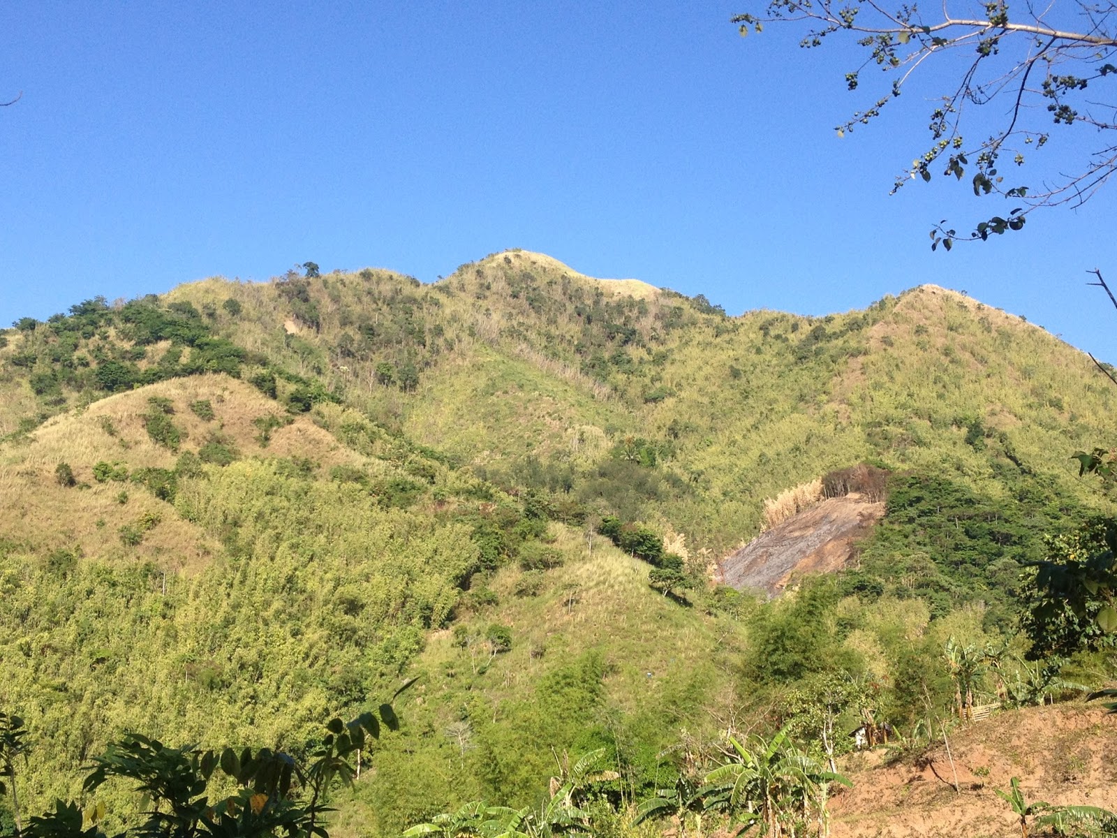
Mt. Maynoba
Mt. Maynoba / Mt. Cayabu
Climbing the Maynoba Circuit would entail climbing Mt. Maynoba and Mt. Cayabu. But the added bonus of having a chance to take a dip in any, if not all of the 8 waterfalls that may be found along the trail surely makes this climb undeniably enticing to everyone.

Having overslept (because I again dozed off after acknowledging the alarm that I have set), it was already 0545H when I arrived at the McDonald’s in Marco Highway to fetch my best hiking buddy (Gani). And after buying some of our needed provisions at a convenience store in Cogeo, we went straight to finding Brgy. Cayabu (Tanay, Rizal).

It was already 0720H when we arrived at Mar-ning’s Resort, the jump-off point for the Maynoba Circuit. After paying the registration fees and securing our local guide for the day, we started hiking at 0745H. Thinking that what we are going to climb is the mountain opposite the resort, we were actually surprised when our guide led us towards the back of the resort.

Welcome to Mar-Nings Farm and Resort

Swimming pool
We initially hiked on rice paddies (one can actually survey the course of the hike here) until we reached the dirt path that eventually led to the “bamboo gate”. We then reached the bohoan at 0800H. While the initial terrain is mainly ascending, there are also some rolling parts that may serve as a breather for the harder climbs ahead.

Monday, April 11, 2016

Mt. Tangisan - Hike after the forest fire

There are two kinds of people. Those who climb mountains and those who sit in the shadow of the mountains and critique the climbers.” 
                                                                                                                            ― Richard Paul Evans

As I only had barely two days left to use my Birthday Leave (we are only allowed to use it during our birth month), it was my first time in a long while to again climb solo, and on a weekday at that.

At first, I could barely decide where to go until a brilliant idea pique my interest and which eventually made me decide to visit some friends in my province. As such, I found myself driving towards the NLEX while eagerly anticipating the climb up Mt. Tangisan.


Mt. Tangisan

Mt. Tangisan as seen from Monasterio de Tarlac


For starters, Mt. Tangisan is one of the mountains located in Western Tarlac (particularly in the town of San Jose), thus the popular term "San Jose Circuit". As I have already done the Circuit Climb twice, I know how humid the climb up the mountains of San Jose can be. Yes, while the mountains in San Jose are not really that tall, the climbing conditions (especially the heat/humidity) can take its toll on a climber / hiker.

Thursday, March 31, 2016

San Jose Circuit - Tramping Advisory (Permit to Climb)

Mountaineers/Climbers/Hikers wishing to climb the mountains in the town of San Jose, Tarlac (San Jose Circuit) are now required to secure a permit from the Municipal Tourism Office. This policy has been enforced due to the untoward incident that happened last 2015 to a group of hikers that went on an Outreach Mission in Sitio Baag.
Mt. Tangisan


Mt. Matalaubaba
For more details, you may contact Engr. Ramil E. De Vera, the Municipal Tourism Officer / Municipal Engineer of San Jose at +63 908 881 9789. You may likewise send an email to him at redevera33@gmail.com


Should you wish to personally drop by the Municipal Tourism Office, it is located at the Municipal Hall Complex in Brgy. Villa Aglipay, San Jose, Tarlac.


Climbing Mt. Kawayan

Skookum Jump....with Mt. Ngile and the San Pedro River Valley in the background
***As I decided to go back to the San Jose Circuit for a dayhike up Mt. Tangisan last March 30, I was informed at the Registration Area that climbers / hikers are now mandated to secure a permit from the Municipal Tourism Office. Hence, I rushed back to the Municipal Hall and was so fortunate to have been permitted to climb despite the short notice. But I would recommend that you secure the permit or at least coordinate with the Municipal Tourism Office prior to the actual date of the climb.


Tramping Advisory 014
003.030.016
San Jose Circuit / San Jose Tarlac (Climbing Permit)

Saturday, March 19, 2016

Pico de Loro / Mt. Palay-Palay - Tramping Advisory (Temporary closure of the Monolith)

***Please note that there are claims (still unverified) that the Monolith is still open since it is supposedly outside the jurisdiction of Cavite, and that one only needs to sign a waiver in case a hiker/climber wishes to scale the Monolith (as of March 23, 2016).


Pico de Loro is one of the most popular climbs in the entire Philippines. Aside from the challenging trails and magnificent views at the summit, it's Monolith is really one of a kind attraction. As such, climbing the Monolith has become a personal rite of passage to the daring.


The Monolith on the left....the Summit on the Right.
On the other hand, this popularity has likewise become Pico de Loro's curse. As the number of climbers scaling it has dramatically increased in recent years, considerable changes along the trail leading to its Summit, much less, the trail leading to the Monolith became more and more obvious.
The Monolith taken from the Summit
In this regard, the DENR-PENRO in Cavite issued an order temporarily barring mountaineers / hikers / climbers from climbing the Pico de Loro's Monolith starting March 15, 2016. The DENR-PENRo Cavite cited the supposed erosion of land and loss of vegetation at the base of the Monolith in issuing the directive.


Mountaineers / hikers / climbers, please be advised accordingly. Let us help the mountain heal itself.


***credits to the owner of this photo that I got from the net
Tramping Advisory 013
003.016.016
Pico de Loro / Mt. Palay-Palay (Temporary Closure of Monolith)

Sunday, February 28, 2016

Manabu Peak - Mataas na Bundok

"He that plants trees loves others besides himself."
- Thomas Fuller -

Manabu Peak is one of the more popular minor climbs that is relevantly close to Metro Manila. Most enjoy its dense forest cover, the interesting flora and fauna within its range, and the wonderful views that it offers. Of course, who would ever forget the free civet coffee of Mang Tino and Mang Pirying. There are really a lot of reasons that climbers continue to flock and climb Manabu.


Arriving at the trail head, we changed gears and prepared to climb. Holding the seedling that we purchased at the registration area in one, we were so eager to trailblaze again.


Engr's seedling
The initial part of the trail is similar to the approach in Mt. Sembrano and Mt. Romelo. Subsequent to the preliminary plunge and ascent, we passed by agricultural  crops and some orchards as we slowly went deeper into the forest and reach the Stations of the Manabu Loop (Yes, the trail is a loop that is comprised by a number of Stations).

The rolling terrain went on until we finally arrived at Station 3 where we briefly stopped for some photo ops. Here, we also had to cross the brook. As the forest in the Malipunyo Range (where Manabu is located) is really one of the more impressive ones in the entire Philippines, it is not surprising that the flora and fauna in the area is really remarkable.


At the Station 3
Onwards, we passed by farmlands and even had to stoop down at one point in order to get pass by steel wires that resemble a clothesline, which I supposed is being used by the locals as a trellis for their vegetable crops.We decided to have our first rest stop at Station 4. This is where the loop trail merges. The trail on the left leads directly to the Grotto (Station 8) and is relatively an easier ascent towards the summit. On the other hand, while the conventional trail on the right is the steeper assault, it nonetheless leads to Station 5, where Mang Tino and Mang Pirying shall gamely offer a free taste of civet coffee to hikers.

Friday, February 26, 2016

Mt. Pulag - Tramping Advisory (Akiki Trail temporarily closed for hikers)

It was announced by the Mt. Pulag National Park administration that the Akiki Trail in Mt. Pulag is currently closed due to the loose rocks that were caused by the forest fire that recently affected the area.


For further updates on the matter, you may seek for updates at Facebook Page of the Mt-Pulag-National-Park-Bulletin or directly contact them: 09291668864 or 09103010423. You may likewise click on this link.


Tramping Advisory 012
002.025.016
Mt. Pulag - Akiki Trail (Temporary Closure)

#MtPulag #SeaofClouds

Saturday, February 13, 2016

Mt. Pulag - Tramping Advisory (20 hikers per group)

The Mt. Pulag National Park has imposed a limitation on the number of hikers that a specific coordinator/organizer shall be allowed to include in a group. Now, the maximum members allowed for each group shall be twenty (20) and only those who comply with this requirement shall be allowed to leave for the Ranger Station.


In line with this, all organizers with more than 20 participants are advised to reduce the members of their respective teams. Those who have previous reservations are given the chance to enter the park but from now on, the management will now start imposing the 20 pax per team to give chances for other climbers to trek the park.

Also, the DENR has qualified that the suspension of reservations for 2017 covers the Babadak Trail on Saturdays only. Trekkers below 10 members per team could however be accommodated to provide social assistance to the community guides and porters.

And lastly, since the park management has not increased its fees since 2000. It was also announced that there shall be an increase in the Entrance Free from P100 per head to P175.00/head pursuant to the Resolution of the Protected Area Management Board (PAMB) in 2015. .

Link to the post: Mt. Pulag - 20 members in a team


Tramping Advisory 011
002.010.016
Mt. Pulag - Members per team; Suspension of Resevations

#MtPulag #SeaofClouds