 |
| Mt. Batolusong's Rangyas Peak...taken from Mapatag Plateau |
 |
| Mt. Batolusong...just before the landslide |
Itching to go on a hike despite their busy schedules, Skookums Oliver and Gani decided to go on a dayhike last March 29, 2015. Since the other Skookums were not available at that time (Skookum Allan was in Mt. Pulag for one of our Open Climbs this summer), we hiking buddies searched for a new tramping ground close to the metropolis. As we were already scheduled later in the day to watch one of the highly-anticipated movie sequels of summer, we chose to scale Mt. Batolusong.
On board Goldie (one of our usual service vehicles), we left Cubao at 0515H and followed Aurora Boulevard to the East, going straight to Marcos Highway in Antipolo. After buying breakfast at Jollibee (located on the opposite corner of the intersection where Sta. Lucia Mall and Robinsons Metro East is located), we continued towards and went past Cogeo. As we reached the outskirts of Antipolo, we gained more altitude and passed by a number of highland resorts and subdivisions such as the Boso-Boso, Palo Alto and Garden Cottage. A few hundred meters after Kilometer Post 51, we arrived at "Batangasan Junction", which leads to Barangay San Andres.
 |
| The Welcome sign at the Batangasan...look for this on the left side of the road just after the 51-kilometer post |
 |
| Marcos Highway going to Sampaloc...the Welcome Marker is on the left side of the highway |
From there, we took a left turn and followed the concrete road that soon became a rough road. The Barangay Hall of San Andres is some 4 kilometers from the highway in Batangasan. To actually reach it, one needs to take a left turn just after the Barangay Chapel. After paying the mandatory registration (P20.00) and guide fees, we immediately put on our gears.
 |
| The Brgy. Chapel...located just before the road leading to the Brgy. Hall |
 |
| The road leading to the Brgy. Hall...some 80 meters |
 |
| The Covered Court and the Brgy. Hall |
Vir (Virgilio), our guide told us to park our car at the compound owned by the President of organization of guides in Brgy. San Andres. The compound is located just after bridge and a few meters from the waiting shed that is adjacent to it.
We started hiking at 0745H. From the compound, we followed the road leading back to the Brgy. Hall but this time, we turned left on the dirt path opposite the waiting shed. A few minutes and we came to a small fishpond that is being nourished by free-flowing water. We went straight towards the makeshift bridge and tramped straight on a ricefield. We crossed a river by inching our way on rocks and boulders (I just wonder if this river swells and becomes impassable during the rainy season). After passing by the residential area, we reached the base of the infinite assault to the Duhatan Ridge at 0810H.

 |
| The Makeshift Bridge |
 |
| The ricefield after the makeshift bridge |

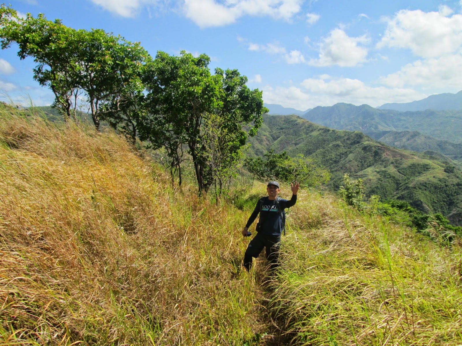
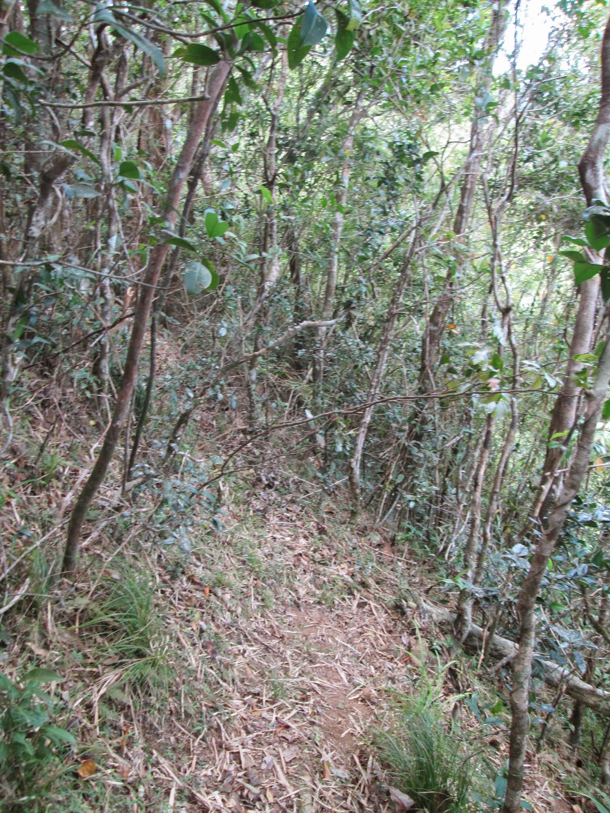
Yes, that is correct. While the initial hike is of the flat, winding, and rolling type, it is pure assault until you reach the Duhatan Ridge, onwards to Mapatag Plateau, and until the newly-opened Rangyas Peak. The trail is of the dusty and slippery type so hikers are advised to take extra caution. The good thing is that there is thick vegetation in the initial stages of the climb. Hence, we definitely enjoyed the forest cover in this part of the climb.

We arrived at the 1st watersource at 0840H (the water here actually tastes sweet). Remember not to cross the small creek / watersource and just continue straight (...this is the only fork that I remember in this part of the trail). At 0910H, we arrived and had a long break at the rest station (made by the guides) at the "Narrahan". After the rest station, the shady trees shall give way to the grassland. We then arrived at the 2nd watersource at 0920H.
 |
| The 1st watersource |

After getting refreshed, we continued and arrived at the Duhatan Ridge at 0925H. The Duhatan Ridge, as the name implies is a ridge where Duhat trees abound. It is also considered by the locals as the 1st peak and is also an ideal campsite owing to its proximity to the 2nd water source.

As mentioned earlier, the Duhatan Ridge is a ridge where a lot of Duhat Trees are found. According to Vir, the locals are really like that, they name a specific place by referring it to what are usually seen in the vicinity. Like "Batangasan" (the area where the Welcome Arch / road leading to Brgy. San Andres is found), it was christened as such by the locals because most of the residents there actually hails from the province of Batangas. There are also areas called as "Narrahan" (a place planted with a lot of Narra Trees), "Bohoan" (an area where Boho [*a type of bamboo] dominates)and "Bangkaan" (because the mountain resembled that of a Bangka".

At 0940H, we continued our hike towards Rangyas Peak (our plan is to summit Rangyas Peak first, eat lunch there and just enjoy Mapatag Plateau on our way back to San Andres). Just before we entered the vicinity of the Mapatag Plateau, we saw traces of a barbed wire fence. According to Vir, there was previously a cattle ranch in the area but due to some controversy, they were actually made to leave the area. There are also huts, which according to Vir serve as shelter to the supposed owner of the land.


We passed by Mapatag Plateau and continued toward the Bohoan. The heat is actually so intense, good thing it was really windy at Mapatag at that time. At 1030H, we were already at the rest stop made by the guides enjoying the shade offered by the Bohoan (Bamboo Grove). This area is somewhat similar to the bamboo groves in Mt. Caoayan, Mt. Tagapo and Pico de Loro. Due to the cool breeze, we decided to have a long rest here.
 |
| Entering the Bohoan |
 |
| The Rest Stop |

Onwards, we reached "The Wall" after a 5 minute hike in the Bohoan. According to Vir, "The Wall" is the shortcut going to the summit (Rangyas Peak). But he advised us to take the longer route along the side of the mountain. We followed the trail and after a brief final assault once we got past the mountain wall, we finally reached Rangyas Peak at 1105H.
 |
| The Wall |


 |
| The Trail on the Northern side of Rangyas Peak |
 |
| Ayos Engr! |
 |
| Model |
 |
| You sometimes have to hug the wall as the trail is still new |
 |
| The Forest before Summit 3 |
 |
| The flag set by the guides in San Andres |
 |
| Mapatag |
 |
| Susong Dalaga Peak |
 |
| Mapatag Plateau...taken from Rangyas Peak |

 |
| Rangyas Peak |
 |
| Sierra Madre is on fire |

 |
| Masungi Rock; Laguna Lake; Talim Island / Mt. Tagapo; and Mt. Makiling |
 |
| The windmills in Pillilla and Mt. Sembrano |
It was relatively an easy hike from there as we were able to reach Mapatag Plateau in 15 minutes. After spending time there for photo-ops, we immediately continued tramping down to the plateau. As the sun was so intense, we decided to rest at the lonesome duhat tree near the Kay-ibon Trail. Another group of hikers passed us by while we were having a brief rest there.


 |
| Susong Dalaga Peak |
 |
| Mt. Batolusong |


It was already 1400H when we reached the Duhatan Ridge. We decided to again have a long rest there just to have a final glimpse of the view and enjoy the cool breeze of the summer wind. When we proceeded to descend the ridge, we tramped straight without taking time for another rest until we reached the Sangab Cave at 1500H.


Sangab Cave is within a private property located on the opposite side of the river which hikers ought to cross after the ricefield at the initial stages of the hike. The flowing water, which is also very clear, is really very cold. The water overflows freely into the river. Sangab Cave has a small opening but according to VIR, the explored portions of the cave is actually a 15-minute hike. Supposedly, there are also stalactites and stalagmites inside Sangab Cave.

 |
| Sangab Cave |


 |
| Take a peek inside |
 |
| Reflecting Pool |
 |
| Don't be deceived....because the water is so cold |

 |
| Fish abound in the pool |
We then tried to look for something to eat, unfortunately, the carinderia owner did not prepare cooked food for the day. We then had to content ourselves with sandwich and liver spread. It was already 1700H when we left Brgy. San Andres, and we ultimately arrived in Trinoma at 1845H.
Traipsing Chronicles 018
003.029.015
Mt. Batolusong - Sangab Cave
Brgy. San Andres, Tanay, Rizal
Category: Minor Climb
Highlights: rolling grasslands; unobstructed views of the nearby flatlands, Laguna de Bay, Talim Island and Mt. Tagapo; Mt. Sembrano, Mt. Makiling and the Sierra Madre Mountain Range; and if lucky, there can also sea of clouds.
Actual Itinerary
0500H
- Assembly - Five Star Bus Station - EDSA, Cubao
0515H - Departure for Brgy. San Andres, Tanay, Rizal
0545H - Buy Breakfast at Jollibee along Marcos Highway
0710H - Arrival at Batangasan Junction; take left turn to Brgy. San Andres
0720H - Arrival at Brgy. Hall, San Andres, Tanay, Rizal - Register / Secure Guide
0730H - Transferred to the Compound of Brgy. Kagawad / Put on gears
0745H - Commence Hike
0810H - Arrival at Trailhead to Duhatan Ridge
0840H - Reached the 1st watersource
0910H - Arrival at the Narrahan Rest Stop
0920H - Arrival at the 2nd Watersource
0925H - Arrival at the Duhatan Ridge
0940H - Commence Hike to Rangyas Peak
1005H - Arrival at Mapatag Plateau
1030H - Arrival at Bohoan Rest Stop
1050H - Arrival at the Wall
1105H - Arrival at the Summit of Rangyas Peak / Summit 3
L U N C
H - Photo - Ops
1315H - Descend
Rangyas Peak - back to San Andres / Sangab Cave
1330H - Arrival at
Mapatag Plateau
1400H - Arrival at
Duhatan Ridge / Rest
1500H - Arrival at
Sangab Cave
1600H - Back at the
Brgy. Hall / Wash-up
1700H - Departure
from Brgy. San Andres
1830H - Arrival in
Trinoma, QC
***You may also find our previous climb interesting:
Mt. Batolusong-Rangyas-Peak-traverse-to-Kay-ibon Falls
Getting There:
Private Transportation
From Cubao LRT2 Station, take Aurora Blvd. East Bound and
continue straight to Marcos Highway. You will pass by Sta. Lucia Grand Mall,
Masinag, and Cogeo. After Cogeo, you will traverse zigzag roads.
You will pass by Palo Alto and Garden Cottages. A few meters from
Kilometer Post 51, the Welcome Arch to Barangay San Andres is on the other side
of the road (left side). This is actually the place that locals refer to as Batangasan
or Batangas.
Follow the road leading down to the valley that is Brgy. San
Andres. The road will have rough portions. You will pass through two small
bridges. Take the left turn after the Brgy. Chapel. The Brgy. Hall cum
registration area is located 30 meters from the main road and just before the
covered court. From Batangasan, the Brgy. Hall is more or less 4 kms in
distance.
Early morning travel from Cubao to Brgy. San Andres is 1 hour 20
minutes. Traveltime from Brgy. San Andres to Cubao (in the afternoon/early
evening) is at least 1 hour 45 minutes because of the traffic.
Public Transportation
From Cubao, take a jeep or FX to Cogeo Gate 2 Antipolo (Php 35). Once in Cogeo, proceed to the jeepney terminal adjacent to the market and take the jeepney
going to Sampaloc/Tanay. Tell the driver to drop you off at Batangasan/Batangas.
(1 hour travel time).
Hire a habal-habalor tricycle to San Andres Baranggay Hall. (15
minutes travel time). You can ask the habal-habal/tricycle driver to fetch you at the
Brgy. Hall on your desired time. The drivers would sometimes ask for advance
payment. The guides at the Brgy. Hall can also make arrangements with the
tricycle drivers in the area.
Jeeps from Sampaloc/Tanay heading back to Cogeo Gate 2 usually
pass by Batangas until 7pm (they leave Sampaloc at 6:30PM).
Once in Cogeo, you can finally hail a ride (FX or jeepney) going to
Cubao.
*In case you are doing the traverse
to Kay-Ibon Falls, you may consider not going back to Brgy. San Andres anymore
and just proceed directly to Marcos Highway, where you will hail your ride in
going to Cogeo Gate 2
Registration Fee / Guide Fee
Hikers are required to register at the Baranggay Hall and pay the
registration fee of Php 20 per person. It is mandatory to secure guides at the
Barangay Hall. The guide fee is pegged at Php 500.00, which is good for 5
persons max. 7 hikers is the maximum number of persons that a single guide is
allowed to handle, but an additional fee of P100.00 per person is charged. For
overnight campers Php 750 is the guide fee. Hikers are of course responsible
for the meals of their guide/s.
Take note that Rangyas Peak is just a new part of the hike. Hence, you need to pay an extra charge of P20.00 per person should you decide to scale Summit 3 / Rangyas Peak. You may pay it at the Barangay Hall when you register, or you can also give your payment to your guide after the climb.
Batolusong - The term was derived from a "Bato Lusong" or "Batong Lusong", which actually refers to a big Stone Mortar used to pound rice and other agricultural products in the rural areas.
Campsite - Hikers may camp at the Duhatan Ridge or at the Mapatag Plateau. As of the moment, camping at Rangyas Peak is not allowed. Also, the nearest watersource is located 10 minutes more or less from Duhatan Ridge.
Mapatag Plateau - There was supposedly a community at the Mapatag Plateau but for some reason, they left the area. According to one account, it is a case that has become controversial in the area.
Sangab Cave - there is actually no entrance fee, but as a sign of respect to the owner of the private property where the cave is located, hikers who visit the place are encouraged to make a donation in favor of the former. According to Vir, there are also guides for the Sangab Cave Tour should you wish to explore its beautiful interior.
Vir mentioned that there are other waterfalls in the area that they are developing. He referred to it as Bangkaan Falls. This new attraction will surely draw added attention to this hiking destination.
Essentials - Take note that this hike is an open trail from the time you leave the forested area before Duhatan until you reach the Bohoan. So sunscreen, and other protection from the sun like hats/caps and rashguards are recommended.
Sea of Clouds - According to Vir, it is very common for Mt. Batulosong to be foggy during mornings. Hence, you may witness a sea of clouds when you are lucky.
Hi Sir/Ma'am may contact numbers po ba kayo sa mga taga barangay or guide. Balak po kasi namin umakyat sa nov. 20 at 21...Thanks
ReplyDeleteHi Ratio...Sorry po Sir / Mam at nasira po yung phone ko last month kaya halos lahat po ng contacts ko nabura.
DeleteAnyway, kahit naman po derecho lang kayo sa barangay hall ok na. Lagi po may tao doon at rotation naman po ang scheduling ng guides. Kaya karaniwan po may nag-aabang na po sa may barangay hall na guide kasi binabantayn din nila ang slot nila.
Try ko din po tanungin yung mga kasama ko kung may na-save silang contact sa Batolusong. Hope this helps. Salamat po.
hi, pwede po ba makahingi ng contact number ng tour guide nyo? thanks in advance. :)
ReplyDeleteSorry po mam at nasira kasi ang phone ko. Yung kasama ko naman na umakyat eh na-holdap daw yung phone nya.
DeleteAnyway, rotation naman po ang guides dun sa San Andres kaya no need to contact the guides at lagi po may nakapila doon sa Barangay Hall. Pwede na po kayo dumirecho doon anytime
May nakuha na po ba kayong number ng guide? Appreciate your reply po... Kailngan kasi namin makakuha in advance.
DeleteHi pwede ba makahingi ng number ng guide? Mag night trek po kami this April 09, 2016 sa Batolusong para malaman ko lang po if sino pwede mag guide sa amin. thanks
ReplyDeleteHi Rose Ann, sorry po mam at nasira kasi phone ko kung saan na-save yung contact ko sa Brgy. San Andres.
DeletePero rotation po ang mga guides for Mt. Batolusong mam. Kaya may pila po ang mga guides doon. Usually kasi nakatambay na sila sa may Barangay Hall kung malapit na ang slot sila sa pila. Kaya hindi naman po nauubos ang mga pwedeng mag-guide sa inyo. So wala pong hassle kahit na derecho kayo sa Barangay Hall ng walang contact na guide.
Tsaka sabado naman po yung April 9, sigurado po na maraming guide ang nagaabang sa Barangay Hall nyan. Karaniwan din kasing sabado ng hapon ang akyat ng mga nag-stay ng overnight sa Mapatag.
Hope this helps...salamat po mam at enjoy your climb.
May nakuha na po ba kayong number ng guide? Appreciate your reply po... Kailngan kasi namin makakuha in advance.
DeletePasensya po mam, wala na po talaga akong contact number ng guide namin sa Batolusong. Pero lagi po talaga merong guide sa Barangay Hall. Kahit madaling araw kayo umakyat...may tao po dun. Marami na po kasi umaakyat dun ng madaling araw para sa river / sea of clouds.
DeleteAnyway, kapag nakakuha po ako kahit sa mga ka-grupo ko...post ko po kaagad dito.
May sea of clouds po ba ng april??
ReplyDeleteMay sea of clouds po ba ng april??
ReplyDeleteMay sea of clouds po ba ng april??
ReplyDeleteHi Kate, yes meron pa ding sea of clouds kahit summer months although mas malaki ang chances (or mas maganda ang sea of clouds) kapag "Ber" months until March.
DeleteAnyway, you have to go there early if on a dayhike or mag-overnight kayo if you plan to experience the sea of clouds in Mt. Batolusong.
Hi Sir/Ma'am,
ReplyDeleteFor private transporation, pwede po bang iwanan ung car s barangay hall?
Thank you
Sir, opo pwede po mag-park doon. Kapag puno na yung sa may barangay hall, pwede po sa may malapit sa school. Sa dulo lang po ng basketball court yun, mga 50 meters from the barangay hall. Mababait naman po tao dun kaya safe din ang sasakyan. In my case twice na po ako nag-iwan ng sasakyan dun. Ewan ko po kung may parking fee na rin dun pero dati wala po.
DeleteYun nga lang, kapag traverse to Kay-Ibon Falls po kayo, mas maigi na makipag-coordinate na kayo ng susundong tricycle sa inyo sa may highway. Kasi medyo malayo pa po sa Batangasan yung lusot nun. Although yung iba nilalakad lang po yun, mga 20-30 minutes din sya papunta ng Batangasan.
Happy Hiking Sir!
Baka mahina na rin pala ang tubig sa Kay-Ibon, kaya to be sure magtanong na lang po sa guide. Anyway, masarap din naman po maligo sa Sangab Cave. Sigurado enjoy kayo dun.
DeleteHi Sir/Ma'am,
ReplyDeleteFor private transporation, pwede po bang iwanan ung car s barangay hall?
Thank you
May aakyat ba this Sat, May 7? Pwedeng pa-join kasi dalawa lang kami mg GF ko, para share all sana sa guide fee? And, san kaya malalaman kung may NPA alert ngayon dun kasi election time?
DeleteMukhang di naman po active ang NPA sa ngayon doon sa San Andres. Ang huling naapektuhan lang naman sa alam ko eh sa Mt. Irid na medyo malayo pa po doon. Yaan nyo sir kapag may balita na engkwentro doon post ko dito sa comment nyo.
DeleteMarami naman po usually ang umaakyat sir tuwing weekend, kung galing kayo ng Cogeo baka doon pa lang may makausap na kayong mga aakyat din. Although kapag may nakita ako mamaya sa FB, post ko dito para sa inyo.
Happy Hiking Sir!
Hi po :) ask ko lng po kung pwede mag hike ng weekdays? At saka solo hike with guide naman po. Thanks po :)
ReplyDeleteHi po :) ask ko lng po kung pwede mag hike ng weekdays? At saka solo hike with guide naman po. Thanks po :)
ReplyDeleteYes mam pwede po mag-hike sa weekdays and solo with guide. Available po lagi guides dun. Syempre hihintayin nyo lang sandali yung guide para makapagbihis sya. Tsaka may guide din po na nakatira sa tapat mismo ng barangay hall...nakalimutan ko lang po pangalan nya kasi nasanay po ako na kagawad ang tawag kasi sa kanya.
DeleteHi po. Ask lang po kung pwede bang sa shaw blvd dumaan instead sa cogeo. Kasi mas gusto nmin ng mas maaga. Thanks
ReplyDeletePwede po Sir / Mam. Pero depende po sa sasakyan nyo. Kung Jeep po papunta ng Tanay, sasakay pa po kayo ulit papuntang Sampaloc Junction. Tapos sakay ulit papunta ng Batangasan.
DeleteKung may sasakyan naman kayo, pareho po ng pagpunta sa Daraitan. Shaw to Tanay, then punta po kayo sa may Sampaloc Junction (Marifanta Highway). Then kaliwa (Northbound) kayo papunta sa Batangasan. Sa alam ko may lusot po diyan galing ng Baras kaso di lang ako familiar sa daan na yun at Tanay/Sampaloc din ang alam ko.
Happy Hiking po!