"Unless we are willing to encourage our children to reconnect with and appreciate the natural world. We can't expect them to help protect and care for it."
- David Suzuki
The town of Tanay in the province of Rizal is fast becoming a mountaineering/hiking hotbed. Proof of this is the emergence of new tramping grounds in the area.
The newest addition to the growing list of mountains in Tanay is Mt. Paliparan (meaning "airport" or "from where things are flown"). Situated in quaint Brgy. Cuyambay, Mt. Paliparan was christened as such since this is supposed to be the place where people belonging to the
Dumagat Tribe fly kites, either for fun or for wagers. According to our guide
Mang Carling, aside from bragging rights, bets in the kite fighting usually involve a sack of rice,
kamote, and other agricultural products.
 |
| Mt. Paliparan...taken from the ridge leading to Tuoy |
 |
| Another view of Mt. Paliparan |
 |
| Mt. Paliparan...photo taken from Tuoy |
 |
| Mt. Paliparan Summit |
After more than an hour of travel from Quezon City, we finally arrived in Brgy. Cuyambay, Tanay, Rizal. As we tried to ask a lady who just bought something from a store for directions in going to the Brgy. Hall of Cuyambay, a man suddenly appeared and inquired if we intend to climb Mt. Paliparan, The man was no other than
Kuya Inso, also referred to as
Sir Inso by our guide
. He then conducted a brief lecture regarding what to expect during the hike, including the climbing conditions and the places of special interests along the trail.
 |
| We were greeted by this view of Mt. Batolusong |
Subsequent to paying the registration and environmental fees, we waited for the arrival of Mang Carling, the guide who was assigned to us for the day. It was 0745H when we left the trailhead (Brgy. Hall) for another day of adventure.
 |
| With Mang Carling at the Barangay Hall |
 |
| From the concrete road, we turned left just before the basketball court. |
 |
| Entering the gate that leads to the Manggahan |
We then arrived at the Mangahan and after we crossed the small concrete bridge, Mang Carling requested if he can go and take a bath in the river before we proceed hiking. Of course, we said no problem.
 |
| Approaching the Mangahan |
 |
| Mangoes everywhere |
 |
| The small bridge...Mang Carling went for a dip at the river. |
Onward, we passed by the local cemetery as we went deeper into the woods. At 0810, we arrived at the Mahogany plantation, the end of which signified the start of the ascent to Mt. Paliparan. We passed by a
Buhoan and eventually reached Tukduan, where we caught up with the group of hikers taking much needed rest under the
Bulakan Tree.
 |
| passing through the local cemetery...may they rest in peace. |
 |
| Tukduan |
 |
| Hikers in Tukduan |
 |
| The Bulak Tree |
 |
| Rocky Goodness |
 |
| Just after the Bulakan Tree |
 |
| Windmills |
After a few minutes rest, we continued and reached the
Tunghayan. This portion of the trail is called as such since this is where the Dumagats supposedly spend time to enjoy the magnificent view of the surroundings. The rock formations here also present a very good place for shutterbugs to do some landscape photography.
 |
| Going up to the Tunghayan |
 |
| On the other side of Tunghayan |
 |
| One more time |
 |
| Tuoy...from Tunghayan |
 |
| The Pillilla Windmills and Mt. Sembrano |
 |
| Groot? |
 |
| Tunghayan |
 |
| The structure in the middle is a former cement plant said Mang Carling |
 |
| Fly free... |
 |
| At Tunghayan... |
 |
| Kaya pa! |
 |
| Slide? hehe |
When we continued hiking, we had a distressing encounter with a swarm of bees while we were at the place called
Parang by Mang Carling. We sent at least five (5) minutes ducking and keeping still as the bees auspiciously hovered above us. Thank God for the alertness of Mang Carling, we safely went on with the hike.
 |
| Approaching the "Parang" |
 |
| We encountered the swarm of bees after we passed by these boulders |
 |
| Oi...tama na yan! Ayan na mga pukyutan...heehee |
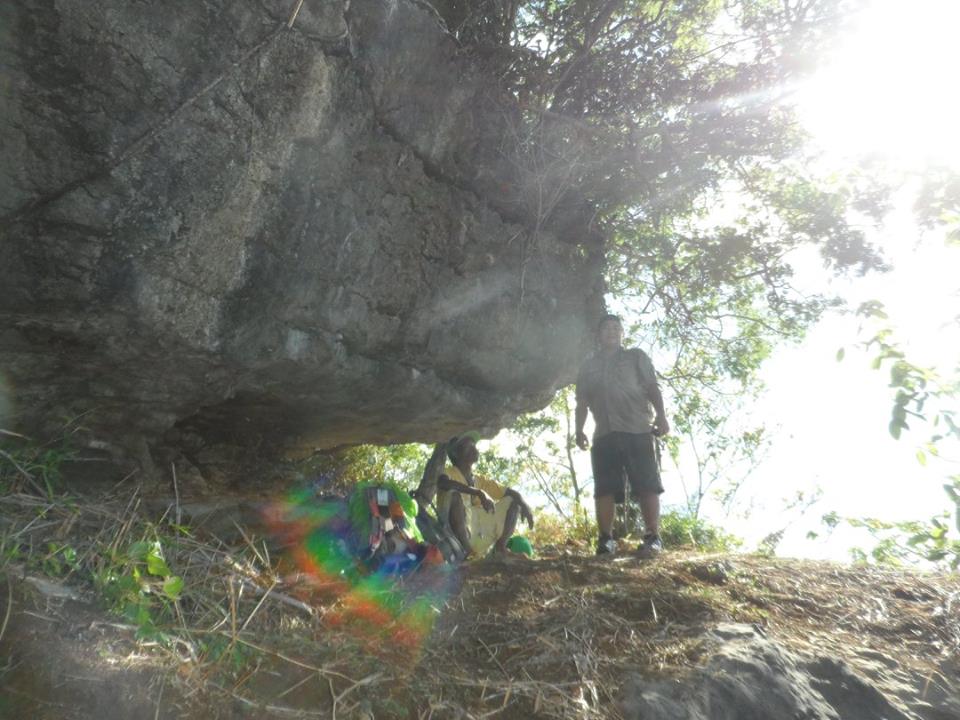
It was already 0800H when we reached the
Taguan. As the name implies, it is where the Dumagats supposedly used to hide or take shelter dating back to the old times and even during the Japanese occupation in World War II. What is accessible in Taguan is really just the first chamber where the access (big hole) to the deeper recesses of the cave is visible. Should you wish to explore Taguan, prepare your head lamps and/or flashlights.
 |
| The Rock formations in Taguan |
 |
| The initial entrance going inside the Taguan |
 |
| It really is a hiding place. |
 |
| The big hole, presumable leads to a deeper chamber |
 |
| Inside the cave. |
 |
| It is cold inside |
 |
| Rock formations |
 |
| Ceiling |
 |
| It's a long way to the top. |
 |
| Hey, what are you doing there? |
 |
| Is that a watch tower?...weehee. |
 |
| Inside the Cave |
A few minutes from Taguan, we descended towards
Hagkanan. This is actually a viewdeck that offers a panoramic view of Laguna de Bay and the Pillilla windmills. This is where your rock climbing skills will be put to a test. Just before you reach Hagkanan, which is also referred to as
Biak na Bato, we passed by the
Silungan. The Silungan is where the Dumagats take a rest since the protruding rock formation serves as a shade from the heat of the sun. You may wish to explore the Hagkanan and let someone climb the nearby viewdeck (which is actually higher), as it will surely present a lot of photo opportunities.
 |
| Hold on to that root. |
 |
| Climb...we must. |
 |
| Careful... |
 |
| I'd fly if I can. |
 |
| Strong winds constantly blow in Hagkanan |
 |
| Awesome |
 |
| Matinee Idol hehe |
 |
| The tree at the view deck |
 |
| Biak na Bato / View Deck / Hagkanan |
 |
| Biak-na-Bato / Silyang Bato |
 |
| Trees for cover at Hagkanan |
 |
| Ayos! Ang Pogi!!! |
 |
| Limestone |
 |
| Akyat... |
 |
| Sharp Rocks may cause cuts and bruises. |
 |
| You jump...I jump |
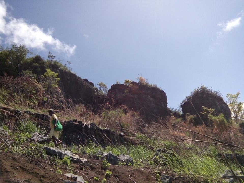
From there, Mang Carling initially offered to us the possibility of going to the Summit via the more forested trail as the usual trail that they used was recently ravaged by a forest fire. In the end, we decided to take the ordinary trail as we still need to hike back to Taguan should we opt to take the more forested trail.
From the viewdeck, we descended westward and observed first hand the devastation that resulted from the conflagration. There were dead trees and shrubs burnt to a crisp. Only the traces of a Buhoan, small trees and some lucky ones remained. Also, the boulders and rock formations along the trail became exposed to the sun. In such regard, the assault up to the base of the summit is one hot, humid and energy-sapping climb.
 |
| It still is a bouldery and steep trail to the summit. One must go down the Hagkanan and go up that mountain. |
 |
| See the wrath of a forest fire. |
Just as we are nearing the base of the Summit, Mang Carling suggested that we first go to the rock formations known as the
Kuya, Ate and
Bunso. There is a clearing beneath the Kuya, Ate and Bunso that is ideal to be used as a camp site. According to Mang Carling, this was the site of an abandoned ulingan. The only problem should climbers decide to camp here is the absence of a nearby water source.
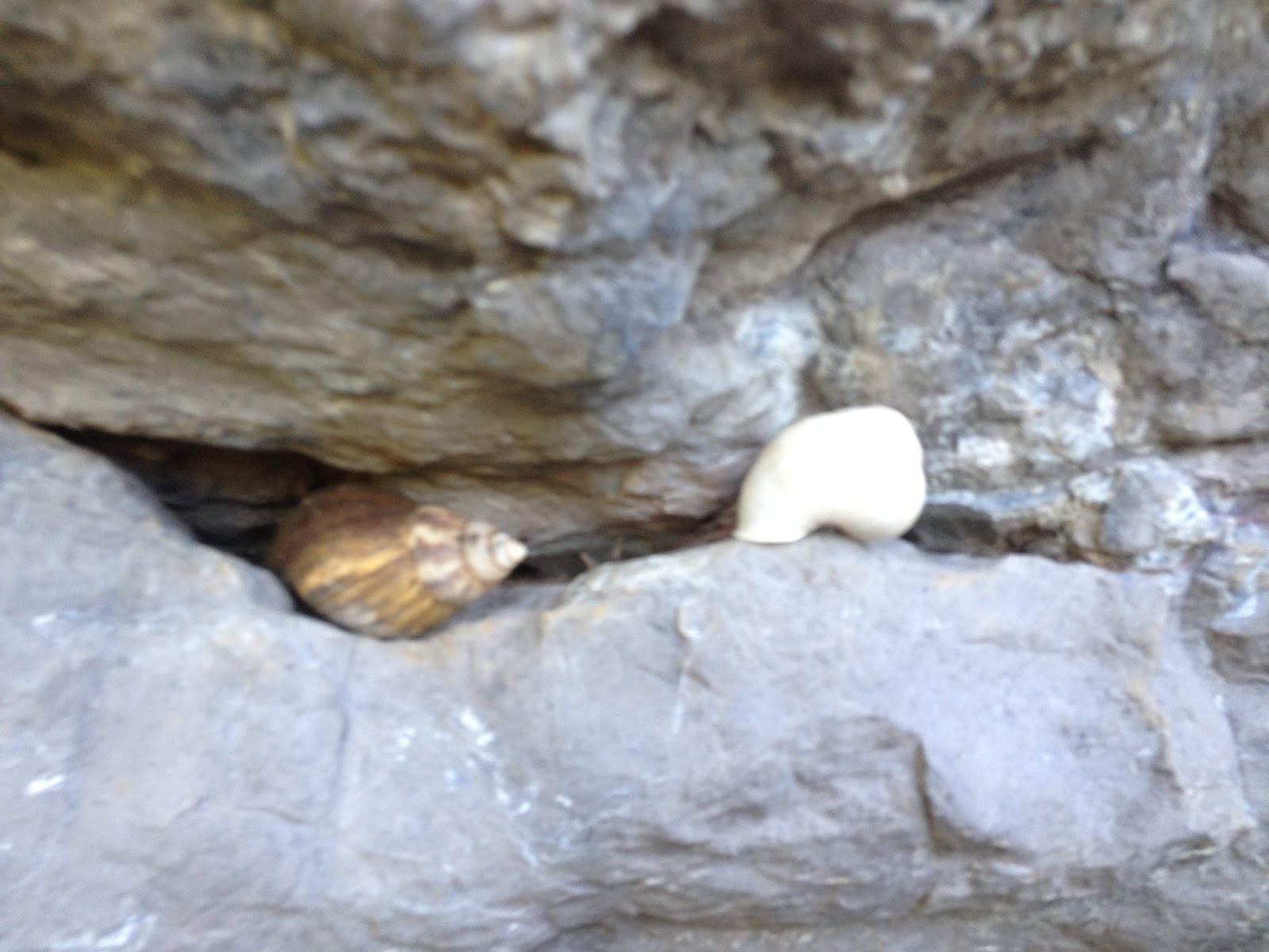
Nevertheless, what made me curious is the presence of a lot of coiled shells that suggest the presence of snails in the area. Mang Carling said that this is a common occurrence in Mt. Paliparan and the surrounding mountains especially during the rainy season. I was actually amazed and encouraged at the same time thinking that if a small snail was able to climb this high, then I have no reason to say that I cannot climb the same mountain (...just my two cents).
 |
| L to R: Kuya, Ate, Bunso |
 |
| Almost there... |
 |
| Hapon... |
 |
| I just love trees who still find a way yo survive. |
 |
| Baging |
 |
| Snails |
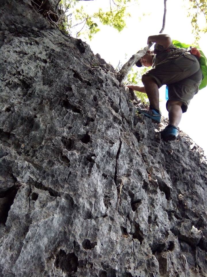
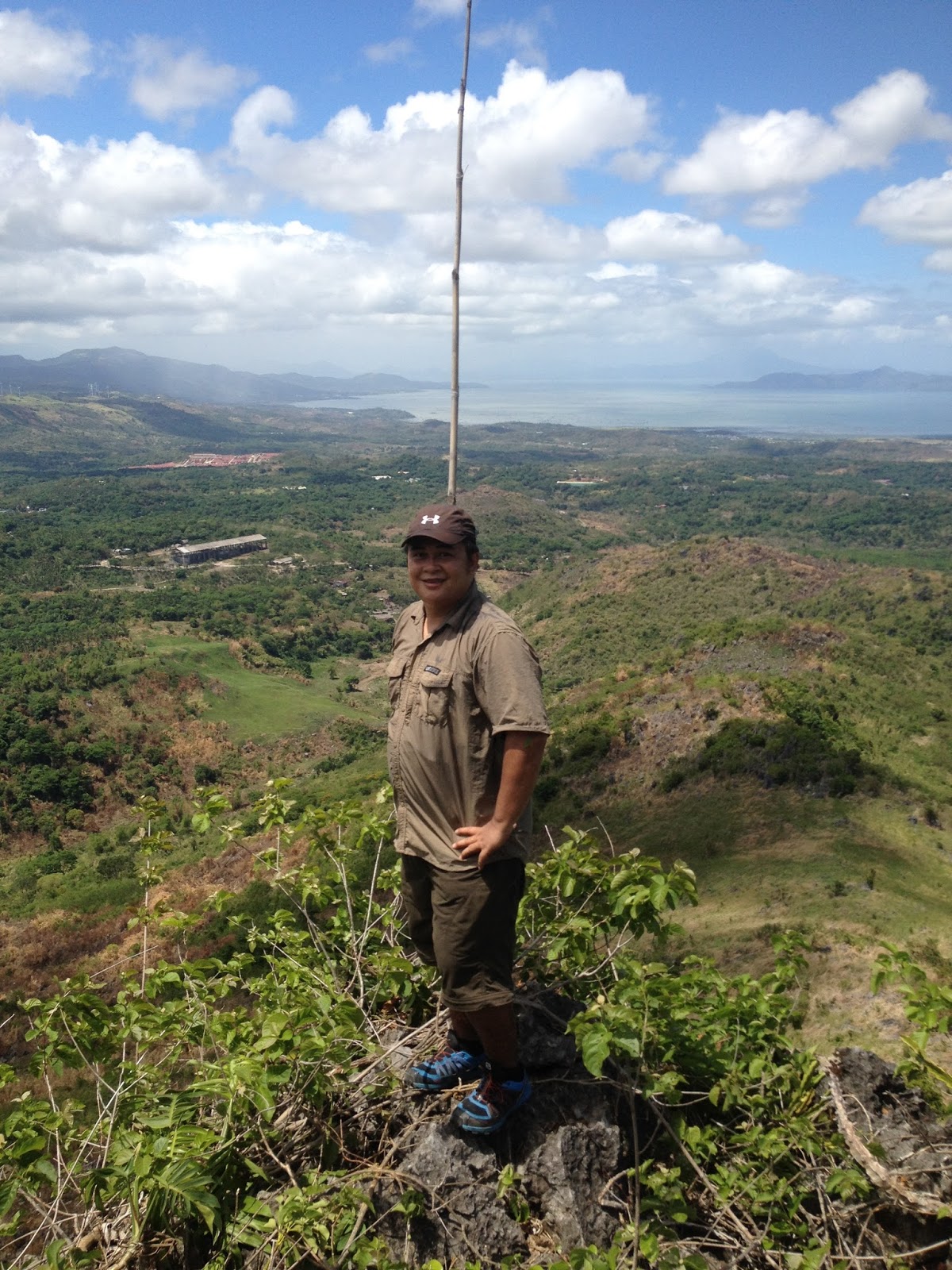
From there, we continued towards the base of the summit. The final assault to the summit is a test of one's resolve and rock climbing skills. It is reminiscent of the mountains in Wawa. So, you may choose to use gloves in this part of the climb. It was already 1030H when we reached the summit of Mt. Paliparan, which in my opinion has similarities to the summit of Mt. Hapunang Banoi.
 |
| Base of the Summit |
 |
| Rock formations |
 |
| The rock climbing starts a few meters from the base. |
 |
| The initial approach from the base of the summit. |
 |
| Final rock climbing to the summit |
 |
| Who says a fat guy cannot do rock climbing? |
 |
| The summit is marked by a bamboo flag pole. |
 |
| The summit of Mt. Paliparan |
While there are trees that may serve as shade at the summit, the searing heat of the sun made us decide to just spend a short time in exploring the area. We opted to take a long rest at the fissure below the summit as we waited for another group of hikers to pass by.
At 1110H, we decided to descend to Tuoy, the tribal community of the Dumagats in Paliparan. The hike towards Tooy is an unremitting descent. From the base of the Summit, we took a trail leading south and followed the grassland similar to that of Mt. Sembrano and Mt. Tagapo. From the grassland, another steep descent though portions of loose soil would ensue. The hike to Tuoy went on until we reached another Buhoan and ultimately the river that we had to cross to get to the other bank. At 1150H, we finally reached Tuoy where we were welcomed by curious children to whom we gave some of our trail food and candies.
 |
| Panoramic view at the summit |
 |
| At the ridge...before we turn left on the trail towards Tuoy |
 |
| Another angle of Mt. Paliparan |
 |
| So sad...too many trees died because of the fire |
 |
| One of the trees along the trail leading to Tuoy |
 |
| The river we crossed in order to get to Tuoy |
 |
| Arriving in Tuoy |
As it started to drizzle, Mang Carling gamely suggested that we take cover at the house of his nephew. After eating lunch, we enjoyed a serving of fresh coconut water for P20.00. At 1230H, we decided to leave Tuoy and continue hiking towards Tungtong Falls.
 |
| The Dumagat community in Tuoy |
 |
| Inside the house....and they were selling buko for P20.00 |
 |
| The Mango Tree occupied by the other group of mountaineers |
 |
| The Store |
 |
| The Dumagats also have a basketball court...#Puso |
 |
| Water Source in Tooy |
We followed the river and had to a lot of river crossings, rock hopping and bouldering. We also had to go through thick
talahib overgrowth. Hence, the trek to Tungtong Falls is really excruciating to both arms and legs. The river trekking went on, and at 1310H, we arrived at the 1st pool of Tungtong Falls.
 |
| Dense talahib trail |
 |
| River trekking / bouldering / hiking through talahib overgrowth = nakakapagod na trail hehe. |
The 1st segment's pool is actually the best area for swimming. The water is cold but bearable. Some hikers from the other group who arrived later than us even did some cliff jumping.
 |
| 1st Falls |
 |
| At the top of the 1st Falls |
 |
| Enjoying cold water bath on a hot day. |
 |
| The small pool above the 1st falls |
At 1410, we decided to proceed to the second segment of the falls. We climbed the side of the falls and continued river trekking upstream. After ten minutes, we finally arrived at the second segment of Tungtong Falls.This second segment of Tungtong Falls, which is composed of three layers, is really a sight to behold. It is definitely the most majestic of the three segments. We wasted no time and chose separate pools to enjoy. I chose the lowest level, while Gani opted for the second level.
 |
| Approaching the 2nd Falls |
 |
| 2nd Segment of Tungtong Falls |
 |
| The lowest pool |
 |
| Cascading water |
 |
| ...with the other group of hikers |
 |
| A closer view of the upper cascade of the 2nd segment of the falls |
 |
| No joke...hikers need to climb this falls to get to the 3rd segment. |
 |
| Skookum Jump |
It was already 1440H when we decided to continue hiking back to the JOP. To our initial surprise, Mang Carling told us that we need to hike up the falls, and we were like..."
are you nuts?!?!". But then again, this is what we live for.
The ascent up the falls is one arduous, challenging, and "
buwis buhay" climb. The steps prepared by those who first explored the trail were indeed very helpful, We then reached the third segment (also the last) of Tungtong Falls. And after a brief moment of taking photos, we went on. At 1500H, we finally reached the top of the falls. Exhausted, we took a brief rest since we still have climb up the "
stairs" up another buhoan.
 |
| The 3rd Falls |
From the buhoan, we continued towards a meadow that led us to a dirt road. We followed the road northwards and passed by residential areas, including the home of Mang Carling. We stopped for a moment at Mang Carling's to buy pure honey (P150.00 each). We even gave candies to his grandchildren. At 1520, we finally arrived at the Barangay Hall.
 |
| Emerging from the grassland to the dirt road |
 |
| The black dog named "Ogag" (according to Mang Carling), which I called Dynamite. |
 |
| Pinoys are really basketball crazy...#puso |
 |
| Mang Carling...proudly showing to us his picture with his wife as they wear their tribal costume. |
 |
| RARES |
 |
| Pico del Pino |
 |
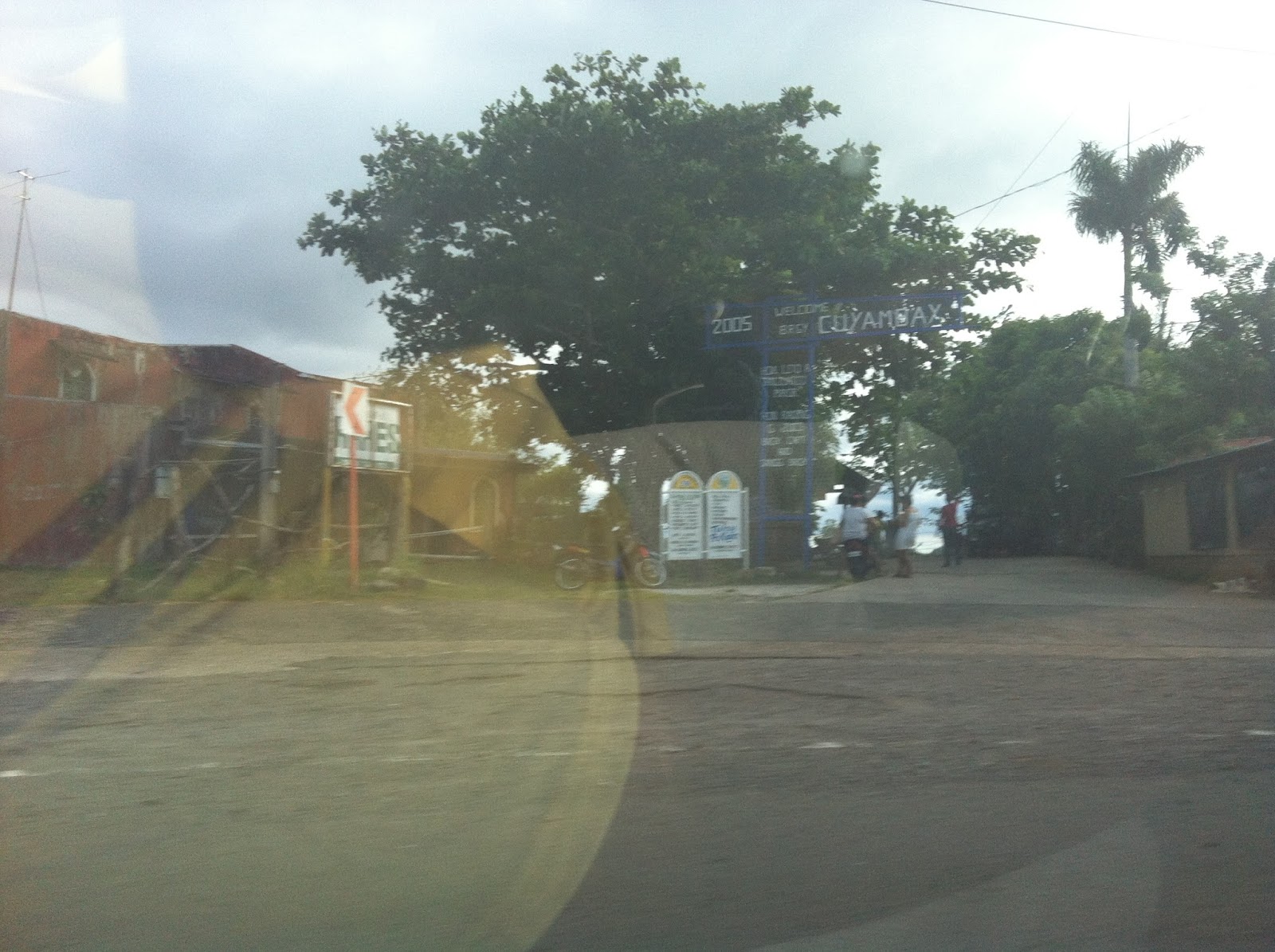
| The Welcome Arch along Marifanta Highway |
#Traipsing Chronicles 036
005.015.016
Mt. Paliparan - Traverse to Tuoy and Tungtong Falls
Brgy. Cuyambay, Tanay, Rizal
Jump off point: Brgy. Hall, Cuyambay, Tanay, Rizal
Major Climb: 5/10
Highlights: Panoramic view of Laguna Lake, Pillilla Windmills, Mt. Sembrano, Mt. Tagapo, Mt. Makiling and other peaks in the Sierra Madre. Rock Climbing, Caving, River Crossings, River Trekking, Bouldering.
Actual Itinerary:
0500H - Departure from West Ave., Quezon City
0710H - Arrival at the Brgy. Hall Cuyambay, Tanay, Rizal / Secure Guide / Briefing
0745H - Commence Hiking
0755H - Arrival at the Manggahan
0810H - Arrival at the Mahongany Plantation / Start Ascent
0820H - Arrival at Tukduan / Bulakan Tree / Photo-ops
0830H - Arrival at Tunghayan / Rest - Photo-ops
0840H - Encountered the swarm of bees / pukyutan at the Parang
0900H - Arrival at Taguan / Esplore the Cave - Taguan
0920H - Arrival at Silungan / Hagkanan / Biyak na Bato
0930H - Departure from Hagkanan to Kuya, Ate, Bunso rock formations
1000H - Arrival at Kuya, Ate, Bunso / Rest Stop
1010H - Arrival at the base of the rock climbing to summit / wait for the big group to go down
1020H - Commence assault to summit
1030H - Arrival at the Summit / Explore Summit / Rest Stop
1110H - Commence descent from summit / Traverse to Tuoy
1150H - Arrival in Tuoy / Rest Lunch
1230H - Commence Hike (River Trekking) to Tungtong Falls
1310H - Arrival at Tungtong Falls / Swimming
1410H - Proceed to 2nd Segment of Tungtong Falls
1420H - Arrival at the 2nd Falls (3 Layers) - Swimming
1440H - Commence Hike back to JOP / Barangay Hall
1450H - Arrival at the 3rd (Last Layer) of Tungtong Falls
1500H - Last of River Crossings - Falls-hopping / Base of Final Stair Climb at the Buhoan
1505H - Reached the top of the Stair Climb / Buhoan
1520H - Arrival at the Barangay Hall / JOP - Wash-up
1610H - Departure from Barangay Hall for QC
1800H - Back at home (West Ave.) for Dinner
Getting There:
Private Transportation. From Cubao LRT2 Station, take Aurora Blvd. East Bound and continue straight to Marcos Highway. You will pass by Sta. Lucia Grand Mall, Masinag, and Cogeo. After Cogeo, you will enter the Upper Marikina Basin Protected Landscape and traverse zigzag roads.
You will pass by Boso-Boso, Palo Alto and Garden Cottages. Go past the Welcome Arch to Barangay San Andres / Batangasan or Batangas (road leads to the trailheads of Mt. Batolusong and Mt. Maynoba), which incidentally is on the left side of the highway.
Watch out for the welcome arch leading to Brgy. Cayabu on the right side of the road. This is located opposite the Pico del Pino.
Early morning travel from Cubao to Brgy. Cuyambay (Brgy. Hall) is 1 hour 30 minutes more or less. Traveltime from Brgy. Cuyambay to Cubao via the same route (in the afternoon/early evening) is at least 1 hour 45 minutes.
Public Transportation. From Cubao, take a jeep or FX to Cogeo Gate 2 Antipolo. Once in Cogeo, take the jeepney going to Sampaloc/Tanay. Tell the driver to drop you off at the Cuyambay welcome arch (opposite Pico del Pino). (1 hour travel time).
Jeeps from Sampaloc/Tanay heading back to Cogeo Gate 2 usually pass by the Cuyambay Welcome Arch until 7pm (they leave Sampaloc at 6:30PM). Once in Cogeo, you can finally hail a ride (FX or jeepney) going to Cubao.
Mountain Guides. It is mandatory for every group of hikers/climbers to secure the services of a mountain guide / local guide. As of this writing, there are no prescribe rates. But we paid Mang Carling P500.00 for the entire hike. Also, mountain guides are assigned on a rotation basis. Hence, there is no need to coordinate with them in advance.
All of the guides at present are members of the
Dumagat Tribe. They have 10 guides (7 men and 3 women) but training is on-going for at least 30 more.
Registration. Each hiker/climber is required to pay the Registration Fee of P20.00 and Environmental Fee of P10.00
Wash-up. Hikers may choose to tidy-up at the Barangay Hall (
free as of this writing) or at any of the nearby houses for P20.00.
Budget. For a DIY climb, the budget for a group of 2 hikers is about P500.00. For a group of five (5), the budget drops to about P350.00 (more or less).
Eateries. There are eateries in Barangay Cuyambay that offer cooked food even for breakfast. Hence, you may choose to buy food for lunch, or even breakfast, here.
Water Source. There is a water source along the river bank near Tooy. For the climb, prepare 2-3 liters of water.
Rappelling. It is also possible to do rappelling in Cuyambay. It is done in
Pinagpatong Rock. But usually this is done as a separate activity. They still do not have rappelling gears in Cuyambay, but they coordinate with a mountaineering group for the needed gears (for a fee).
*Credits to Engr. for some of the pics.


Sir may contact po ba kayo ng Van from Cubao to Brgy.Cuyamaby?
ReplyDeleteSir may contact po ba kayo ng Van from Cubao to Brgy.Cuyamaby?
ReplyDeleteSorry Sir wala po. Nagdala po kasi ako ng sariling sasakyan nung pumunta kami doon.
DeleteGood after noon. may contact po ba kayo brgy. official?
ReplyDeleteHi Sir Aaron, sorry wala po at nasira kasi ang cellphone ko dati kaya nawala din yung mga contacts ko. Pero pwede naman po nyo try mag-pm sa admin ng FB page nila.
Deletehttps://www.facebook.com/mtpaliparanph/
Happy Hiking Sir!