It is the first time for us Skookums to attempt a circuit climb as well. For starters, a circuit climb is made when mountaineers successfully summit a series of mountains that are usually located within close proximity of each other. It may be a dayhike, an overnight climb, or an extended hike that may last three to five days. In other cases, it may be called as Trio Climb (as in Bakun Trio) or even a Trilogy Climb (as in Nasugbu Trilogy). Another Circuit Climb that has become popular to mountaineers over the years is the Kibungan Circuit in Benguet.
The San Jose Circuit ("SJC") actually refers to the series of mountains that straddle the town of San Jose in Tarlac. Nevertheless, the term San Jose Circuit has evolved in the mountaineering world and now refers to the hike (usually a dayhike) wherein three (3) mountains namely: Mt. Caoayan; Mt. Bungkol Baka; and Mt. Tangisan, are scaled.
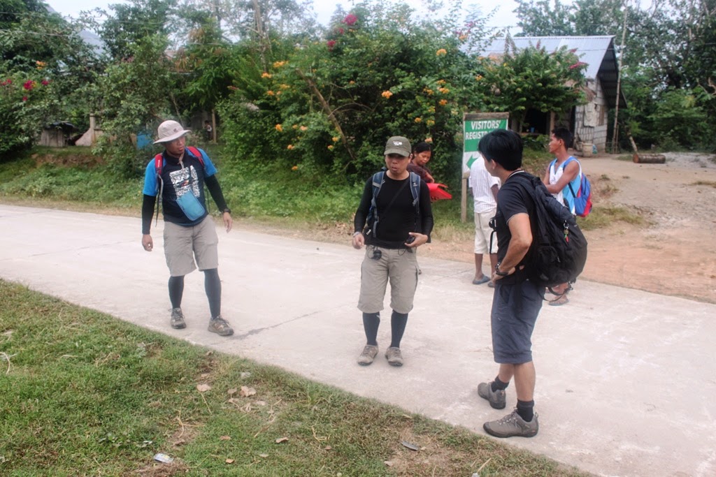
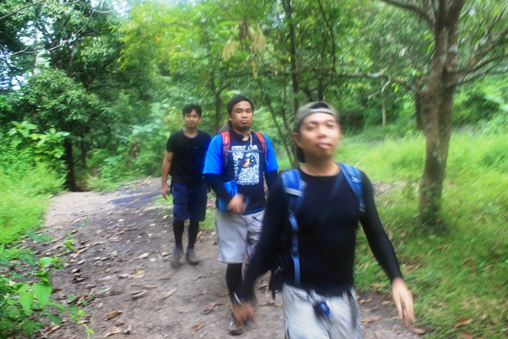
For this climb, four Skookums namely: Allan, Gani, Lennon and Oliver dared to answer the challenge.
We decided to meet at Mcdonald's Eton Centris (along EDSA before Quezon Ave.) at 0145H. At 0200H, we were already on our way to rustic Sitio San Pedro, San Jose, Tarlac. Even with our leisurely pace, we reached Tarlac City at 0400H. After spending minutes going around looking for an eatery, we just decided to eat breakfast at the Mcdonald's located on the junction just opposite Tarlac State University.
It was still dark when we arrived in San Jose (0520H), and since at first, we thought we still had to go to Brgy. Iba where we were advised by one barangay official that we still had to backtrack and find our way back towards the Monasterio de Tarlac and turn right towards the gravel road leading to Sitio San Pedro. So much with the thinking that we were still very early haahaa.
 |
| "Double Shot" |
 |
| Waiting for the sunrise |
 |
| dare to climb |

 |
| We were already in Brgy. Iba before sunrise |
We finally arrived at the registration area in Sitio San Pedro at 0630H. We were gladly met by the Kapitan Oming, the chieftain of the Abeling Tribe. We paid the registration fee of P50.00 each and had to shell out P850.00 for the guide (since we are going for three peaks).
 |
| the sign opposite the registration area |
 |
| Parking is not a problem |
 |
| That is Kapitan Oming |
 |
| Stretching with Lennon |
 |
| Ano pare kaya ba ang three peaks? |
 |
| ayan na sila... |
 |
| Maglaba ay di biro |
We arrived at the man-made lake a few minutes later. Here, Melegrito (our guide) was pointing at us the direction that we are going to traverse for the day. We continued to circle the man-made lake towards its northeastern side and tramped on rice fields until we started to do some river trekking, which I really never expected.
 |
| Mt. Tangisan is the closest to the village among the three mountains |
 |
| Mt. Fuangi |
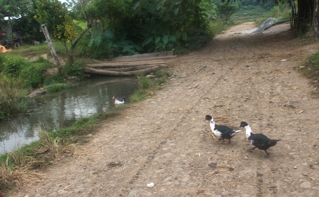 |
| the ducks...going for a swim |

 |
| The man-made lake |
 |
| Carabao taking a dip in the water |

 |
| Crossing the Fields of Gold |
 |
| Guyito |
 |
| That's the bridge on the other side of the lake...it is here where the dam is located...this is also where the SJC ends. |
 |
| Reflecting Pool? |
 |
| Skookum jumpshot |


We continued to encircle the mountains until we reached the Biak-na-Bato. A few strides from here, we decided to take our first rest at the river just before the start of the actual climb up Mt. Kawayan.
Mt. Caoayan
According to Melegrito, Mt. Caoayan came to be known as such because of the prevalence of bamboo (or Kawayan) in the mountain, especially on its ravine facing Bungkol Baka.
From the river (base point), it was all uphill. As we all barely had sleep, it was really so hard for us to continuously hike. Too bad, it was at this point when the sun started to beam in all its glory.
While it was already hard for us to ascend, we could just imagine
how harder it could have been if not for the rains that washed off the dust
particles on the trail. I’d say that it is one of the purest ascents that we
have so far encountered.
After 1hour of passionate climbing, we finally reached the
plateau where the entire might of Mt. Caoayan became visible. Melegrito
mentioned that we still need at least an hour before we reach the first of the
three summits. As the heat of the sun became more intense, we all decided to
take a break so that we can replenish our water containers. Yes, our water
supply has already been drastically diminished because of the feverishness and
humidity that prevailed.
From the plateau, the trail will led us south of
Mt, Caoayan. We had to negotiate the rolling and open
terrain, with a series of ups and downs, until we finally reached the rice paddy where a hut is also located very close to it. The actual
ascent to Mt. Caoayan began at the Southwest face of the mountain. In
other words, we already crisscrossed our way to at least 300° from
where we initially started (Northwest part of Mt. Caoayan).
From the base (rice field), we snaked our way towards the top. We were so
relieved once we reached the summit and were greeted by splendid views
of the nearby Zambales Mountain Range, the flatlands of Central Luzon, and the
other nearby peaks in the Circuit. A herd of cows is similarly visible in the
slopes of Bungkol Baka as if they were eagerly expecting our arrival at the
peak.
After a series of photo-ops, Melegrito showed us the “Batong
Indak”, so-called because according to him, it is here where the group of
Tarlac Mountaineers hold their induction ceremonies for new members.
As there are no other trails in Mt. Caoayan,
summiteers must retrace the trail and descend back to the rice paddy. As we
were already so hungry at that time, we decided to eat lunch there under the
shade of a paper tree.Mt. Bungkol Baka
Mt. Bungkol Baka is known as such because of its close resemblance to a "cow's hump".
From the rice field (base of Mt. Caoayan), we followed the trail
westwards towards the mud pit of carabaos. Thick cogon grass would even block (usually
the entire passageway) most parts of the trail until the Bungkol Baka-Tangisan
junction. From here, we proceeded downhill towards the fenced area where a lot
of guava trees is located. According to Melegrito, this “Bayabasan” is the camp
site for Bungkol Baka.
From the camp site, the assault towards Bungkol Baka shall
continue. While there are more trees that intermittently dot the trail towards
Bungkol Baka, the trail would sometimes edge through boulders and gaps.
Further, be wary of the constant presence of cows in the area as it is always
possible that a bull might charge its way towards you.The summit of Bungkol Baka is not the actual summit of the mountain as this is only the pinnacle of the Bungkol Baka Peak. According to Melegrito, there are no trail yet leading to the real summit of Mt. Bungkol Baka.
With our tired feet and wobbly knees, we tried to secure shade
from a boulder and a diminutive guava tree. Nevertheless, despite the weariness
in our bodies and the dampness of the atmosphere (we were actually praying for
rain to fall), we thoroughly relished the spectacular views set before us. Of
course, the sight of cloud-covered Mt. Tapulao in the northwest triggered
stories of our previous adventure that we ceaselessly repeat whenever we are
blazing trails. The man-made lake and dam, and the Monasterio de Tarlac on the
northeast all serve as landmarks as to how far have we hiked already and yardsticks as to how close
we are at its completion.
With this in mind, we again backtracked towards the
campsite, which we reached in 30 minutes. A few minutes later, we again
ascended to the Bungkol Baka – Tangisan Junction and followed the downward
trail towards the ravine between Mt. Kawayan and Mt. Bungkol Baka.
Mt. Tangisan

From the junction, the cogon grass along the trail became thicker (including the noxious plant that has a pink flower resembling that of the makahiya's). We had to bushwhack our way along the trail until we finally
reached the clearing that eventually led to the forest. It was practically a
trek along the ravine between Caoayan and Bungkol Baka. The bamboo groves that
Melegrito mentioned earlier became more evident as we essentially had to cling
unto shoots along the trail while negotiating the very steep descent. According
to Melegrito, this is the part of the trail (until that downhill portion on the
other side of the ridge where bananas are predominant) considered to be perilous
for being notoriously slippery during the dry season. Our only consolation at
this point is that we already have cover against the sun. Nevertheless, the
surroundings still felt no less humid.
The descent went on until we reached the base and had to do a
series of river crossings. From here, the trail shall become uphill once more
until we reached the “ulingan” where a hut is also located. From here,
the trail shall become downhill once more (remember the bananas with
slippery trail that I mentioned earlier). There are instances where we had
to slide our way down due to the absence of roots or branches where we can
cling on to. This will go on until we reached the water source (spring)
located near a river/stream. Melegrito further informed us that the trail that
leads to the North leads to another mountain in the Circuit (Mt.
Talubaba???, I really do not remember that well maybe because of exhaustion).
We then had river trek as we followed the river westward. After a
number of river (stream) crossings, we encountered some farmers planting
(irrigating) rice paddies that are surprisingly located on either side of the
trail. Pushing forward, we still had to navigate the winding and rolling
terrain until we reached the fork leading towards the summit of Mt.Tangisan.
After a very long rest, we proceeded as darkness started to
prevail (the winter solstice has already prevailed, hence it tends to get dark earlier than usual). We had to continue the hike with our headlamps on. Maybe because of the ultra-hot (Melegrito
mentioned that the heat that day is really more intense than the usual)
temperature or our lack of sleep, we all needed extra time to recover strength for the final assault.
From the summit, we hurriedly descended back to the fork and just
decided to rest at the bridge where the dam is located. From here, we decided to proceed and buy
refreshments at a local store on the other side of the village before we
continued back to the registration area where we eventually freshen up.
Climbing the dreaded three peaks of the San Jose
Circuit in one day is truly an extremely strenuous hike. Sheer willpower is really
not enough and you will be frustrated by the seemingly unrelenting challenges
that you must surpass. But once you triumphantly achieve it, your feat shall forever
echo as one of your most outstanding. |
| Mt. Caoayan on the left...on the middle is Bungkol Baka...and on the right is Mt. Tangisan |
Traipsing Chronicles 014
011.009.014
San Jose Circuit - Mt. Caoayan, Mt. Bungkol Baka, Mt. Tangisan
Sitio San Pedro, Brgy. Iba, San Jose, Tarlac
Category: Major Climb - 6/9
Highlights: rolling farmlands; unobstructed views of the nearby flatlands, Mt. Arayat and the Zambales Mountain Range;
Actual Itinerary
0145H Scheduled meet up
0200H Departure from Mcdonalds Eton Centris (EDSA), Quezon City
0400H Arrival in Tarlac City
0430H Breakfast at McDonald's (opposite Tarlac State University)
0520H Departure for San Jose, Tarlac
0630H Arrival in Sitio San Pedro - Register and Final Preparation
0730H Commence Hiking up Mt. Caoayan
0830H Arrival at the Biak na Bato
0845H Start assault towards plateau
0930H Arrival at the plateau
0940H Rest at the water source (like an irrigation tube)
1020H Arrival at the Rice Field (base of Mt. Caoayan)
1100H Arrival at the summit of Mt. Caoayan - Photo Ops - Rest
1120H Descend summit of Mt. Caoayan
1150H Lunch at the rice field (base of Mt. Caoayan)
1220H Continued trek to Bungkol Baka
1300H Arrival at the campsite (guava orchard) - Rest Stop
1345H Arrival at the summit of Mt. Bungkol Baka - Photo Ops - Rest
1420H Descend summit of Mt. Bungkol Baka
1445H Arrival at the Bungkol Baka - Tangisan Junction / Start descent through the bamboo trail
1520H Arrival at the base (water source) - Rest Stop
1535H Commence assault towards the ulingan / hut
1610H Arrival at the hut - Continued descent towards the "Banana Slide" trail.
1645H Arrival at the "Tangisan Fork"
1810H Arrival at the Summit of Tangisan
1820H Descend Mt. Tangisan / back towards "Tangisan Fork"
1900H Arrival at the "Tangisan Fork"
1910H Arrival at the Bridge - Rest
1950H Arrival at the Store
2020H Wash up at the water pump near the bridge (near the registration area)
2100H Left Sitio San Pedro for Metro Manila
Side Trip. Close to the jump-off point is the Monasterio de Tarlac, which in recent times has become a popular pilgrimage site among devout Catholics. It is under the supervision of the Servants of the Risen Christ, as well as, the Handmaids of the Risen Christ. Shrined in a chapel (there are already plans of constructing a Basilica/Cathedral) here is a tabernacle containing the relic of the true cross, which was previously under the care of a monastery in Germany.
Also, there is already a growing interest concerning white water rafting in San Jose. You may look contact Rapid Stream for more details.
For those who prefer to just take a dip in the river, you may go to the so-called Saipan Beach. Saipan Beach, as the locals would call it is actually not a beach but a river where nipa huts and cottages are located. It is about a 10-minute drive from Sitio San Pedro. From Sitio San Pedro, the jumpoff leading to Saipan Beach is located just before you reach Brgy. Lubigan proper.
Another popular activity in Sitio San Pedro is Falls Hopping. While we were told that there are at least three water falls in the area, the more popular are the Duglo Falls and the Pangasaan Falls. Some mountaineers/hikers even combine mountain climbing (a summit or two) and falls hopping in one day.
Guides. It is mandatory to secure the services of a guide. The rate for "three hits", even on a dayhike, is P850.00.
The guide fee for one summit is P350.00. Melegrito mentioned that there are 15 member-guides of the United Guides of the Abeling Tribe (UGAT) who underwent a series of rigorous training sessions.
Transportation. Traveling from Tarlac City to San Jose in the wee hours of the morning is not really a breeze. So hikers either have their own transportation or coordinate with GAME-NEST concerning the hiring of a jeepney that will take them from Siesta Bus Terminal (Victory Liner) in Tarlac City to Brgy. Iba, in San Jose and back.
However, hikers may opt to use their own transportation in going to Sitio San Pedro. Hopefully the directions provided below will help.
1. From EDSA(Balintawak) or A. Bonifacio, take the NLEX and go straight to the SCTEX (located after the DAU Exit). From the toll gate, turn right towards the northbound direction (leading to Baguio, Tarlac, Pangasinan, Ilocos). Take the Luisita Exit until you reach the McArthur Highway (landmark would be the traffic light (with the statue of Ninoy Aquino on your left). Turn right (northbound) towards Tarlac City.
2. Once you reach the junction situated after SM City Tarlac (McDonald's will be on your right side; Siesta Bus Stop is likewise located here), take the road on the left and go straight until you see the junction where you will see another branch of McDonald's (Tarlac State University shall be on your left side). Go straight until you get past Mcdonalds and turn left once you reach the dead end (Tarlac River). Go straight until the dead end and turn right towards the bridge.
3. Turn left once you reach the junction leading to the San Jose (a gasoline station (K.K.K) is located on the right side and a school on the left side). This is actually the first intersection after the bridge. Follow the signs that lead up to the Monasterio de Tarlac or the town of San Jose. You will need to go past the Tarlac Recreational Park, including the road leading to the San Jose Municipal Hall and Police Station. Remember that there will be some zigzag roads along the way.
4. After passing by the road leading to the Municipal Hall and Police Station, turn right towards the road leading to the Monasterio. Go straight until you see the junction where you must turn left. Cross the bridge (a long-span but seems to be lacking in width), follow the road and go past Brgy. Lubigan proper. A few kilometers from Lubigan Brgy. Hall, watch out for the road sign on the right side of the road (the Monasterio is already visible on top of the mountain on the left side of the road). Turn right towards the rough road (going downhill) where the abovementioned road sign is located and Sitio San Pedro is just 2.2 kilometers away. Follow the road and you will never miss the registration area as it is readily visible.
Note: Just to keep everything simple, follow the road signs leading to the Monasterio de Tarlac. Just be mindful of the road sign pointing the way to Sitio San Pedro after Brgy. Lubigan Proper. You already need to backtrack your way to the rough road leading to Sitio San Pedro if ever you have already reached the Monasterio. The Monasterio and the Tarlac Eco-Tourism Park are located on top of the mountain.
Remember that while Sitio San Pedro is geographically a part of Brgy. San Pedro, you will never get to Brgy. Iba Proper as Sitio San Pedro is located on/near the mountains. So you need to backtrack in case you have already reached Brgy. Iba Proper.
Wash up. There is actually a water pump ("poso") where you can freshen up after the hike. From the registration area, it is located at the dirt path on the right side of the road before the bridge. However, there are no lights there or any cover at all. As for us, we hurriedly changed clothes in the dark.
Nevertheless, you may likewise discuss this with your guide or with the minders at the registration area. You may likewise discuss this matter with the Tribal Chieftain.
Abeling Tribe. The Abeling tribe look a lot like the usual Aetas. The only difference is that they do not have kinky hair. Ilocano is widely spoken by the Abeling people. They are mostly into farming, fishing, and hunting.
pwede po kami humingi ng contact number ng jeepney? :)
ReplyDeleteHi Mam, sorry wala po ako contact number ng jeep kasi nagdadala po ko ng sasakyan derecho doon. Although sige po, try ko rin magtanong sa mga contact ko doon. Update ko kayo mam within the week.
DeleteHi Mam, sorry wala pa po contact na jeep yung kakilala ko doon...will update you once I have the info. Thanks
DeleteHi Sir, pede po mkahingi ng contacts ng guide and securing ng permit to climb? thanks in advance.
ReplyDeleteHi Mam, sorry for the late reply.
DeleteFor the climb permit, please contact Municipal Tourism Officer - Engr. Ramil De Vera - +63-908-8819789 or pwede rin po kayo mag-send ng email sa kanya redevera33@gmail.com
Yung guides naman po is rotation. Sa Registration Area na po sila mismo magbibigay ng guide. Hanapin nyo na lang po si Kapitan Omeng (sya po yung tribal chieftain) doon sa Registration Area.