 |
| Mt. Ayaas taken from the Bulakan Tree |
 |
| Making our way towards the Wawa Dam |
Although we took easy on the gas, we arrived in Wawa still 30 minutes early. Thus, we decided to park at the Multi-Purpose Hall in the hope getting additional sleep. But we were roused by a knock in the front passenger seat window by a smiling man, who turned out to be Emman, our guide for the day.
After preparing our gears and paying the customary registration fees at the DENR, we started hiking at 0715H and made our way towards the Wawa Dam. We continued towards the other side of the dam and had to cross to the other bank of the Wawa River where the trailhead for Mt. Ayaas is located. Apparently, it is also the area where the house of Emman is located.
 |
| Wawa Dam |
 |
| The upper portion of the dam |

 |
| From the other side of the dam...Binacayan (left) and Pamitinan (Right) |
 |
| River Crossing |
 |
| Yuff...wading through the Wawa River |
 |
| Is it deep? |
 |
| The Campsite |
It was already 0750H when we commenced hiking and made our way towards the Karugo Falls. Aside from crossing the Wawa River, the hike up Mt. Ayaas entails river trekking (during the rainy season). The river (actually more of a brook now, and is actually dry during the summer) starts at the back of the area where Emman’s house is located.
 |
| Hiking through the woods |
After the Karugo Falls, we passed by an area where there is a
pool which is supposedly at least 10-ft deep. According to Emman, the pool got
so deep because of the treasure hunting operations that once thrived in the
area. Legend has it that among the treasures recovered from the said pool is a
big piece of platinum. We then passed by the trail leading up to Mt. Pamitinan
and continued to trek along the river.
 |
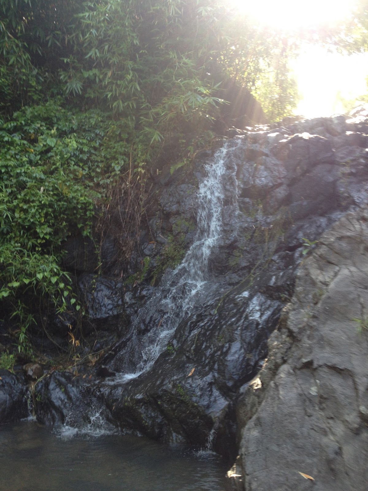
| Karugo Falls |
 |
| The Deep Pool |

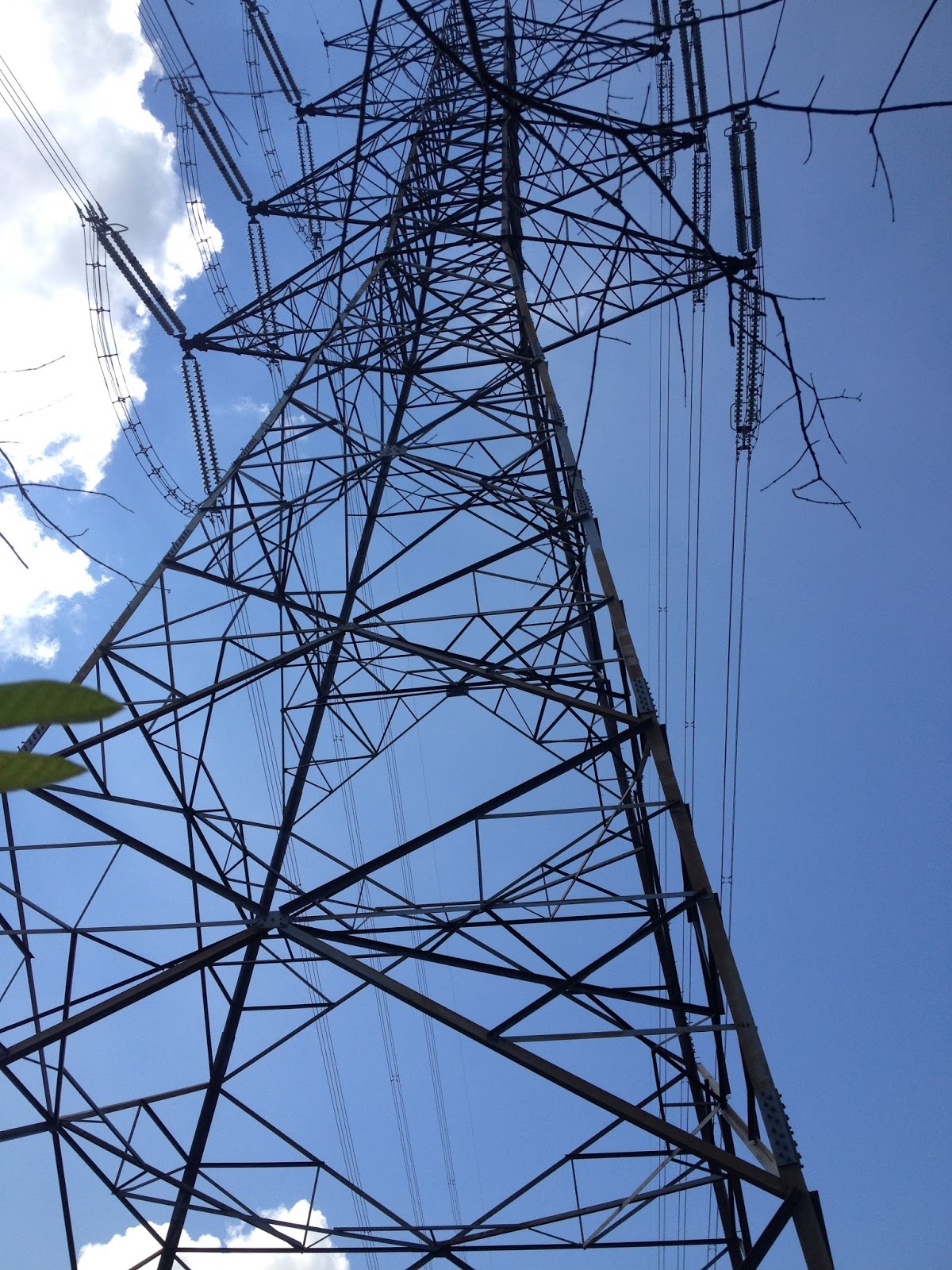
Just after the 3rd residential area, we had to pass through a gate (similar to that in Mt. Ampacao) meant to keep the cows from destroying the crops planted by the locals. We even passed through bamboo groves, similar to that in Mt. Batolusong and Pico de Loro. We also saw some vestiges of charcoal making activities. The river-trekking went on until we reached start of the assault towards the NGCP Transmission Line / NAPOCOR Tower. This is that part of the river where there are a lot of boulders and bamboo around. From here, we put on our hiking/trail shoes (although it was really fun hiking with my Crocs…haahaa).
 |
| One of the many waterfalls |
It was already 0950H when we reached the Napocor Tower. This area also serves as a viewpoint since the panorama of the surrounding mountains are already visible. From the tower, we had to climb a fence again and continued to hike open terrain but there are still areas where we enjoyed the comfort of the shade offered by trees. We even had to pass by the edge of a ravine where the trail really became so narrow.
At 1020H, we eventually reached the 2nd peak after the NAPOCOR Tower and finally saw the Summit Area. As we still have lots of time to spare, we decided to take some time off before we enter the open grassland.
The grassland will remind you of Mt. Batulao. It was already 1040H when we arrived at the Summit. Just before the summit, we noticed a cavity along the trail. Emman said that it was a foxhole built and used by the Japanese Imperial Army during World War II (How cool is that!). All in all, there are at least three foxholes at the summit area of Mt. Ayaas. I was even able to pick up a three-inch bullet (How cool is that!). Too bad I was not able to take a photo of it.
 |
| Sierra Madre / Panoramic View at the Summit |
 |
| Just one of the foxholes used by the Japanese in WWII |
 |
| The summit is marked by a Philippine flag |
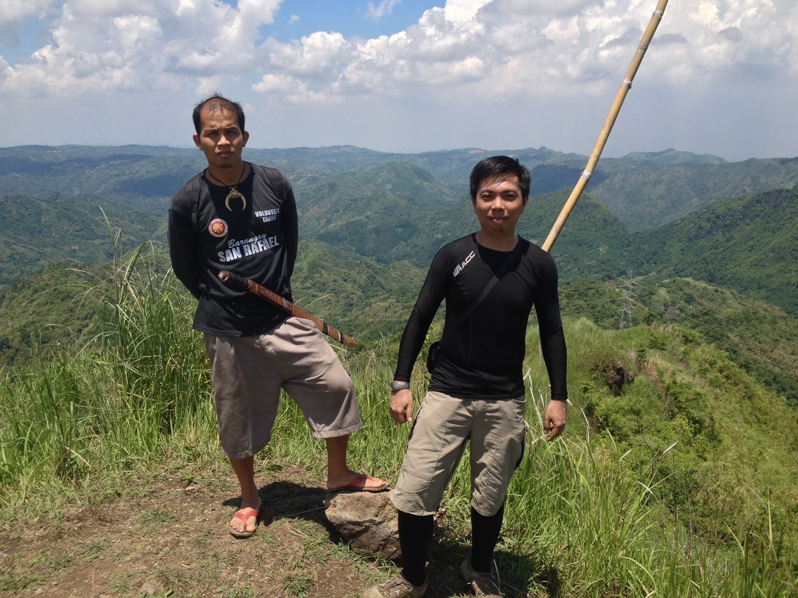 |
| Emman and Engr. |
The unique feature in Mt. Ayaas (aside from the Japanese foxholes) is the maze-like appearance of grassland and small trees that seems to be a well-manicured lawn, just below the Southeastern portion of the summit. The “grass terraces” were indeed remarkable and very pleasing to the eyes.
 |
| Grass Terraces |
Since clouds shielded us from the scorching sun at that time, we were able to spend more time at the summit and even eat lunch there. It was already 1130H when we decided to resume hiking.
We descended down the ravine leading to the grassland terraces. It was a bit steep and slippery but manageable. The trail is still indistinct complicated, maybe due to the fact that only a handful of people has ever tried to climb Mt. Ayaas, much less do the traverse from Wawa Dam to Brgy. Mascap. We followed the footpath, passed through rows of lemongrass (tanglad), and then climbed towards the wrecked and abandoned nipa hut. We continued until we finally reached the Bulakan Tree where wooden benches were incidentally available.
We then followed the path down towards the dirt road, which is effectively a muted version of the trail in Mt. Tapulao since there are a lot less rocks and boulders on it. At the fork, we took the old road on the left as it is a lot shorter. Eventually, the road became a lot narrower and expanded again just as we reached the Mahogany Forest. In a few minutes, we finally reached the first residential house in the Brgy. Mascap (…just forgot the name of the Sitio).
Just before the waiting shed, where the Old Road that we took will converge with the newly-bulldozered road (longer route that I mentioned earlier), we encountered a group of mountaineers. While we initially chose to proceed before them, they were so kind enough to let us hitch a ride until the tricycle station just before the bridge in Brgy. Mascap, where we finally enjoyed cold drinks and a very long rest. From there, it still is a 25-minute ride to the Total Gas Station where we hailed a tricycle that took us back to Sitio Wawa.
Mt. Ayaas, although not yet as famous as the other peaks in the Rodriguez area (but I bet it will also be famous in no time at all) is really one of the better hikes near the Metro.
Traipsing Chronicles 023
006.028.015
Mt. Ayaas
Brgy. Mascap, Rodriguez, Rizal
Jump off point: Wawa Dam, San Rafael, Rodriguez, Rizal
Minor Climb: 3/9
Highlights: River trekking; Water Falls hopping; Grassland Terraces; Japanese (WWII-era) Foxholes; views of the rest of Sierra Madre and nearby areas
Actual Itinerary
Mt. Ayaas - Wawa Dam Traverse to Brgy. Mascap
0445H - Meet-up McDonald's Eton Centris
0545H - Departure from Family Mart Timog for Wawa Dam
0630H - Arrival in Sitio Wawa
0645H - Register at the DENR
0715H - Commence Hiking
0740H - Arrival at Emman's House/Compound on the other side of Wawa River
0750H - Proceed to trailhead / Continue Hiking / Start of river-trekking
0755H - Arrival at Carugo Falls
0820H - Arrival at the 2nd residential area
0835H - Arrival at the 3rd residential area (left bank of the river) / 1st gate comes next
0850H - Rest Stop at the top of a waterfalls
0910H - Arrival at the base of the assault to the NGCP / NAPOCOR Transmission Tower
0930H - Arrival at the clearing opposite the 4th residential Area - Turn right towards the tower
0950H - Reached the NGCP / NAPOCOR Tower / start of the grassland
1020H - Arrival at the 2nd Peak after the Tower
1045H - Arrival at the Summit / Photo-ops / Early Lunch
1130H - Descend from the Summit
1200H - Reached the large Bulakan Tree / Rest Stop
1225H - Continued hiking towards the Dirt Road
1230H - Arrived at the Dirt Road
1245H - Arrived at the Fork / Took the Old Road (left side)
1300H - Arrived at the Mahogany Forest / 1st Residential Area
1320H - Arrived at the Waiting Shed / Junction where the Old Road and New Road will converge
1335H - Hitched a ride to Brgy. Mascap (about 3 kms. to go...Thanks to the helpful mountaineers)
1345H - Reached Brgy. Mascap / Bridge / Tricycle Line
1410H - Depart for the Highway / Total Gas Station
1435H - Arrival at the Total Gas Station
1440H - Hailed a tricycle back to Wawa
1450H - Back in Wawa / Wash up
1510H - Left Wawa for QC
1600H - Back in MRT QAve. Station
Guide. There are no specific rates / guide fees in Wawa. It is up to the climbers to determine how much to give the guide for his/her services. However, it is customary to give P300.00 to P400.00, just a little more depending on where you are going to hike. As for us, we paid P500.00 to Emman for the Ayaas traverse.
For Mt. Ayaas and all the other mountains in Sitio Wawa, you may reach Emman at +639493956589. He is the most knowledgeable guide (I call him Master Guide) when it comes to Mt. Ayaas because he mentioned that his father used to do kaingin in an area near one of the peaks of Mt. Ayaas.
Trails. It is also possible to climb Mt. Ayaas using the trail in Brgy. Mascap. Actually, it is the easier trail but the trail from Wawa is a lot more exciting because of the numerous waterfalls, flora and fauna that you will encounter along the trail. Should you decide to use this backtrail, coordinate or at least register at the Brgy. Hall of Mascap and inquire if guides are available (although it is easier to spot and follow the trail here as compared to that complicated trail that follows the brook/river (Karugo Falls).
There are also other variations of the trek / traverse. Better inquire with Emman or your guide about it.
Other Options. Mountaineers / Climbers doing the traverse may opt to not go back to Wawa anymore. Jeepneys, Vans and FXs going to Cubao are already available within the vicinity of the Total Gas Station.
Caveat. Please take note that climbing Mt. Ayaas during the rainy season is entirely different as compared with climbing it during the summer months. The River/Brook and series of waterfalls really swells after a heavy downpour. On the other hand, it dries up during summer.
 |
| Wawa Gorge |
 |
| Water from a tunnel / cave? |
Other Mountains in the Wawa Area:
Mt. Binacayan + Mt. Pamitinan Twinhike
No comments:
Post a Comment