- T.S. Eliot
Since we were badly in need for a tune-up climb for our upcoming climb in Akiki, and having no idea to go, we decided to join an organized climb for a change. After threshing out the details from Kagawad, we were in no time up and about to tramp in the newest hiking hotbed in Tanay, Rizal, the Laiban Quatro.
 |
| Mt. Ngusong Kabayo |
 |
| Laiban Brgy. Hall |
 |
| Sign in front of Kagawad Toto's home |
From the main road in Laiban, we backtrailed for about a hundred meters, turned right toward, and followed a footpath in between residential houses until we ascended into the mountain trail. As rain poured throughout the previous night, it was already one muddy and slippery climb from that point on. As we were told, our first stop would be Mt. Lubo, then proceed to Mt. Ngusong Kabayo, traverse to Tangwa Peak, and then take the backtrail to Mt. Lubo before turning left for the descent towards the famed four (4) waterfalls of Laiban.
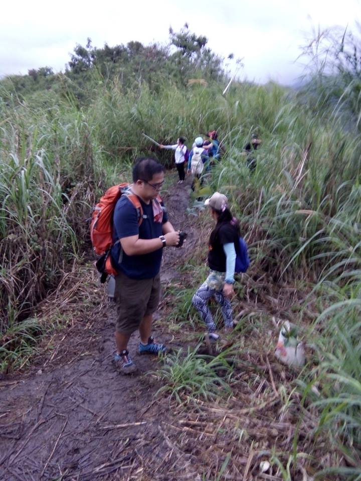
The stairs-like open trail leading to Mt. Lubo is flanked by cogon grass and occasionally dotted by some trees. As we continue to elevate to higher ground, the profile of the area started to register on us I was practically in awe and cannot do anything but admire the serenity and quaintness of the place. I was essentially teleported back to my childhood days where the crow of roosters would rouse you in the morning, the chirping birds are the eminent music at dawn, you get to be chased by fireflies and watch the sun rise and light up the sky.
Somewhere before the summit of Mt. Lubo, we planted the seedlings (Duhat) that our guide brought with us. When in Laiban, it is mandatory for each hiker to plant a seedling along the trail. Each seedling is worth P10.00. Hopefully, a good number of these seedlings mature into trees that will benefit the future generations.
 |
| Tree Planting |
 |
| Hoping that it'll grow into a tree |
 |
| Mt. Lubo Summit |
It was already 0720H when we reached the big tree perched on a boulder. This is actually the entrance to the summit area of Mt. Ngusong Kabayo. As there were still a lot hikers along the trail, leading to and at the summit area, we decided to spend more time here for photo-ops. We finally reached the summit area at 0735H.
 |
| Tree on the edge |
 |
| Huge Bonsai |

Mt. Ngusong Kabayo (literally "Horse's Snout" in Tagalog) was referred to as such since the rock formations at its summit actually resembles the snout of a horse, The actual summit of Mt. Ngusong Kabayo is the top of the rock formations where the horse's snout is found. According to one of our guides, legend has it that the rock formations actually is now a lot larger as compared to how it was before.
We spent a lot of time at the summit area since we had to wait for our turn to proceed and negotiate trough the slits and crevasses in the rock formations. It was already 0820H when we finally commenced hiking and continued towards Tangwa Peak. We had to be careful as we passed through the gaps and openings at the summit. This went on until we reached the other side that was soon followed by the buhoan. The trail went on until we reached another clearing where boulders are located. While this offered a chance for photo-ops, we decided to move on just to get over the foot traffic.
 |
| Opening at the back / beneath the rock formations |

 |
| Buhoan |
 |
| At Tangwa Peak |
It was already 0920H when we left Tangwa Peak and followed the ridge to the southwest. The grassland is reminiscent of Mt. Batulao and Mt. Sembrano. I could only imagine how hot a hike here could be in the summer months. The good thing is that one may opt to proceed to the waterfalls to cool down after the tiring hike. From the steep and slippery descent in the grassland, we arrived at another part of the buhoan at 0945H.

From the buhoan, we ultimately reached the final part of the backtrail as we emerged near the fork (where we took the trail on the left) located a few minutes from the big tree that was perched on a boulder. Here, we took the trail on the left until we finally started to descend the ridge.
The steep and slippery descent continued until we finally reached another buhoan. The descent at the buhoan can be tricky. The good thing however is that there are bamboo rails that were put in place by the locals for hikers. We then arrived at the view deck. This is a good spot for photo-ops as the full might of Laiban Falls 1 may be observed here.

The upper portion of Falls #1 is an impressive cascade that arcs down to a mid-level section, which in turn gives way to the lower level that rushes down to a a pool (waist-deep) that is big enough to accommodate a number of people. The flowing rapids in this part however, is strong but bearable. Downwards, is the bigger and deeper pool that I should say is one of the cleanest of all the freshwater pools that I have seen. And as the highest, Falls #1 also provides the most resounding sound and forceful flow of all the waterfalls in this part of Laiban.
 |
| Falls #1 viewdeck |
 |
| Falls #1 lower level; small pool |
 |
| Cool waters |
 |
| The natural pool of clean and clear water below the smaller pool. |
 |
| Slippery |
 |
| Salute to the two ladies in our group. Sorry, we failed to even get your names...heehee |
It was already 1230H when we left Falls #1, and started river trekking. We followed the river downstream and a few minutes later, we arrived at what was supposed to be considered as Falls #2. Mind you, it was also impressive in its own right. We had to descend on the right side of the falls. We carefully followed the path that was carved out of the boulder wall. At its base, we spent a few minutes to admire the scenery and of course, for photo-ops,
 |
| Falls #2 |
From there, the river trekking (with some minor bouldering), went on. I don't know if it was just me, but I enjoyed getting my feet wet at that time. Simple as it may seem, but we cautiously threaded the water, rocks, and boulders as there is always that danger of slipping, or getting tripped.
 |
| River trekking |
Falls #3 has two levels, albeit shorter and smaller when compared to Falls #1. However, its natural pool of blue-green waters makes it as the most preferred site for swimming. Also, the protruding rock wall a few meters above the pool also serves as a diving platform for the daring. While a good number of hikers were swimming at that time, we only spent there a few minutes for photo-ops and decided go ahead.
 |
| Falls #3 |
 |
| The Pool and the Platform on the right |
 |
| The pool at Falls #3 |
 |
| The deep pool on the background |
 |
| Silent waters run deep |
 |
| Falls #4 |
 |
| Falls #4. Just impressive! |
It was already 1350H when we left Falls #4 for the JOP. We followed the course of the river downstream until we ascended to the gravel path just before the main river system. This river also has clear waters and may be good for swimming, albeit in my opinion, is more dangerous. We continued to follow the footpath until we chanced upon what was supposed to be an old piggery. According to Rose, the piggery was ordered closed due to the complaints of the locals since it actually is located near the residential area.
At 1415H, we were back at the souvenir shop opposite Laiban High School but were asked to proceed to the Brgy. Hall to log-out, which we ultimately reached a few minutes later. All in all, it was a challenging but fun-filled experience.
Traipsing Chronicles #040
001.029.017
Laiban Quatro - Mt. Ngusong Kabayo via Mt. Lubo Traverse to Tangwa Peak and Laiban Falls
Jump off point: Brgy. Hall, Laiban, Tanay, Rizal
Minor Climb: 4/10 (may count as a Semi-Major Climb due to the river-trekking)
Highlights: Panoramic View of the Sierra Madre Mountain Range / Tanay Mountains (Maysawa Circuit, Mt. Batolusong, Mt. Irid, Mt. Daraitan), Laiban River, Sea of Clouds, Laiban Falls, Buhoan (Habitat of the endemic Cloud Rat)
***Credits to Engr. for some of the pictures used in this post
Actual Itinerary
12:00MN - Assembly Parking Area opposite Burger King / Four Seasons Buffet (Near Gateway)
0230H - Departure for Tanay, Rizal via Cogeo
0355H - Arrival at Brgy. Sampaloc, Sitio Mayagay transfer to Monster Jeep
0410H - Departure for Brgy. Laiban
0440H - Arrival at Brgy. Laiban Hall (jump off) - Register
0515H - Go to House of Kagawad Toto
0545H - Briefing at the Brgy. Hall (JOP)
0555H - Start Hiking ETA Tangwa Peak
0635H - Arrival at Mt. Lubo / 1st Flag / View Deck
0720H - Arrival at Big Tree before the Summit Area / Photo Ops
0735H - Arrival at Mt. Ngusong Kabayo Summit / Photo Ops
0820H - Departure from Ngusong Kabayo Summit
0840H - Arrival At Buhoan
0900H - Arrival at Tangwa Peak / Photo Ops
0920H - Departure from Tangwa Peak
0950H - Arrival at the Backtrail fork
1120H - Arrival at the Water Falls #1 / Lunch / Swimming / Photo Ops
1230H - Continue hiking to JOP / River Trekking
1235H - Arrival at Waterfalls #2 / Photo Ops
1245H - Arrival at the Waterfalls #3 / Photo Ops
1330H - Arrival at Waterfalls #4 / Photo Ops
1415H - Arrival at Kagawad's House / Souvenir Shop - Lomi House / Proceed to JOP to Log-out
1420H - Arrival at the Brgy. Hall / Log-out
1430H - Washup
1550H - Proceed to Kagawad's House / Eat Lomi / Wait for the other participants
1750H - Departure from Laiban
1920H - Arrival in Cogeo
1940H - Arrival at McDonald's opposite Sta. Lucia Grand Mall / Taxi
2020H - Arrival in West Avenue, QC
Private Transportation. From Cubao LRT2 Station, take Aurora Blvd. East Bound and continue straight to Marcos Highway. You will pass by Sta. Lucia Grand Mall, Masinag, and Cogeo. After Cogeo, you will enter the Upper Marikina Basin Protected Landscape and traverse zigzag roads.
You will pass by Boso-Boso, Palo Alto and Garden Cottages. Go past the Welcome Arch in Barangay San Andres / Batangasan or Batangas (road leads to the trailheads of Mt. Batolusong and Mt. Maynoba), which incidentally is on the left side of the highway. You will also pass by gravel path to Maysawa, the welcome arch leading to Brgy. Cuyambay on the right side of the road, and Pico del Pino. (This is a few hundred meter after Kilometer 53).
Go past the Sierra Madre Mountain Resort. Youa are already near Sitio Mayagay once you pass by Hassan Kabab and Steaks on the left side of the highway.
The small concrete road in Sitio Mayagay (still a part of Brgy. Cuyambay) that leads to Brgy. Laiban is located a few meters after the entrance of Martessem Mountain Resort. Take a left turn from the Marilaque Highgway and follow the concrete road until it slopes down to Brgy. Laiban. Continue straight and there will be 9 river crossings (so you better have a 4x4 vehicle) until you reach Laiban. As for my personal assessment, even vans may not be able to bear the road conditions especially during the rainy season. (Take note that we took the monster jeep from Mayagay to Laiban)
The Brgy. Hall in Laiban is located about two hundred meters from the 9th river crossing. Once there, secure you guides and pay the registration fees. You may park your vehicle at the open space where the covered court of the barangay is located.
Early morning travel from Cubao to Sitio Mayagay is 1 hour 30 minutes more or less. Traveltime from Sitio Mayagay to Laiban is about 35 minutes to 45 minutes.
On your way back, owing to the fact that you will be ascending to Sitio Mayagay, travel time from Laiban to Mayagay will be 40 minutes to 50 minutes and may even reach 1 hour depending on the road conditions. Travel time from Sitio Mayagay to Cubao LRT2 Station via the same route (in the afternoon/early evening) is 1 hour 50 minutes (depending on the traffic conditions in Marcos Highway and Aurora Blvd.
Public Transportation. From Cubao, take a jeep or FX to Cogeo Gate 2 Antipolo. Once in Cogeo, take the jeepney going to Sampaloc/Tanay. Tell the driver to drop you off at Sitio Mayagay. Once there, you may hire a habal-habal (if my memory serves me right, costs Php150.00 per person). According to our guide, habal-habal drivers are available in Sitio Mayagay as early as 2:00AM. The habal-habal will take you straight to the Brgy. Hall in Laiban. Just prepare yourself to get wet, owing to the 9 river crossings until you reach Brgy. Laiban.
Jeeps from Sampaloc/Tanay heading back to Cogeo Gate 2 usually pass by the Mayagay until 7pm (they leave Sampaloc at 6:30PM). Once in Cogeo, you can finally hail a ride (FX or jeepney) going to Cubao. After the stated hours, jeepneys may still ply the same route but on an irregular basis.
Another option would be to hike from Sitio Mayagay to Brgy. Laiban (We saw a number of hikers doing this during our hike). It will be mostly a downhill hike, (including the river crossings) for 45 minutes to 1 hour depending on the pace.
Laiban Quatro. Located within Brgy. Laiban, Tanay, Rizal, the Laiban Quatro is dubbed as such since Brgy. Laiban is situated within a river valley tucked between four mountains namely: Mt. Lubo (488 MASL); Mt. Ngusong Kabayo (625 MASL); Mt. Toyang (656 MASL); and Mt. Matang Ulang (537 MASL).
The river in Laiban is also very clear. It is the same river that flows in Brgy. Cayabu (where Mt. Maynoba is located) and Brgy. Daraitan (where Mt. Daraitan and Mt. Mamara are situated).
According to our guide, there are also caves in the area but are still closed to the public for now since these are currently undergoing exploration. The same goes with Mt. Matang Ulang and Mt. Toyang.
The place also prides itself as part of the habitat of the endemic Cloud Rat. These cuddly rodents supposedly live in the forest and basically survive on a diet of young leaves and shoots. Due to the destruction of their habitat, and other reasons such as hunting (for their meat) and physical limitations (only one young is born each year), they are actually endangered.
Permit. As Laiban is located in Tanay, it is best to coordinate your climb with the Tourism Office and/or Barangay. Securing a climbing permit is supposedly mandatory and in this case, the presentation of medical certificate may be required. In our case, the climb organizers were the ones who secured the permit and they did not require us also to present a medical certificate.
For more information on this, you may contact Tanay Tourism Office at +63 2 736 1059 / +63 998 9881590 and/or Kagawad Toto at +63 998 494 3595.
You may also contact Mr. Pedrito Tampus at 09193265454 09263652353 or send him an email at pedritocampus@gmail.com
Fees. Registration and Environmental Fees are imposed based on the attractions that hikers will go to. Pegged at P20.00 per attraction, we paid P80.00 for the entire hike.
Guide Fee is P500.00 - up to 5 hikers. There is also a seedling fee of P10.00 for each seedling. If only I knew that we are going to plant trees, I would have asked our guide to bring 10 seedlings for my share.
Laiban Falls. According to our guide (Rose), they refer to the falls as Laiban Falls 1, 2, 3, and 4, depending on from where you are hiking from. In our case, we came from Mt. Lubo, hence, the highest falls is Laiban Falls 1, and so on (in descending order).
However, if you would be coming from the River trail, the number of the Falls will be in the ascending order in such a way that Laiban Falls 4 in the order above (descending) would be considered as the 1st falls and the 4th and last falls is the highest falls (the Laiban Falls 1 referred to above).
River Trekking / Crossings. As mentioned above, there are 9 river crossings from Sitio Mayagay to Brgy. Laiban. According to Rose, these usually swell during the rainy season. And if such happen, the people in Laiban would have to wait for the water level to go down, or take the monster jeep.
As regards the two hours of river trekking, alertness and vigilance are required from each hiker. During the rainy season, our guide (Rose) told us that the water would tend to swell. In this case, hikers may only visit Falls #1, then will have to backtrail to Mt. Lubo and continue back to the JOP instead of going through the traverse route.

Eateries. There are eateries / stores in makeshift stalls opposite the Barangay Hall. They sell breakfast even at 4:00AM. Cup noodles, hard-boiled egg, chips, etc., are also available. They also sell snacks such as lomi, palabok, bbq, squid balls, fish balls, among others.
But at the house of Kagawad Toto (opposite the Laiban High School), they also offer Lomi and some t-shirts and other souvenirs such as bag tags.
Cloud Rat. The area is supposedly part of the habitat of the Cloud Rat. Now considered as an endangered specie, the cloud rat is endemic to the Philippines. Hence, should you see one along the trail, please consider A nocturnal animal, they feed on shoots and young leaves, and live in hollow trunks of trees.
Sea of Clouds. While we did not encounter the sea of clouds phenomenon during our hike, it is not uncommon that this happens in Laiban. Especially that Mt. Binutasan (of the Maysawa Circuit) is just a stone's throw away from Tangwa Peak. Take note that the best views of the Sea of Clouds in Maysawa can be seen at the peak of Mt. Binutasan. So, you know, just do the math.
Trail Map. For reference, you may refer to the trail map below, which is courtesy of the Nomad Terra Crawlers. Credits to the owner of the photo.

The river in Laiban is also very clear. It is the same river that flows in Brgy. Cayabu (where Mt. Maynoba is located) and Brgy. Daraitan (where Mt. Daraitan and Mt. Mamara are situated).
According to our guide, there are also caves in the area but are still closed to the public for now since these are currently undergoing exploration. The same goes with Mt. Matang Ulang and Mt. Toyang.
The place also prides itself as part of the habitat of the endemic Cloud Rat. These cuddly rodents supposedly live in the forest and basically survive on a diet of young leaves and shoots. Due to the destruction of their habitat, and other reasons such as hunting (for their meat) and physical limitations (only one young is born each year), they are actually endangered.
Permit. As Laiban is located in Tanay, it is best to coordinate your climb with the Tourism Office and/or Barangay. Securing a climbing permit is supposedly mandatory and in this case, the presentation of medical certificate may be required. In our case, the climb organizers were the ones who secured the permit and they did not require us also to present a medical certificate.
For more information on this, you may contact Tanay Tourism Office at +63 2 736 1059 / +63 998 9881590 and/or Kagawad Toto at +63 998 494 3595.
You may also contact Mr. Pedrito Tampus at 09193265454 09263652353 or send him an email at pedritocampus@gmail.com
Fees. Registration and Environmental Fees are imposed based on the attractions that hikers will go to. Pegged at P20.00 per attraction, we paid P80.00 for the entire hike.
Guide Fee is P500.00 - up to 5 hikers. There is also a seedling fee of P10.00 for each seedling. If only I knew that we are going to plant trees, I would have asked our guide to bring 10 seedlings for my share.
Laiban Falls. According to our guide (Rose), they refer to the falls as Laiban Falls 1, 2, 3, and 4, depending on from where you are hiking from. In our case, we came from Mt. Lubo, hence, the highest falls is Laiban Falls 1, and so on (in descending order).
However, if you would be coming from the River trail, the number of the Falls will be in the ascending order in such a way that Laiban Falls 4 in the order above (descending) would be considered as the 1st falls and the 4th and last falls is the highest falls (the Laiban Falls 1 referred to above).
 |
| At the viewdeck (Falls #1) |
 |
| Mini Falls |
 |
| Just an amazing experience |
 |
| At the supercool pool |
 |
| Superb! |
 |
| I own it! |
 |
| Falls #2 |
As regards the two hours of river trekking, alertness and vigilance are required from each hiker. During the rainy season, our guide (Rose) told us that the water would tend to swell. In this case, hikers may only visit Falls #1, then will have to backtrail to Mt. Lubo and continue back to the JOP instead of going through the traverse route.

Eateries. There are eateries / stores in makeshift stalls opposite the Barangay Hall. They sell breakfast even at 4:00AM. Cup noodles, hard-boiled egg, chips, etc., are also available. They also sell snacks such as lomi, palabok, bbq, squid balls, fish balls, among others.
But at the house of Kagawad Toto (opposite the Laiban High School), they also offer Lomi and some t-shirts and other souvenirs such as bag tags.
Cloud Rat. The area is supposedly part of the habitat of the Cloud Rat. Now considered as an endangered specie, the cloud rat is endemic to the Philippines. Hence, should you see one along the trail, please consider A nocturnal animal, they feed on shoots and young leaves, and live in hollow trunks of trees.
Sea of Clouds. While we did not encounter the sea of clouds phenomenon during our hike, it is not uncommon that this happens in Laiban. Especially that Mt. Binutasan (of the Maysawa Circuit) is just a stone's throw away from Tangwa Peak. Take note that the best views of the Sea of Clouds in Maysawa can be seen at the peak of Mt. Binutasan. So, you know, just do the math.
Trail Map. For reference, you may refer to the trail map below, which is courtesy of the Nomad Terra Crawlers. Credits to the owner of the photo.

No comments:
Post a Comment