- Martin Luther King -
The mountains in Tarlac have their own reputation that is, though not that high in elevation, they actually pack a myriad of surprises even for experienced mountaineers. As to Mt. Damas, while it is common knowledge that this mountain already provides a punch, we decided to add more challenge to this already grueling hike (usual dayhike) by setting the bar a notch higher owing to our intended cross-country climb in the Cordillera.
 |
| Mt. Damas (taken from Brgy. Papaac) |
 |
| Mt. Damas (the Summit taken from the campsite at the western side of the mountain) |
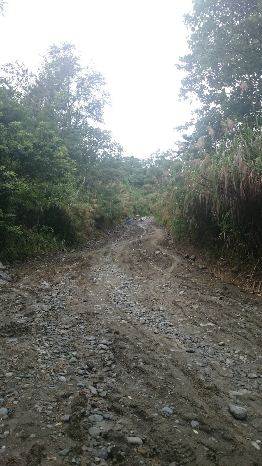
Our intended Mt. Damas Superloop Traverse commenced at the usual jumpoff point in Brgy. Papaac. It was 1045H when we left for Sitio Dueg. While Mt. Damas is already near the area, we followed the dirt road in the opposite direction (northward, leading to the basketball court) until we passed by some rice paddies and residential areas where dogs barked continuously at us. the initial part of the hike is a relatively easy walk on a flat surface. Trees along the road would sporadically offer shade, but there are also areas where we were fully exposed to the searing heat of the sun.
 |
| Papaac JOP |
 |
| The Basketball Court opposite the Registration Area |
 |
| L to R: Gani, Allan, Freddy, Chino, Aloha, Domeng, Oliver, RJ, Francis Front: Jerome |
 |
| The dirt path from the JOP |
 |
| Mini Rice Terraces |
Upon reaching the junction, we turned left westward and followed another dirt path. We started to hike on a rolling terrain and continued until we finally reached the concrete road leading to Sitio Dueg. The real uphill climb began as soon as we have set foot on the pavement. Moreover, the hike became next to unbearable due to the intense heat not only from the sun above, but as well as from the concrete pavement that we were threading. Nevertheless, we continued until we reached the Canding Crossing.
 |
| The end of the dirt path. We turned left here. Right will lead to Brgy. Macondray. |
 |
| Rolling terrain |
 |
| Finally we turned left upon reaching the road to Sitio Dueg. |
The Canding Crossing is supposedly the usual jumpoff point of mountaineers who use the trail in Dueg (Though apparently, there are different trails in Dueg leading to the summit of Mt. Damas.). It is where the pavement ends and the rough road begins. According to our guides Alex and Tonton, hikers would most of the time ride the habal-habal from Canding to Sitio Dueg for Php100.00 each person, or would start the uphill trek from here.
 |
| Chasing pavement |
 |
| Canding Crossing...right goes to Canding Hanging Bridge (and Falls). |
 |
| At the Canding Crossing |
 |
| Dirt path to Canding |
 |
| Fees |
 |
| Hanging Bridge |
 |
| The cottages |
 |
| Cool and clear Canding River |
 |
| Chicharong Camiling! |
Feeling refreshed, we decided to continue our hike to Sitio Dueg at 1300H although it was still raining at that time. We backtracked towards the same dirt path that we took until we were ultimately back at the concrete pavement. A few meters from the dirt path leading to Canding, the concrete road gave way to a rocky, rough road. 'Twas the formal start of the unrelenting uphill climb to Sitio Dueg.
 |
| Canding Hanging Bridge...taken from the road to Dueg. |
 |
| Artistahin |
 |
| Uphill...all the way! |
It was 1500H when we reached the junction leading to the Timangguyob Falls. We decided to take a brief rest at the nearby waiting shed. And since we know that Dueg is at least 2 kilometers to go, we continued hiking without knowing that there is a trail that leads to Mt. Damas (usual trail used) before one reaches Sitio Dueg (of course, our guide did not mention this to us thinking that we have something important to fetch in Dueg...oh my).
 |
| Downhill view |
 |
| Take 5...more like Take 15 :) |
 |
| Alex...one of our local guides. |
 |
| The waiting shed at the junction to Timangguyob Falls |
 |
| 11 KMs more to the falls |
We then encountered a hut on the side of the road, purposely built by the construction workers who at that time were paving the rocky road with concrete. After the road construction, the rocky road continued until we arrived at the concrete pavement, a sign that we are already near Sitio Dueg.
We finally arrived at Sitio Dueg at 1545H and settled ourselves in one of the variety stores. We bought snacks and soda as we waited for our other companions to arrive. While that mini-Tapulao hike from Brgy. Papaac to Sitio Dueg can really be draining, it will nevertheless give hikers a lot of chances for stories and time for bonding.
 |
| Hut...more like temporary shelter for the road workers |
 |
| The part of road construction ahead |
 |
| Part of the cemented road...more like 800 meters to go until we reach Sitio Dueg |
 |
| Uphill still. |
 |
| Finally in Sitio Dueg....at the store. |
 |
| The Registration Area in Sitio Dueg (There is also a store located here). |
 |
| Backtrail |
 |
| The hardest part is still to come. |
 |
| Trail to Mt. Damas from Dueg Proper is on the right, near the electric post. |
 |
| The clearing at the edge of the residential area. |
 |
| Mangatarem, Pangasinan |
 |
| Mt. Damas |
 |
| We need to go down, then up that mountain in front, then down to the river, then up again. |
 |
| eh ang sukal pa kaya ng trail...heehee |
 |
| captivating |
 |
| Uphill...then the slippery and steep descent to the bamboo grove. |
 |
| Sitio Dueg |
At 1755H, we arrived at the bamboo grove. The funny thing in hiking in a bamboo grove is that the trail gets slippery and muddy after the rain. So we again had to carefully consider our footing lest we risk ourselves of getting injured. The slippery descent from the grassland, and now at the bamboo grove, will surely take a toll on one's knees. It was 1810H when we reached the Dueg River, where we decided to again cool ourselves and take a dip.
 |
| The River |
 |
| Darkness |
True to our mantra, "'di kami nagmamadali sa trail, basta huwag lang kaming magutom", we cooked adobong palaka (yes...some native delicacy), grilled pork chops, and tomatoes with alamang. It was really some sort of a picnic along the riverbanks of the Dueg River.
 |
| Busy si Chef! |
 |
| Adobong Palaka (Frog) |
 |
| Grilled Porkchops |
 |
| May alamang pa at kamatis! |
At 2200H, we finally arrived at the final watersource before the "cardiac assault" to the summit. Please make no mistake, but this is different from the cardiac assault at the Papaac Trail. We had to make one last refill of our water bottles and containers before proceeding to negotiate the steep ascent. It was already 2215H when we started to negotiate the very steep and slippery ascent to the campsite. Moreover, the trail conditions were made more challenging by the dense overgrowth of bushes, vines, and the ever-present talahib. Fatigue would make its presence felt, what with our heavy packs and all, but we chose to move forward and climb higher.

Though it was already deep into the night, we could feel the heat and humidity of the surroundings. As the trail is actually located above a river that literally divides the mountain boundaries, neither a breeze nor a puff of air came. While we thank the heavens for the intermittent drizzle that would in a way douse our warm bodies, it nevertheless made the trail a lot more slippery, and the cogon grasses harder to hold on to.
Deeper into the forest, we reached and crossed a brook. This part of the trail seems to be just one of the miniscule flat portions thereof. From the brook, we again climbed higher until we were almost of the same height as the mountain on western portion of the trail. In the middle of the trail, we decided to have very long rests and my group even decided to wait for our tail group. It was already 2320H when the tail group arrived, and at which time, we similarly decided to leave.
We then arrived at a bamboo grove where we reached a point where had to literally crawl beneath what seemed to be a short tunnel of bamboo branches and/or sticks. It was really burdensome for us to go through that area since we were also carrying our backpacks while trying to push ourselves upwards. As for me, I remember slipping at least thrice in that area.
It was already 0045H when we arrived at a clearing (grassland). Due to tiredness, we tried to doze off by just lying on the ground, without minding the mosquitoes and and other insects that would occasionally sting us. Fortunate enough, the rains have started to fade and though the heavens are still shrouded with clouds, stars began to twinkle in the sky.
A few minutes after an hour thereafter, just as the last hiker was arriving who decided to camp at the clearing, we continued hiking towards the campsite. We again followed the trail towards the tall cogon grasses, as we surprisingly inched northwards. The trail soon turn right and the cliff was to our left. The summit is now visible and we can already see the lead group perched along its western side. We followed the trail until it reached the peak in front and once there, the trail started to slope downwards towards a gorge.
Sooner than we think, the trail again started to slope upwards for the final push to the campsite. While we were gasping for our breaths, we were actually surprised that the campsite is just 50 meters above us. We could only laugh our hearts out as we recall the ordeal that we had to go through during the climb.
 |
| Campsite at last! |
 |
| The lights below |
At dawn, some of us went out of their tents just to verify whether there was a sea of clouds, but there was none. Actually, the sea of clouds appeared at around 0730H already, while we were having our breakfast. At 0845H, a group of dayhikers were already in the summit. As for us, we left the campsite at 0930H and were able to reached the summit after 15 minutes of hiking.

 |
| Break camp |
 |
| We had to improvise so that we can fit our tents in the campsite. |
 |
| Mayantoc |
 |
| Mt. Semilya |
 |
| Camiling....TPLEX is visible on a clear day. |
We spent a considerable time for rest near the water source as we decided to wait for tail group (they arrived at 1140H) and act as sweepers. As we were already starving at that time, we decided to have lunch there before we continue the hike to the river. It was already 1230H when we continued tramping on the slippery slopes of Mt. Damas.
The hike continued on an open trail with nary a cover. As we were already the last hikers for the day, the trail became more slippery as we expected. We had to be more careful in descending, and had to cling on to bushes and talahib in most tricky parts of the descent. The trail then continued towards a small river (which seemed to be a dead end) until it emerged on the other side of what seemed to be a river bank. From here, the trek continued until we finally arrived at a bamboo grove. While we can already hear the rapids below, we knew that we still had to negotiate a considerable hike towards it.
As we went forward, bit by bit, trees lined up the trail until the forest cover became more pronounced. At the last part of the drop, we had to rappel down the roped segment of the trail. It was already 1340H when we (the sweepers) finally reached the river. We immediately drop our bags and took a dip in the river to somewhat douse the heat and any weariness that we were feeling. It was so refreshing that we seemed to have forgotten that we still had to make our way back to Papaac.
 |
| At the river...left goes to Ubod Falls...right goes to Papaac. |
 |
| Sarap maligo |
 |
| Teddy Bear ni Sir Domeng |
It was already 1520H when we continued river trekking going to the east (opposite the direction to Ubod Falls). As we were actually river trekking upstream, we had to be extra careful while we negotiate the slippery boulders and crags as we move in and out of the water. At about 10 minutes of river trekking / bouldering, we arrived at the 1st mini waterfalls were we were required to rappel on the west wall of the mountain. While some of us decided to rappel up the wall, others opted to scale the wall as it is.
 |
| 1st mini-falls (trail to Papaac) |
 |
| Rappelling...the daring can also wall climb on the left side. |
 |
| River trekking / Bouldering |
We decided to rest just above the waterfalls for the final push to the "kubo". According to one of our guides, we still have 5 kilometers to go once we arrive there. Hence, we indulged ourselves with chocolates and other snacks before we decided to continue hiking at 1630H. We continued to river trek and passed by a water source on the left side riverbank. Though tired, we continued hiking as we knew that the presence of the water source is a sign that we are already nearing the kubo. After a few minutes, we subsequently climbed the trail on the right side river bank. We passed by vegetable gardens and finally reached the kubo at 1700H.
Fortunately, and to our surprise the owner of the kubo is selling cold soda. We rested for a while and decided to leave the kubo for the final hike towards Papaac at 1715H. We followed the ascending trail for a about a hundred meters and from its apex, it is all downhill from there. As we tramped on the dirt trail in the middle of the forest, it came to our minds that this might be the gradual ascent that most hikers / bloggers mention as the first part of the Papaac Trail when climbing Mt. Damas.
We continued to tramp until we finally reach and had to cross a small river. We continued to descent until we passed by bamboo groves and followed the river downstream. As we continuously tramped without bothering to stop even for a while, darkness started to creep in as we arrived at the first residential area near the trail. A few minutes from the residential area and the foot path became wider and more pronounced. Then came the first electric post followed by another residential area. In no time we eventually left the confines of the forest and continued towards the gravel road as we passed by rice fields where locals are trying to catch frogs.
Once at the gravel road, we turned left and continued straight towards Papaac. It was already 1820H when we finally emerged at the junction where the waiting shed cum registration area is located. Relieved that the challenging hike we planned has already ended, we then proceeded towards the residential area opposite the waiting shed for us to finally freshen up.
All of us in the group have already hiked a lot of mountains. But we are unanimous in asserting that truly, Mt. Damas Superloop is one of the most notorious and hardest overnight climbs that we have ever had.
Thanks to S'Tours!
Tramping Chronicles #046
008.004-005.017
Mt. Damas Super Loop - Papaac jumpoff to Dueg to Mt. Damas Summit and then back to Papaac
Sitio Dueg, Brgy. Maasin, San Clemente, Tarlac
Jumpoff for Super Loop / Super Traverse Climb: Brgy. Papaac, Camiling Tarlac
Usual jumpoff for traverse climb: Dueg Resettlement, Brgy. Maasin, San Clemente, Tarlac
690 MASL
Days required/ Hours to summit: 1-2 days/ 4-5 hours under normal circumstances
Specs: Major climb, Difficulty 7/10, trail class 1-4
Highlights: Unlimited Assault, Steep Descent, Mini Tapulao Trail, Grassland, River Trekking/Crossing, Roped Segments / Rapeling, Bouldering, Waterfalls hopping, Panoramic view of the Zambales Mountain Range, Central Plains of Luzon, Mt. Balungao, Mt. Sem-milya, Sea of Clouds.
Actual Itinerary - Mt. Damas Superloop (Papaac to Papaac via Dueg Traverse)
Day 1
0300H - Meet-up McDonald's Quezon Ave. cor. EDSA
0400H - Departure for Brgy. Papaac, Camiling, Tarlac
0520H - Arrival at the PTT SCTEX Station / Stopover
0540H - Departure from PTT Station / 7-11
0620H - Arrival at TPLEX Ramos Exit
0710H - Arrival at Camiling Public Market (Buy additional supplies)
0840H - Departure from Camiling Proper to Brgy. Papaac
0940H - Arrival at the Registration Area / Papaac JOP (initially followed signs that led us to the wrong trail) - Pay fees / Secure guides
1030H - Commence Hiking
1055H - Arrival at the 1st junction / dirt road (turn left)
1110H - Arrival at the 2nd junction / concrete pavement (turn left to Dueg)
1140H - Arrival at Canding Crossing (decided to go to Canding Hanging Bridge for Lunch)
1150H - Arrival at Canding Hanging Bridge (Lunch / Swimming at the river)
1300H - Commence Hiking
1310H - Back at the Concrete Road to Sitio Dueg
1315H - Start of the Rocky Road / End of the concrete pavement (Mini Tapulao)
1450H - Arrival at the junction to Timangguyob Falls - Long Rest at the Waiting Shed
1545H - Arrival in Sitio Dueg / Snacks at the store
1640H - Commence Hike to Registration Area
1645H - Arrival at the Registration Area - Pay Fees / Briefing
1710H - Commence traverse to Mt. Damas
1725H - Arrival at the clearing before the wooden gate / photo-ops
1735H - Continued Hike / Some uphill climb then steep descent in the grassland (trail similar to Mt. 387 traverse to Aloha Falls)
1755H - Arrival at the Bamboo Grove (still a steep descent to the river)
1810H - Reached the Dueg River (Long rest)
1915H - Start river trekking
1925H - Settled at a flat surface on the left river bank / Prepare Dinner
2040H - Dinner
2140H - Continued river trekking towards the trail leading to the summit
2200H - Arrival at the base of Mt. Damas / trailhead leading to summit / last water source
2215H - Commence the cardiac assault to summit via the "masukal" trail
2250H - Arrival at the small river (cross the river)
2300H - Arrival at the steep climb before the bamboo tunnel (long rest stop)
2330H - Arrival of the tail group / continued hike
0010H - Rest stop at the bamboo grove
0020H - Continued Hiking
0045H - Arrival at the clearing after the bamboo grove (grassland) - Very long rest / sleep
0200H - Arrival of the tail group (make sure everyone's okay) / commenced final hike to campsite
0245H - Arrival at the camp site (Lead group arrived at 0100H)
0330H - Lights out
Day 2
0600H - Wake up call / Prepare breakfast
0730H - Breakfast / Sea of Clouds (more like sea of fog harharhar)
0815H - Break camp
0930H - Commence hike to Summit
0945H - Arrival at the Summit / Photo ops
1000H - Commence descent to Brgy. Papaac via the Papaac Trail
1010H - Arrival at the famous Duhat Tree (Millennium Tree) - photo ops
1020H - Rest along the trail (area shaded by trees after the Millennium Tree)
1030H - Continued Hiking towards the water source
1100H - Arrival at the water source / refill water containers / long rest
1140H - Arrival of the tail group (decided to become the sweeper group) / Lunch
1230H - Commence slippery descent to the river
1340H - Arrival of the sweeper group at the river / Swimming / Lunch for the others
1520H - Continued river trekking (upstream) - (trail to opposite that going to Ubod Falls / east from the junction)
1530H - Arrival at the 1st "mini falls" / Rappel / Wall climb
1545H - Sweeper Group - Arrival at the top of the mini falls)
1605H - Arrival at the 2nd mini falls / Rappel again
1610H - Sweeper Group at the top of the mini falls - Long rest
1630H - Continued river trekking towards the "kubo"
1650H - Arrival at the water source along the bank of the river (with bamboo pole)
1700H - Arrival at the kubo (long rest / bought ice cold soda)
1715H - Continued hike to Brgy. Papaac JOP
1735H - Arrival at the small river / stream (cross the stream to the other side)
1805H - Emerged from the forest
1810H - Reached the dirt road
1820H - Arrival at the Papaac JOP / End of Mt. Damas Super Traverse
1830H - Wash up
2000H - Departure from Brgy. Papaac
2100H - Dinner
2200H - Departure for Manila
2350H - Back in QC - Home Sweet Home
***Credits to Sir Allan Calura and Sir JR Arambulo for the photos used in this post. Skookum!
***Another quality hike by #S'TourS
How-to-get-there - Mt. Damas is accessible to both private and public transport. And with the constructions of the TPLEX, it has even become more accessible than ever. However, please take note that there are at least 2 jump off points in climbing the mountain. One is located in Brgy. Papaac, Camiling Tarlac, which is famous for those who do the dayhike. The other is Sitio Dueg, Brgy., Maasin, San Clemente, Tarlac.
Private Transport. Just pass through the NLEX, the SCTEX (turn right towards Tarlac/Baguio), and continue until you reach the TPLEX. Take the Ramos Exit and turn left towards Paniqui upon reaching the Ramos-Paniqui Road. After 2 kilometers, you will reach the McArthur Highway, then turn right. Turn left once you arrive at the junction where Jollibee, Chowking, UCP, and BDO are located. Go straight (you will pass by the Paniqui Public Market) until you reach the town of Camiling. At the junction, continue straight and you will pass by a bridge. Then turn left at the 1st street (Romulo St. / Chowking would be your landmark) and then turn right (Bonifacio St.).
Continue straight for about 7 kilometers until you reach the Brgy. Birbira. At the Birbira High School, turn left and then follow the road to Brgy. Bacsay. You will subsequently reach another crossing (landmark is a bridge on the left) but continue straight until you reach Brgy. Papaac. At the basketball court, take the road on the left. This will ultimately lead you to the JOP. Your landmark would be the waiting shed and the registration area on the left, and the the basketball court on the right.
From McDonald’s Panay Ave. cor. EDSA in Quezon City, travel time to Brgy. Papaac is 3.5 hours (including rest stops) depending on the prevailing traffic and speed of your trip.
Public Transport. Take a provincial bus going to Bolinao, Anda, and Alaminos. Tell the bus conductor that you are going to alight in Camiling Public Market. Once there, take a tricycle going to Brgy. Papaac (if you are hiking via Papaac Trail) or in Sitio Canding (if you are climbing via Sitio Dueg).
Note: Please take note that due to the current road conditions, only 4x4 vehicles, SUVs, trucks, and motorcycles may be able to negotiate the road to Sitio Dueg.
Note: Please take note that due to the current road conditions, only 4x4 vehicles, SUVs, trucks, and motorcycles may be able to negotiate the road to Sitio Dueg.
Registration Fee. Each hiker is charged a registration fee of P20.00 in Papaac. Another P20.00 registration fee must be paid in Sitio Dueg.
Guide. It is mandatory for hikers to hire the services of a guide. As we hiked via the Super Loop / Traverse, we paid Php2500.00 for two guides.
Ubod Falls. Hikers in Mt. Damas (especially dayhikers) would usually make a side trip to Ubod Falls. It is located about 1 hour from the junction at the Papaac Trail leading to the summit of Mt. Damas. An ascent through a different trail is then made when hikers go back to Brgy. Papaac.
Chicharong Camiling. Slabs of deep fried pork (counterpart of "bagnet"), considered as a specialty in Camiling, it is readily available at the meat stalls inside the Camiling Public Market. We bought 1 kilo for P350.00.
Bamboo Coin Bank. The guides in Brgy. Papaac sell coin banks made of bamboo. Smaller sized coin banks are pegged at P35.00 each, and the bigger / longer ones sell for P50.00 each.
Ubod Falls. Hikers in Mt. Damas (especially dayhikers) would usually make a side trip to Ubod Falls. It is located about 1 hour from the junction at the Papaac Trail leading to the summit of Mt. Damas. An ascent through a different trail is then made when hikers go back to Brgy. Papaac.
 |
| #mtdamas |
Chicharong Camiling. Slabs of deep fried pork (counterpart of "bagnet"), considered as a specialty in Camiling, it is readily available at the meat stalls inside the Camiling Public Market. We bought 1 kilo for P350.00.
 |
| Sorry...yan na lang ang natira. |
 |
| Crispy |
No comments:
Post a Comment