Since Typhoon Florita was then within the so-called
Philippine Area of Responsibility, the Southwest Monsoon was relatively
enhanced thereby causing inclement weather throughout the archipelago.
Nevertheless, we did not let this dampen our spirits as Gani and I dared not
only to brave the elements but to take it a notch higher this time by doing a
twin dayhike.
In mountaineering jargon, a twin dayhike
(as the term implies) refers to summiting two separate mountains within a
single day. While this is no longer uncommon since there are also those who
even do triple dayhikes (also referred to as circuit hikes), it is safe to say that only the most hardcore of mountaineers dare to do a twin dayhike. In our case, we went for the Mt. Talamitan - Mt Batulao Twin Dayhike.
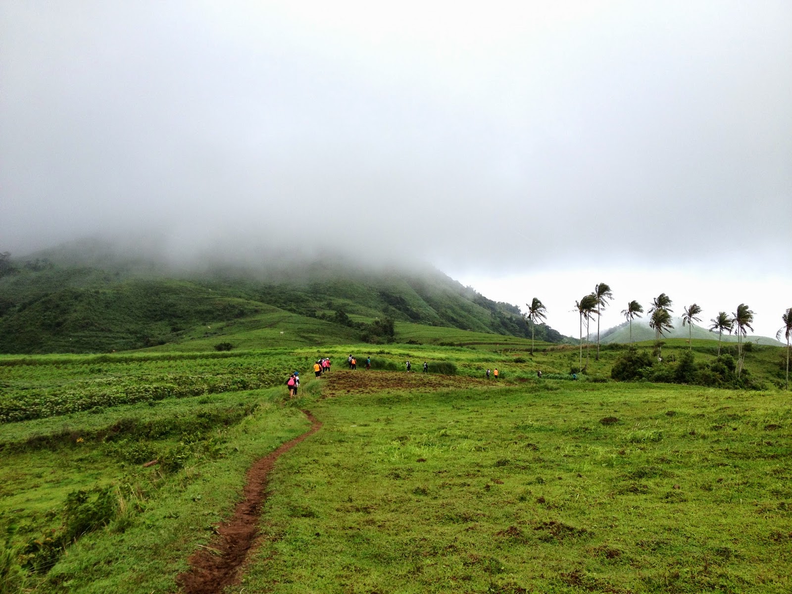 |
| Mt. Talamitam is covered by storm clouds |
I left our house in Quezon City at 0430H and was able
to fetch Gani at the MRT Boni Station 10 minutes later. At 0610H, we arrived
at the jump-off point to Mt. Talamitam, Km. 83 along the Tagaytay-Batangas
highway in Sitio Bayabasan, Brgy. Aga, Nasugbu, Batangas.
 |
| That is the Highway (the truck is heading towards Nasugbu); the road leads to the trail leading to Mt. Talamitam |
 |
| B1 (Hardcore #1) |
 |
| B2 (Hardcore #2) |
Since as per our intended itinerary, we are scheduled to summit Mt. Talamitam and supposedly get back to the jump-off point before noontime, we already ate for breakfast the beef tapa that Bette prepared as our lunch. At 0635H, we commenced our twin dayhike.
 |
| The 1st Registration Area located along the Highway (just after Km. 83) |
We arrived at the 2nd registration area ten minutes into the hike. After paying the customary registration fee, we continued. We passed by some locals along the way who told us to take extra precaution in climbing since the trail is expected to be slippery because of the rain that poured overnight.
 |
| The 2nd Registration Area |
We subsequently arrived at the split and
took the concrete bridge leading to the other side of the river. This was
immediately followed by the 2nd bridge, albeit in a state of
disrepair supposedly because of a strong typhoon that caused the river to swell
and ravage the area. Good thing there was already a makeshift bridge made of
bamboo.

 |
| The 1st bridge |
 |
| The 2nd Bridge |
From here, we started to ascend as we enter
the forest portion of the trail. The trail is relatively uncomplicated and 40
minutes into the hike (0725H), we already reached the so-called “Teletubbyland”. The
Teletubbyland is a clearing that is reminiscent of the grassy slopes made
famous by the television characters The Teletubbies. This serves as a grazing
area mostly for cows and goats, whereas the surrounding areas are dedicated to
agriculture.
 |
| Selfie muna sa Teletubbyland |
 |
| grazing cow in Teletubbyland |
 |
| Is that you Po? Heehee |
 |
| Open trail...good thing there are clouds all around |
While there are scenic views of the
countryside, thick storm clouds covered most of Mt. Talamitam. Its sibling, Mt. Batulao (incidentally the 2nd summit of our twin hike)
is also barely visible over the distance. As we were still early in our
itinerary, we decided to do a little exploration of the area and went to this
“ulingan” that pique our interest.
 |
| Gani emerging from the Forest Area as we enter the Teletubbyland; with the cloud-covered Mt. Batulao in the distance |
 |
| The rain clouds are coming |
 |
| Emotero...waahaa |
 |
| Ulingan...the trail is that sloping portion of Teletubbyland in the background |
5 |
| Onward we go...yihee |
Just as we were enjoying running on the
sloping and winding part of the trail after the Teletubbyland, the rain that we
expected all along fell. Although we decided beforehand to get wet, we had to
seek cover at the mango trees before the hut cum goat pen for us to make sure
that our things are waterproofed.
After 10 minutes (0815H), our assault to the summit
began. As the other group chose to climb through the more conservative trail,
we chose to climb the steeper (more slippery/dangerous) trail. The trail was
really slippery and there are a lot of dangerous portions along the way. We
were able to reach the summit at 0900H. Surprisingly, aside from the hikers
who stayed overnight at the summit and the dayhikers that climbed a lot earlier
than us, there were about 25 hikers who braved the stormy weather at that time.
There was even an ice drop vendor.
 |
| Rainy...nothing to see in the summit but clouds |
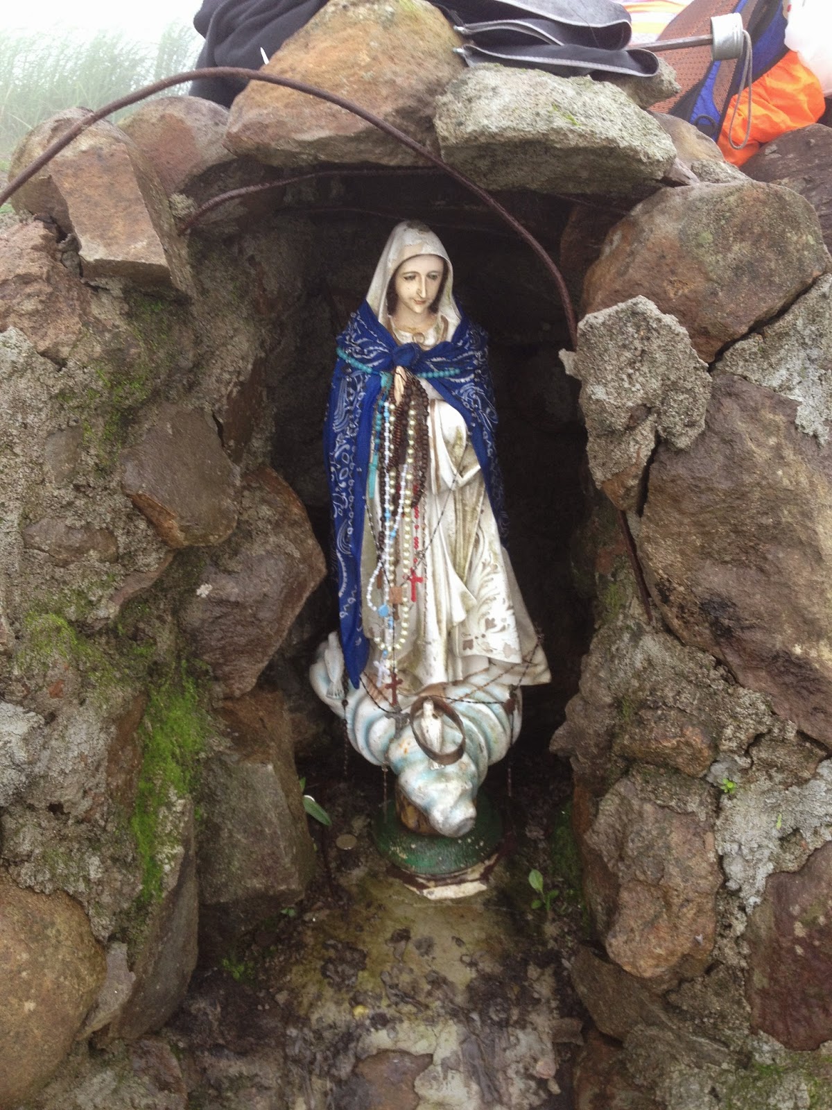 |
| The Grotto at the Summit of Mt. Talamitam |
 |
| Emoterong Engr |
 |
| Ang Lammmiiiiiiggg...brrrr |
 |
| the Boulders at the Summit |
Mt. Talamitam is indeed Mt. Batulao’s
sibling as these two have relatively the same open terrain, unobstructed views
at the summit, cogon grasses, deep ravines, rolling and winding trails, and a
small forested area.
 |
| foggy |
 |
| too bad we can't see the view because of the thick clouds that cover the summit |
 |
| Some of the other hikers that day...at the summit |

After enjoying the cool breeze, taking
pictures, and chatting with the other hikers, we decided to descend at 0940H
since we still have another mountain to summit for the day.
On our way down, the trail was really
slippery making us slide, roll and stumble a number of times. Although I’d say
that the danger is real, the adventure was well worth it. After an hour of
hiking, we decided to take a rest at the forest area a few minutes before the 1st
of the two bridges (bamboo bridge). We were able to reach the jump-off point at
a shade before 1100H.

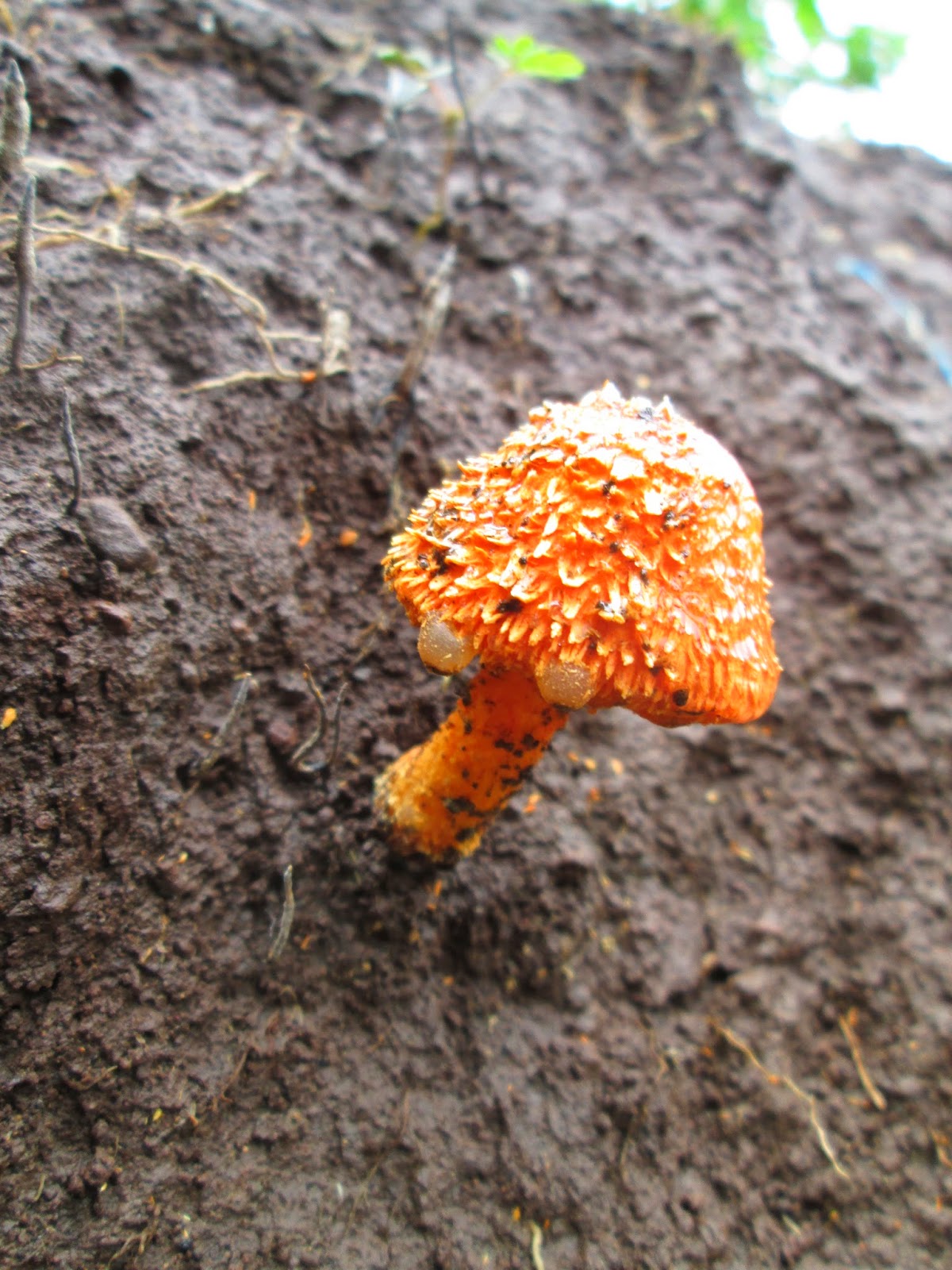 |
| even this mushroom is soaking wet |
 |
| the hut that serves as shelter for the goats |
 |
| green... |
 |
| open trail |
 |
| mushrooms...burger? |
 |
| these two ran to their Mama when they saw us coming...cute |
 |
| We are done eating lunch at the jump-off point |
We then decided to eat lunch at the store cum carinderia before tidying
ourselves up for the short drive to the jump-off point of Mt. Batulao. We left Km.
83 at 1200H and arrived at the residential area inside Evercrest at 1220H. We started to ascend our second mountain for the day (Mt. Batulao) at exactly1230H.
 |
| Mt. Batulao is covered with clouds |
 |
| At the residential area inside Evercrest...ready to rumble. |
 |
| Mt. Talamitam as seen from the trail in Mt. Batulao...sayang at clear na ang summit :( |
The dirt path along the residential area (up until before the first peak really) is really muddy and so slippery. We had to carefully watch our steps and balance ourselves as we move on. As we reach the last of the houses, a heavy downpour ensued. We were fortunate to be able to seek shelter at one of the stalls selling buko juice (coconut water). It was a good thing that we had a chitchat with a local who gave us a number of unsolicited advice about climbing in the rain.


The heavy downpour lasted until a little over 1300H. The slippery trail became more muddy and dangerous. Hence, we had no choice but to take it easy. Imagine the dusty trail that prevail during sunny days, has transformed into one slimy and slick surface.


Nevertheless, we were able to reach the fork going to the old trail at around 1330H. We then had a brief rest at the 1st house that we encountered at the Old Trail. Eventually, we reached the Old Trail Camp Site at around 1400H. We had a brief chitchat with the caretaker and he informed us that there are still quite a number of hikers who braved the rains and climbed Mt. Batulao that day.
 |
| Had to use the Bamboo bridge.... |
 |
| Here come the rain clouds again...at the Old Trail |
 |
| Soaking wet...dead tired...ok lang yan...hardcore! |
 |
| Camp site at the Old Trail |
At 1430H, we reached the "solitary tree" at Camp 7, it was here where we were met by strong winds and rain. At Camp 9, we were hindered by a group of hikers at the roped segment of the trail leaving us with no other choice but to climb the wall spiderman style even if the rocks were more slippery than usual because of the rain.
 |
| At the "Solitary Tree" |
 |
| At Camp 9...waiting for the hikers that were trying to go down the roped sections of the Old Trail |
 |
| Happy to reach the summit again |

We were so happy to have scaled our second mountain for the day. All that we can see are the We took some pictures until the rain poured again, splashing our faces with ice-cold water as storm-like breeze whip our bodies with careless abandon. It was really an out-of-this world experience that only the daring would have the courage to do. As the rain started to subside, we decided to descend the summit via the new trail at 1520H.
As compared with the Old Trail, the New Trail was a lot easier to tramp on. There were no muddy portions and it was easier to have a grip on the rocks at that time. We were able to reach the New Trail campsite at 1600H. We decided to take a long rest here as we chatted with Mang Resty regarding the repairs that he was doing on his kubo.
We started to descend back to the jump-off point at 1620H. We would stop for brief moments to enjoy the scenery and for us to catch our breath from time to time. We arrived at the jump-off point (parking/residential area) at 1745H.
 |
| and what is that I am pointing at? |
 |
| this is what I am pointing at in the previous photo |
While we were really so tired, at the end of the day, we were so happy that our first twin (double) dayhike was a success.
***Traipsing Chronicles 006
Mt. Talamitam - Mt. Batulao (Old Trail to New Trail) - Twin Dayhike
Highlights: Teletubbyland; Unobstructed views at the Summit; Grotto at the Summit (Mt. Talamitam); Rolling Terrain; Grasslands; Open Trail
Rating: 6/9
Actual Itinerary - (we used private transport so make the necessary adjustments)
Mt. Talamitam - Km. 83, Nasugbu, Batangas
Mt. Batulao - Evercrest, Nasugbu, Batangas
0430H - Left Quezon City for Nasugbu, Batangas
0610H - Arrival at Km. 83 (Nasugbu, Batangas) - jump-off to Mt. Talamitam (Register)
0635H - Start Trek to Mt. Talamitam
0645H - Arrival at the 2nd Registration Area (pay P20 each)
0655H - Arrival at the 1st of two bridges
0725H - Arrival at the Teletubbyland
0735H - Arrival at the "ulingan" (this is located on the right side and is really not part of the trail)
0755H - Back at the trail
0810H - Arrival at the Goat Pen just after the Mango Trees
0815H - Assault to the Summit
0900H - Arrival at the Summit - Explore summit; socialize with other mountaineers
0940H - Descend summit for the jump-off point
1000H - Back at the Teletubbyland
1030H - Back at the Forest Area - rest
1100H - Arrival at the jump-off area
Lunch at the jump-off area
1200H - Left Km. 83 for Evercrest - Jump-off to Mt. Batulao
1220H - Arrival at the jump-off (residential area) inside Evercrest
1230H - Start trek to Mt. Batulao
1245H - Rest at one of the Buko Stalls in the Residential Area because of the heavy rain
1330H - Arrival at the Y-junction leading to Old Trail
1400H - Arrival at the Old Trail Camp Site
1430H - Arrival/Rest at the "Solitary Tree" in Camp 7
1500H - Summit - Mt.Batulao
1520H - Descend summit - to New Trail Camp Site
1600H - Arrival at the New Trail Camp Site
1620H - Descend to jump-off point
1745H - Arrived at the jump-off point (residential area inside Evercrest)
1800H - Wash-up
1830H - On the way back to Manila
2030H - Back in QC
Mt. Talamitam
Registration. Hikers need to register at the jump-off point. It is located along the highway, just after the Km. 83 post. There is a store where hikers may buy their provisions for the climb and an eatery that offers home-cooked meals. One need not pay a registration fee at this point.
There is a 2nd Registration Area where hikers are required to pay P20.00 each.
Trails and Guides. While there guides are available, they are not really compulsary as the trail is relatively straightforward. Just look at the mountain and follow the trail leading up the summit.
There are at least three trails from the Teletubbyland that lead to the summit of Mt. Talamitam. One is located on the left portion which actually has the steepest assault. The second trail is also on the left side of the Teletubbyland only that hikers using this trail must follow the trail on the right side once the assault commences. The last one is the trail along the Teletubbyland, which is the longest but is actually the easiest one.
Often referred to as Mt. Batulao's lesser known sibling, Mt. Talamitam offers trails and challenges that are similar to that of the former. As such, it is recommended for novice or "newbie" hikers.
Mt. Batulao
Old and New Trails. Since it was our first time to climb Mt. Batulao on a rainy day, we did so via the traditional Old Trail to New Trail route. However, it is proven that the Old Trail tend to be a lot more muddy and slippy than the New Trail. Hence, the latter is easier to climb on a rainy day.
No comments:
Post a Comment